Circular route from the Saint-Vit ponds to the Moulin du Pré

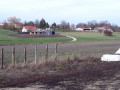
A short, easy family circular route, following paths amongst the ponds of the former sand pits. You’ll reach the Moulin du Pré, a riverside rest stop and the base of the local rowing club, before returning via the cycle route along the river.

Details

1647250
Creation:
Last update:
Last review:
  • Walking
    Activity: Walking
  • ↔
    Distance: 4.03 mi
  • ◔
    Average duration: 1h 50 
  • ▲
    Difficulty: Easy

  • ⚐
    Back to start: Yes
  • ↗
    Ascent: + 7 ft
  • ↘
    Descent: - 7 ft

  • ▲
    Highest point: 725 ft
  • ▼
    Lowest point: 712 ft
  • ⚐ Country: France
  • ⚐ City: Saint-Vit (25410)
  • ⚑
    Start/End: N 47.166366° / E 5.82901°
  • ❏
    IGN map(s): Ref. 3323O
  • Hour-by-hour weather

Photos

Description of the walk

The start is at the car park, on the bend in the path leading to the lock.

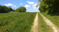
(S/E) Follow the path back in the opposite direction, skirting the pond. Leave the county road quickly and turn left onto a well-marked path which joins a lovely track suitable for vehicles; take this to the left. Continue to the junction at the edge of the fields. Take a moment to walk down to the banks to spot the waterfowl, which are often abundant on the water.

(1) When you reach Chemin du Goufferand, turn left and walk for about 200 metres.

(2) Look out for a grassy path on your right which separates two plots of land and runs alongside a pumping station. At the next junction, turn right and continue to the corner of the pumping station.

(3) At the junction leading to the pumping station, turn left onto the tarmac path. Continue along Rue des Joncs until you reach the junction with the cycle route. You are now in front of the Moulin du Pré site. You might even spot the young rowers from the rowing club.

(4) Once on the cycle route, turn left and head upstream along the river, on a path shared by cyclists and inline skaters.
Carry on to the lock.

(5) When you reach the lock, leave the cycle route and take the path on the left that goes behind the house. You’ll reach your car park a few dozen metres further on (S/E).


Waypoints

  1. S/E : mi 0 - alt. 719 ft - Car park near the lock
  2. 1 : mi 0.73 - alt. 722 ft - Chemin du Goufferrand
  3. 2 : mi 0.85 - alt. 715 ft - Grassy path on the right
  4. 3 : mi 1.28 - alt. 715 ft - Junction towards the pumping station
  5. 4 : mi 2.2 - alt. 715 ft - Cycle route to the Moulin du Pré - Doubs (rivière)
  6. 5 : mi 3.96 - alt. 725 ft - Lock - Canal du Rhône au Rhin
  7. S/E : mi 4.03 - alt. 719 ft - Car park near the lock

Reviews and comments

4.7 / 5
Based on 2 reviews

Reliability of the description
5 / 5
Ease of following the route
5 / 5
Route interest
4 / 5
dynou
dynou

Overall rating : 4.7 / 5

Date of your route : Sep 01, 2019
Reliability of the description : ★★★★★ Very good
Ease of following the route : ★★★★★ Very good
Route interest : ★★★★☆ Good

A lovely walk we did as a family with a pushchair – it took an hour and a half at a leisurely pace.

Machine-translated

pnuninger
pnuninger

Hello. Thank you for your comment. This is a route best enjoyed in autumn, on windless days, so you can admire the reflection of the autumn-coloured trees in the river and on the ponds.

During the week, it’s less crowded, though that also depends on everyone’s availability.
Have a lovely day and enjoy your walks

Machine-translated

nabote
nabote

Overall rating : 4.7 / 5

Date of your route : Jun 10, 2019
Reliability of the description : ★★★★★ Very good
Ease of following the route : ★★★★★ Very good
Route interest : ★★★★☆ Good

Thanks for the idea
It’s a lovely route, but best avoided during long, sunny weekends – barbecues and wild camping do take away from the natural charm of this route

Machine-translated

Other walks in the area

For more walks, use our search engine .

The GPS track and description are the property of this route's author. Please do not copy them without permission.