Country:
 City:


Park at the Mas lay-by, along the D6 near the hamlet of Duprat, after the bridge over the motorway when coming from Casteljaloux.
(S/E) Set off north-west (do not cross the road) and follow the route marked in yellow.
(1) Leave the marked route at the first path on the left. The track approaches the D6 road then turns right to follow it for a short distance.
(2) Turn right; the path runs alongside the motorway. Further on, take a fairly steep descent which leads down to a stream.
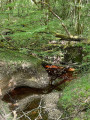
(3) Turn right and follow the path alongside the stream.
(4) Cross the stream via a small bridge. Turn left after the bridge. Then turn right and follow a narrow path that appears to have been cut into the ground, with walls on both sides (this path does not appear on the map). Return to the edge of the motorway.
(5) Turn right and pass to the left of the house at a place called Lasmolles. Cross a road and follow the yellow-marked route opposite. Go downhill, then up a fairly steep slope, and continue on level ground. You’ll come out onto a road; first turn right then left to follow the track that runs alongside the motorway service area. You’re still on the yellow-marked route.
(6) Leave the track and the marked route shortly after the motorway service area: turn onto the first path on the left into the woods (a path not shown on the map). Follow the path between the motorway (on the left) and the track (on the right).
(7) After a short, fairly steep descent, turn left and go through a culvert that runs under the motorway. This is a large culvert allowing pedestrians and cyclists to pass through (see the recommendations in the practical information). After the culvert, turn left and follow the path to the road. Cross the road and first turn left then right to follow a path.
(8) Turn left at a T-junction. Follow the path straight on. Cross a track, continue straight on, ignoring the path branching off to the right. The final section is a steep descent.
(9) At the bottom of the descent, turn right and follow the path alongside the Pichagouille stream. You’ll come out onto a road; follow it to the left for about 150 metres. Then take a path on the right. Reach the D6, follow it to the right for about a hundred metres and take the track branching off to the left. Pass the roundabout (six-way junction) and continue straight on. Follow the track almost to the end; you’ll see a barrier blocking the track ahead.
(10) Turn left and follow a narrow, unmarked path through the woods that does not appear on the map, with a stream on your right. Watch out for pidgeon hunting huts on the right, on the other side of the stream. Follow the path alongside the stream.
(11) At the end, turn left and follow the path straight on. You’ll come out onto a track; follow it to the right. After about 200 m, turn left onto a path (not shown on the map). Join another track and turn right.
(12) Take a small path on the right (difficult to see). Follow it, keeping to the left. Turn left and follow the stream bed on your right.
(13) Go through a culvert under the motorway (same instructions as for the previous culvert). After the culvert, turn left and follow the path winding through the woods (not shown on the map).
(14) At the motorway emergency access road, turn right and then immediately right again into the woods. Follow the path straight on (not shown on the map). Turn left at the first fork, cross the small stream again and continue straight on. At the road, turn left. Cross the D6 and head for the car park (S/E).

 Visorando Member
 Easy

 Difficult