Country:
 City:


Parking in the Lac de Salabert car park.
(S/E) Leave the car park by going round the back of the lake house and follow the path along the lake. Continue along the path until you reach the information board about insects. At this board, turn left then right and continue along the lake.
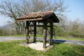
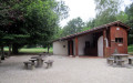
(1) When you reach the sign describing bird feeding, turn left onto the path marked with a yellow arrow, which leads into the woods and passes by a hut.
(2) When you reach the road, follow the yellow signposting to the right. After about fifty metres along this road, turn left onto the stony track leading up into the woods. On the climb, at a three-way junction in the road, ignore the track on the right leading up towards the village and Burgas. Continue straight ahead following the yellow markings. On leaving the woods, continue along the dirt track, which then becomes tarmac, towards the village of Lacépède.
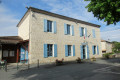
(3) At the entrance to the village, after passing the old girls’ school, turn right onto Rue de l’Église and walk down this street to the entrance to the church. After passing the steps leading up to the church, continue straight ahead onto Rue du Métier. Pass an old ‘shoe-smith’s workshop’ for oxen. At the end of Rue du Métier, take the sharp left-hand bend onto Rue de la Maison de Pays. Pass the Maison de Pays, a former Protestant church, then turn right down Rue du Temple towards the town hall.
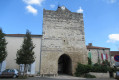
(4) Enter the town hall courtyard and walk along its left-hand side (toilets at the rear of the town hall). After passing round the back of the town hall, head down to the road, walk up about twenty metres to the left, then head down to the right, between the cemetery and a hazelnut grove.
(5) At the end of the hazelnut trees on the left, at the sign explaining the landscape, turn left onto the grassy path leading downhill, marked in yellow. After crossing a small bridge, continue uphill.
(6) At the top of the hill, turn right towards the Maison de la Noisette. When you reach its car park, turn right onto the gravel track for about a hundred metres, then left between the hazelnut trees and a hedge, following the yellow markings. At the end of the hedge, take a sharp right onto the gravel track. After about thirty metres, continue left onto the tarmac road until you reach the hamlet of Sarraillé.
(7) In the middle of the hamlet, turn left past a shed, a former tobacco drying shed. Follow the grassy path downhill, passing a high-voltage pylon. At the bottom of the descent, cross the Ruisseau le Salabert and continue straight ahead, following the yellow and orange markings. At the top of the hill, cross the road and continue along the grassy path, following the yellow markings alongside a high-voltage power line. At the junction with the Chemin des Faures, continue straight ahead for 200 metres.
(8) Turn left onto the grassy path, with a Yellow Cross opposite, and carry on until you reach a road. When you reach the road, opposite house number 78, turn right for 50 metres, then cross Rue de l’Église heading towards the hamlet of Saint-Vincent on the left and carry on straight ahead along the grassy path running alongside a hedge.
(9) At the three-way junction, turn left. At the next junction, continue along the stony track towards the sewage treatment works. In front of the works, carry on along the grassy track leading uphill towards a wood.
(10) At the top of the climb, at the three-way junction, follow the yellow markings to the left towards the high-voltage power line and carry on until you reach a road. When you reach the road, continue towards the hamlet of Dominipech.
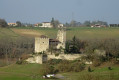
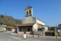
(11) On leaving the hamlet, turn left towards the church, go round it to the right, continue to the woodland and turn right until you reach the road, then head down to the left towards the lake.
(12) At the bottom of the descent, before crossing a bridge, turn right onto the stony path between a woodland and some hazel bushes. When you reach the lake’s embankment, turn left onto the grassy path along the embankment (Yellow route) and continue to the car park where you started (S/E).

 Visorando Member
 Easy