


 Country:
 City:
City:


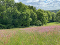
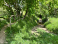
Park in the centre of Grignols on the large central square.
Green and yellow signposting.
(S/E) Head towards Cocumont and take a small road on the right towards the cemetery. Follow the green and yellow markings labelled ‘Route du Lysos’.
(1) Leave the road before the cemetery and turn left onto a track.
(2) Turn right onto the D655E5 and immediately left onto a path leading downhill. At the bottom (elevation 77), turn right to rejoin the road.
(3) Follow the road to the right and quickly turn off onto a small road on the left. Very quickly turn off this road onto a track on the right.
(4) Cross a stream and head uphill to the hamlet of Rouchet. Continue along the road. At the end, follow the D655E to the left to enter the village of Cours-Les-Bains.
(5) Before the church, turn right. The track winds its way and joins a road. Turn left, pass the hamlet of Fuguiès and turn left again. Reach the hamlet of Dubouil and follow the D655E8 to the right.
(6) Take thefirst track on the left. Wind your way through the woods until you reach a T-junction after a gentle descent.
(7) Then turn left and continue north-north-east. Cross a stream and head uphill on the other side, still through woodland.
(8) At the top of a slope, leave the woods and walk alongside a vineyard on your left. Then go straight on between fields and walk past a farm on your left (make sure you stay on the path).
(9) Carry on along the small road that serves these few houses. Continue straight on until you reach the D252.
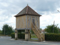
(10) Turn left. At the crossroads in the hamlet of Balahade, take thesecond left and pass by the foot of a water tower. Leave the hamlet of Marcon on your left and head towards the hamlet of Didot.
(11) Turn left just before a house. Follow the path as it winds its way, heading generally south and then west. You’ll come to a road.
(12) Then turn left onto a winding path which leads to the Church of Saint-Jean-Baptiste in Auzac.
(13) Turn right onto the road leading downhill. Cross the D655E6 and head back up the road opposite towards Harbaut.
(14) At the top of the hill, turn right and immediately leave the road, passing a house on your left. Follow a path not shown on the map, heading north-west, and descend to the D655E6.
(15) Cross the road carefully and head straight ahead along a grassy track. The track turns right and climbs a hillock to reach the hamlet of Campanot.
(16) Continue northwards along the access road. Take thefirst left and walk past Saint-Loubert Church and its adjoining cemetery (drinking water available).
(17) Shortly afterwards, and before a junction, leave the “Circuit du Lysos” route and turn left towards “Bl de Grignols”. Follow a path that crosses a field and then descends (rugged path). Cross a stream and you’ll reach a road.
(18) Follow this road to the left for about 300 m and cross another stream. Near pidgeon hunting huts, take a path on the right (avoid this in October and November during the pidgeon hunting season). Climb up to the hamlet of Laboyrie.
(19) Continue straight on along a small road. Pass Lampeau and arrive at a junction.
(20) Turn left.
(21) Take thefirst left, pass the care home and arrive in the centre of Grignols. Turn right to reach the car park (S/E).


 Visorando Member
 Easy
Easy 
 Moderate
