Uxeau circular loop via Mont Dardon

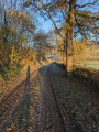
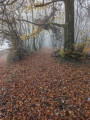
A lovely circular walk along country lanes and through woodland. The walk takes you around Mont Dardon, passing numerous chestnut trees.

Details

43060863
Creation:
Last update:
Last review:
  • Walking
    Activity: Walking
  • ↔
    Distance: 7.68 mi
  • ◔
    Average duration: 4h 20 
  • ▲
    Difficulty: Moderate

  • ⚐
    Back to start: Yes
  • ↗
    Ascent: + 879 ft
  • ↘
    Descent: - 883 ft

  • ▲
    Highest point: 1,654 ft
  • ▼
    Lowest point: 1,066 ft
  • ⚐ Country: France
  • ⚐ City: Uxeau (71130)
  • ⚑
    Start/End: N 46.663949° / E 4.025348°
  • ❏
    IGN map(s): Ref. 2826SB
  • Hour-by-hour weather

Photos

Description of the walk

Park in the church car park.

(S/E) Walk past the church on your right until you reach the junction with the Route de Sainte-Radegonde (D255). Turn left and follow the road for about 500 m.

(1) Leave this road and turn right, towards Chez le Quatre. Continue to the first path on the left.

(2) Turn sharply left and take this dirt track, descending for 300 m, until you reach a junction.

(3) Turn left, towards Mont Dardon, and head up a dirt track. Mont Dardon is directly in front of you. Join the Route de Sainte-Radegonde, which you left earlier.

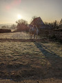
(4) Cross it and continue towards “Montmort”–“Grand Dardon” on a tarmac road. Pass “Chez le Pat”, which sells walnuts from its own harvest (see photo). Continue for 300 m until you reach a farm.

(5) Leave the road and turn onto a path, slightly hidden on the left, just before the farm. This path climbs steeply. Continue the ascent towards Mont Dardon on this path: Uxeau is behind you. Reach the top of the path.

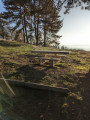
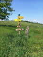
(6) Turn right and follow the signs for “Accès au Dardon”. The climb becomes steeper and takes you through pine trees. The access point to Mont Dardon is about 500 m away: the site is well-maintained, with tables and benches provided for picnics.

(7) At the summit, look for a small path to the right of the only car park on the site. In summer, this may be hidden by vegetation. Follow this pretty path down through the pine and chestnut trees. The path leads out onto a meadow.

(8) Walk along the meadow to the right for about 100 m, and join the lovely path coming from the hamlet of Les Gautherons, which is on the right.

(9) Follow this path to the left and join the tarmac road (Route du Dardon).

(10) Take the sharp left-hand bend on this road and continue to a T-junction.

(11) Turn right and continue along Route du Dardon. Carry on for about 1.5 km until you reach the hamlet of Vaudelin and pass through it.

(12) Turn left towards Le Pontot and continue for about 600 m until you reach a junction after the Ruisseau de Vaudelin.

(13) Leave the road and continue left onto an uphill track. Carry straight on for 2 km. You cannot go wrong on this section of the route. You will reach a tarmac road near the Glafoux farm.

(14) Take the road on the left and continue for about 1.5 km. Follow a wood on the left and arrive at the Route de Gueugnon (D25)

(15) Ignore this road and turn left at the hairpin bend towards “Bois Michelot”–“La Jeutisse”. Continue along this small road for about 1 km until you reach the sign for “La Jeutisse”.

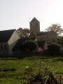
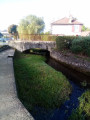
(16) Turn right towards Uxeau, whose church can be seen in the distance. You will come to a bridge.

(17) Cross it to the left and continue along Rue des Écoles to return to the church square and the car park (S/E).

Waypoints

  1. S/E : mi 0 - alt. 1,263 ft - Church square
  2. 1 : mi 0.32 - alt. 1,207 ft - Junction
  3. 2 : mi 0.41 - alt. 1,181 ft - Junction on the path
  4. 3 : mi 0.63 - alt. 1,070 ft - Crossroads
  5. 4 : mi 1.07 - alt. 1,178 ft - Route Sainte-Radegonde
  6. 5 : mi 1.19 - alt. 1,201 ft - Junction on the path
  7. 6 : mi 1.65 - alt. 1,421 ft - T-junction
  8. 7 : mi 2.12 - alt. 1,644 ft - Mont Dardon (506m)
  9. 8 : mi 2.59 - alt. 1,388 ft - Arrival at a meadow
  10. 9 : mi 2.67 - alt. 1,378 ft - Chemin Gautheron
  11. 10 : mi 2.92 - alt. 1,339 ft - Route de Dardon
  12. 11 : mi 3.26 - alt. 1,230 ft - Triangular junction
  13. 12 : mi 3.94 - alt. 1,181 ft - Vaudelin
  14. 13 : mi 4.41 - alt. 1,099 ft - Turn left
  15. 14 : mi 5.26 - alt. 1,280 ft - Glafoux Farm
  16. 15 : mi 5.84 - alt. 1,339 ft - Route de Gueugnon
  17. 16 : mi 6.49 - alt. 1,283 ft - Sign for La Jeutisse
  18. 17 : mi 7.14 - alt. 1,125 ft - Bridge
  19. S/E : mi 7.68 - alt. 1,263 ft - Church square

Notes

The village bar is closed.
Toilets on the square.
The Dardon site is well-equipped and ideal for picnics.

Worth a visit

Reviews and comments

4.8 / 5
Based on 3 reviews

Reliability of the description
5 / 5
Ease of following the route
5 / 5
Route interest
4.3 / 5
Jean Philippe REBET
Jean Philippe REBET

Overall rating : 5 / 5

Date of your route : Feb 15, 2025
Reliability of the description : ★★★★★ Very good
Ease of following the route : ★★★★★ Very good
Route interest : ★★★★★ Very good
Very busy route : No

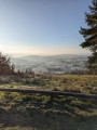
A really enjoyable hike, quite a bit of a workout, with a magnificent view from Mont Dardon in particular.

Machine-translated

Moietmonchien
Moietmonchien
• Edited:

Overall rating : 4.7 / 5

Date of your route : Nov 01, 2024
Reliability of the description : ★★★★★ Very good
Ease of following the route : ★★★★★ Very good
Route interest : ★★★★☆ Good
Very busy route : No

I live in Uxeau and I know this road well. It’s really lovely.
Just a quick note: Since summer 2024, the bar-restaurant has found a new owner and a new name: Restaurant À l'Ombre du Tilleul
Opening hours:
Monday Closed
Tuesday Closed
Wednesday 10:00–14:00
Thursday 9:00–14:00
Friday 10:00–14:00 18:00–22:00
Saturday 10:00–14:00 18:00–22:00
Sunday 9:00–14:00 18:00–22:00
By appointment 06 88 84 86 01
https://www.facebook.com/profile.php?id=...
https://fr.restaurantguru.com/Bar-Restau...

Machine-translated

sandrine DTanguy
sandrine DTanguy

Overall rating : 4.7 / 5

Date of your route : Jul 15, 2024
Reliability of the description : ★★★★★ Very good
Ease of following the route : ★★★★★ Very good
Route interest : ★★★★☆ Good
Very busy route : No

Thank you for the route details for this hike.
We went for a walk today and, sure enough, we found the famous path to the right of the car park at Mont Dardon, past the mast. But it was impassable due to the lush vegetation (tall thistles, stinging nettles and brambles greet you on all sides).
We went back down past point 6 to the junction of two roads and immediately turned right onto the GR13 to reach point 11.
This route from Mont Dardon is best tackled this autumn or winter when the vegetation is less dense. We’ll be back.

Machine-translated

Other walks in the area

For more walks, use our search engine .

The GPS track and description are the property of this route's author. Please do not copy them without permission.