Uxeau circular route via the Étang de Chevalot

A circular route on the hills above Gueugnon around the hamlet of Uxeau. The route alternates between forest paths, dirt tracks and small tarmac roads. It passes by the Étang de Chevalot and the hamlet of Petit Dardon.

Details

n°42880119
Creation:
Last update:
Last review:
  • Walking
    Activity: Walking
  • ↔
    Distance: 7.42 mi
  • ◔
    Average duration: 3h 55 
  • ▲
    Difficulty: Moderate

  • ⚐
    Back to start: Yes
  • ↗
    Ascent: + 584 ft
  • ↘
    Descent: - 587 ft

  • ▲
    Highest point: 1,257 ft
  • ▼
    Lowest point: 883 ft
  • ⚐ Country: France
  • ⚐ City: Uxeau (71130)
  • ⚑
    Start/End: N 46.663234° / E 4.024818°
  • ❏
    IGN map(s): Ref. 2826SB
  • Hour-by-hour weather

Photos

Description of the walk

The walk starts at Place de l’Église, in the village of Uxeau.

(DA) Take the Route de Saint-Radegonde, which quickly takes you out of the village. Continue along this road for about 500 metres until you reach the first junction.

(1) Turn right onto Route de Chez le Quatre and continue for about 200 metres until you reach the path on the left.

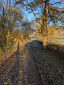
(2) Take the dirt track leading down to the left until you reach the next fork. The view of the surrounding hills is superb!

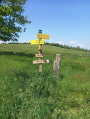
(3) Carry on straight ahead, towards “La Guette via Le Petit Dardon” (yellow hiking sign). Continue along the track until you reach the Toulon/Arroux road.

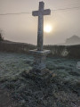
(4) Cross it (there’s a cross there), heading towards the hamlet of Le Petit Dardon. Walk through the hamlet and rejoin the Toulon/Arroux road.

(5) Turn left onto it and continue until you reach a crossroad.

(6) Turn left onto this road (Chemin de la Maison Rouge). You’ll now be looking towards Mont Dardon. Carry on for about 500 metres until you reach a junction.

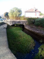
(7) Turn slightly to the right, still on the Chemin de la Maison Rouge. The path is now a dirt track and leads into the countryside. Continue for about 2 km, passing a pretty pond (see photo), and you’ll reach the Route de Brusserolles.

(8) Turn right onto this road and carry on for about 2 km until you reach the Étang de Chevalot.

(9) Walk alongside it, following the Route de Toulon/Arroux to the next junction.

(10) Turn sharply right, towards “Loges Vagets”, and continue for about 200 metres.

(11) Turn left into the Impasse des Loges Vagets. Stay on the road until you reach the last house in the hamlet.

(12) Turn left onto a track leading towards the Bois de la Valla and enter the woodland. This track is well-maintained and clearly visible. Continue for about 300 to reach a fairly wide track.

(13) Turn right onto it and head up into the Bois de la Vella. It is impossible to go wrong on this north-westerly stretch. Carry on until you reach the exit.

(14) Carry on straight ahead until you reach a dirt track. Continue for about 2 km until you reach the junction.

(15) Take the track on the left (slightly downhill) for about 100 m. Turn off onto the track on the right (slightly uphill) which joins the Chemin des Boulays.

(16) Turn right and walk for about 1 km, uphill, towards Uxeau, until you reach the Route de Chez le Quatre.

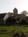
(17) Cross the road and continue straight on: “Towards Mairie-Bourg” along the grassy path. You’ll see the village church. At the road, turn right to return to the Place de l’Église (S/E).

Waypoints

  1. S/E : mi 0 - alt. 1,257 ft - Place de l’Église in the village of Uxeau
  2. 1 : mi 0.29 - alt. 1,207 ft - Junction
  3. 2 : mi 0.39 - alt. 1,184 ft - Fork in the road
  4. 3 : mi 0.61 - alt. 1,066 ft - Junction
  5. 4 : mi 0.92 - alt. 1,125 ft - Crossing the road
  6. 5 : mi 1.21 - alt. 1,030 ft - Route de Toulon/Arroux
  7. 6 : mi 1.33 - alt. 994 ft - Chemin de la Maison Rouge
  8. 7 : mi 1.54 - alt. 1,027 ft - Junction
  9. 8 : mi 2.51 - alt. 1,024 ft - Route de Brusserolles
  10. 9 : mi 3.64 - alt. 902 ft - Chevalot Pond
  11. 10 : mi 3.82 - alt. 892 ft - Junction
  12. 11 : mi 3.88 - alt. 889 ft - Impasse des Loges Vagets
  13. 12 : mi 4.22 - alt. 974 ft - Loges Vagets
  14. 13 : mi 4.51 - alt. 961 ft - Junction onto a forest track
  15. 14 : mi 5.38 - alt. 1,070 ft - Road junction
  16. 15 : mi 6.15 - alt. 1,024 ft - Junction
  17. 16 : mi 6.44 - alt. 997 ft - Chemin des Boulays
  18. 17 : mi 6.99 - alt. 1,171 ft - Cross the Route de Chez le Quatre
  19. S/E : mi 7.42 - alt. 1,257 ft - Place de l’Église in the village of Uxeau

Notes

A fairly easy walk with a variety of views.
The bar-restaurant has found a new owner and a new name: Restaurant À l’Ombre du Tilleul
Toilets on the village square.

Reviews and comments

4.2 / 5
Based on 2 reviews

Reliability of the description
4 / 5
Ease of following the route
4 / 5
Route interest
4.5 / 5
User 4041015

Overall rating : 3.3 / 5

Date of your route : Nov 03, 2025
Reliability of the description : ★★★☆☆ Average
Ease of following the route : ★★★☆☆ Average
Route interest : ★★★★☆ Good
Very busy route : No

Machine-translated

Moietmonchien
Moietmonchien
• Edited:

Overall rating : 5 / 5

Date of your route : Nov 01, 2024
Reliability of the description : ★★★★★ Very good
Ease of following the route : ★★★★★ Very good
Route interest : ★★★★★ Very good
Very busy route : No

Hello,
I live in Uxeau and know this road well. It’s really lovely.
Just a quick note: since the summer of 2024, the bar-restaurant has found a new owner and a new name: Restaurant À l’Ombre du Tilleul
Opening hours:
Monday: Closed
Tuesday: Closed
Wednesday 10.00–14.00
Thursday 9.00–14.00
Friday 10.00–14.00, 18.00–22.00
Saturday 10.00–14.00 18.00–22.00
Sunday 9.00 am–2.00 pm 6.00 pm–10.00 pm
Bookings on 06 88 84 86 01
https://www.facebook.com/profile.php?id=...
https://fr.restaurantguru.com/Bar-Restau...

Machine-translated

Other walks in the area

For more walks, use our search engine .

The GPS track and description are the property of this route's author. Please do not copy them without permission.