


 Country:
 City:


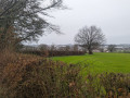
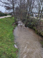
The starting point is on Rue Jean Bouveri, after the Eric Tabarly roundabout: parking available.
(S/E) Head towards Bourbon-Lancy for about a hundred metres, then turn right onto Rue de la Vesvre. The Collège Jorge Semprun soon appears on the right. Continue along the small road, where the climb towards Les Essenleys is steep. Walk for about 800 m.
(1) At the top of the hill, turn right for about 100 metres, then turn right again onto the first dirt track. The walk takes you through woodland: continue for about 300 metres.
(2) At the junction, carry straight on along the track until you come out onto Route de Valette.
(3) Turn left and follow this road for about 2 km: there are no junctions until the next signpost.
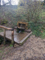
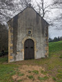
You can take a break and fill your water bottle at the spring by the Chapelle Saint-Thibault, which you’ll find on the left: the chapel is well worth a visit.
(4) Retrace your steps and rejoin the route to the left, heading towards the Étang de Valette.
(5) Carry on straight ahead without crossing the dyke. On the right is the Moulin de Valette. The road climbs slightly and reaches a junction. Continue to the right until the next junction.
(6) The walking signs are damaged at this point: one sign points to the hamlet of Valette. Do not follow this direction but turn left onto the road towards Chez Buisson. The road slopes steeply downwards. Continue for about 500 m.
(7) Turn left at the Chez Buisson junction and carry straight on at the next crossroads, onto the Chemin du Verne. You’ll come to another junction where there’s a large oak tree.
(8) Turn left to reach the Mercully neighbourhood. Gueugnon is visible in the distance on the left. Continue along the road until you reach the junction with Chemin de Mercully.
(9) Carry on in the same direction, then keep left at the T-junction, staying on Chemin de Mercully as you head downhill. Continue straight on until you reach Route de Bourbon-Lancy, about 1 km away.
(10) Cross with care and head towards Gueugnon on the left, using a lane running parallel to the county road. Continue for about 500 m until you reach the sign for “Chemin des Bruyères d’Abreu”, then turn right onto this street and carry on to the end.
(11) Follow Rue du Reuil du Plessis to the left. Continue for about 300 m until you rejoin Route de Bourbon-Lancy.
(12) Turn right and walk alongside the road, using the pavement, until you reach the starting point (S/E).

 Visorando Member

 Easy
 Very difficult
 Association / Club / Walk leader
 Tourist office

