


marcherin

 Visorando Member
 Premium user
Sign up:
Published route(s)
 Walk from La Vecquée to Stoumont
 5.05 mi
 +771 ft
 -771 ft
 3h 00
3h 00
 Moderate
 Departure from Stoumont (Province de Liège)
Following the blue markings, starting from the church square, this route will take you to the highest point in the municipality of Stoumont. You will start with a climb, crossing the pretty hamlets of Roua and Monthouet. Along the way, you will discover the Croix Honnay, which is said to have been planted long ago by a traveller lost in the snow, and the Pyramide, a geodetic marker which, according to legend, was an observation post for Caesar's army. La Vecquée then opens up before you. This large, wide firebreak at the top of the slope is the ancient Roman road that the prince-bishops used in the Middle Ages to travel from Liège to Stavelot Abbey. A historic border between states, it still marks the boundary between Theux and Stoumont today. To descend, you will walk along the Pansîres nature reserve, cross woods and pastures, and come across the Cheval de pierre, a block of quartzite that looks like a lying horse.
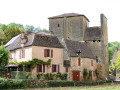
Urval South Circular Route
 6.16 mi
+679 ft
-659 ft
3h 25
6.16 mi
+679 ft
-659 ft
3h 25
 Easy
Departure from Urval (Dordogne)
Easy
Departure from Urval (Dordogne)
A route starting from Urval, a typical Périgord village, on the left bank of the Dordogne in the Périgord Noir, between Belvès and Le Buisson de Cadouin. A route, mainly through woodland, with little elevation gain and few tarmac sections. Ideal for families.