Bonrepos via Lalanne

This walk is best undertaken after heavy rain, which can make the footpaths and tracks muddy and impassable. This route uses only tarmac roads, most of which are quiet.

Details

n°4818746
Creation:
Last update:
Last review:
  • Walking
    Activity: Walking
  • ↔
    Distance: 5.84 mi
  • ◔
    Average duration: 2h 50 
  • ▲
    Difficulty: Easy

  • ⚐
    Back to start: Yes
  • ↗
    Ascent: + 217 ft
  • ↘
    Descent: - 217 ft

  • ▲
    Highest point: 879 ft
  • ▼
    Lowest point: 646 ft
  • ⚐ Country: France
  • ⚐ City: Fontenilles (31470)
  • ⚑
    Start/End: N 43.552571° / E 1.191791°
  • ❏
    IGN map(s): Ref. 2043ET
  • Hour-by-hour weather

Photos

Description of the walk

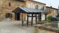
Park in the town hall car park or, if that’s full, on Boulevard de la République.

(S/E) On the church forecourt, with your back to the church, walk to the road junction. Turn left onto Rue du 11 Novembre and follow the footpath on the left-hand side of the road. Take the footbridge to cross over the Aussonnelle, then cross the road at the raised pedestrian crossing.

(1) Take thefirst street on the right, Impasse du Moulin; walk past the children’s playground on your left and continue up to the end of the cul-de-sac. Go through the tunnel to pass under the Fontenilles bypass and continue towards Route de Bonrepos.

(2) Cross the road at the raised pedestrian crossing and continue straight ahead onto Route de Saiguède, which becomes Route de Fontenilles as you cross the municipal boundary. Continue to the junction with the D12, Route du 12 Juin 1944.

(3) Cross the departmental road with care and continue straight ahead onto the Voie Romaine, keeping to the right at the three-way junction that appears immediately. Begin the climb towards the Château du Candelé.

(4) On the slight incline after thefirst climb, turn right onto the Chemin du Moulin and head down to the Rue de l’Aussonnelle.

(5) Turn right at the bottom of the descent and carry on to the roundabout. Go round the roundabout on the right, using the pedestrian crossing, and take the road opposite.

(6) Continue to the right on the widest road, the D68 Route de Tourneris, which further on becomes the Route de Bonrepos as you cross into the next municipality. Carry on to thefirst road on the left, which is closed to traffic.

(7) Turn left onto the tarmac road, cross over the Aussonnelle and head up to the Chemin du Garrousset.

(8) Turn right onto the road that forms part of theGR® 86, which you should follow right to the finish. Continue to the roundabout leading to the ring road. Go round this roundabout on the left, using the pedestrian crossing, and take the path opposite.

(9) Turn right to pass under the ring road and head towards the town centre, following the road leading to the Magnolias residential estate. Continue to the next junction.

(10) Turn right onto Route de Lias and carry on straight ahead until you reach the church forecourt and the town hall car park, the starting point of the route (S/E).

Waypoints

  1. S/E : mi 0 - alt. 663 ft - The forecourt of the - Église Saint-Martin (Fontenilles)
  2. 1 : mi 0.14 - alt. 650 ft - Children’s playground. After the - Aussonnelle (rivière)
  3. 2 : mi 0.59 - alt. 669 ft - Impasse du Moulin
  4. 3 : mi 1.89 - alt. 705 ft - D12 road
  5. 4 : mi 2.58 - alt. 879 ft - Top of the Chemin du Moulin
  6. 5 : mi 3.32 - alt. 732 ft - Rue de l’Aussonnelle
  7. 6 : mi 3.46 - alt. 715 ft - Route de Tourneris
  8. 7 : mi 4.51 - alt. 679 ft - The left-hand lane is closed to traffic
  9. 8 : mi 4.75 - alt. 676 ft - Chemin Garrousset
  10. 9 : mi 5.16 - alt. 673 ft - Tunnel under the ring road
  11. 10 : mi 5.42 - alt. 666 ft - Route de Lias
  12. S/E : mi 5.84 - alt. 663 ft - The forecourt of the - Église Saint-Martin (Fontenilles)

Notes

It is advisable to bring high-visibility vests (yellow vests).
Drinking fountains and toilets are available in the post office building when it is open to the public.
Public toilets are available on the Place du Souvenir, outside the Maison des Loisirs.
On the square, opposite the church, the café ‘Chez Lulu’ is a great place to quench your thirst after your ride, with a lovely terrace and, at lunchtime on weekdays, a home-style meal.
There are no particular difficulties on the route, which is mostly flat.

Worth a visit

(S/E) On Saturday mornings, the smithy is open and in operation thanks to its volunteers, which makes for a pleasant way to round off the walk.
The church has been fully restored.

Always be cautious and plan ahead when you're outdoors. Visorando and the author of this route cannot be held responsible for any accidents occurring on this route.

The GR® and PR® markings are the intellectual property of the Fédération Française de Randonnée Pédestre.

Reviews and comments

4.7 / 5
Based on 1 review

Reliability of the description
5 / 5
Ease of following the route
5 / 5
Route interest
4 / 5
gbnos
gbnos

Overall rating : 4.7 / 5

Date of your route : Feb 17, 2021
Reliability of the description : ★★★★★ Very good
Ease of following the route : ★★★★★ Very good
Route interest : ★★★★☆ Good
Very busy route : No

An easy walk along quiet country lanes, perfect for keeping fit in winter. Once you reach Bonrepos, you can take a look at the castle from the outside and carry on along the GR36. Take care when crossing the D12 twice if you have children or pets, as there is quite a lot of traffic.

Machine-translated

Other walks in the area

For more walks, use our search engine .

The GPS track and description are the property of this route's author. Please do not copy them without permission.