


 Country:

 City:
City:


Park in the car park at the entrance to the village of Trigance.
(S/E) Enter the village and head to the small square with the fountain.
(1) Take the street on the left, walk past the post office, then first turn right then left to leave the village.
(2) Follow the PR® (yellow markings) by turning right. Enjoy a lovely climb through a forest of magnificent maritime pines, up the slope of the Colle de Breis, to soak up the morning sun filtering through the pine tops. Join a track.
(3) Follow this track, heading to the left. Take a sharp left-hand bend and climb one final slope to reach the Crête de Casseyère.
(4) Continue to the left: the path narrows and winds its way between rocky outcrops towards the Sommet de Breis, which you’ll leave to your left. Join a track and the GR® 49 at a hairpin bend.
(5) Take the fairly steep track downhill to the right.
(6) Leave the GR®49, which heads off to the right, and carry on straight ahead to reach a sort of clearing (Encastel).
(7) Take a narrow, barely visible drovers' road uphill to the right through the vegetation. You’ll soon reach a limestone plateau where the road leads straight on towards the Rancoumas viewpoint and the Gorges du Verdon: if you lean carefully over the sloping rock, you can see the bottom of the gorges and the torrent, which you can hear. You may also spot vultures, whose shadows fall upon the cliff opposite. There is a cave near the viewpoint, marked on the map, but we were unable to find it, perhaps due to the dense vegetation.
(8) On the way back, take the same drovers' road in the opposite direction towards the track. Follow this drovers' road uphill (it’s tough going!) until you reach the junction with the PR®.
(5) Continue to the right along the track which climbs through the forest, following the dual signposting for the GR®49 and the PR®. You’ll reach a clearing that’s perfect for a picnic break after the tough climb up the track.
(9) Carry on straight ahead, heading downhill towards Entreverges (no patous reported). You can then enjoy the afternoon sun.
(10) As you leave the hamlet, leave the track that heads straight on and take the path on the left (GR®/PR®).
(11) A little further down the slope, heading towards the Crête de la Serrière du Preil, this path turns into a narrow track through vegetation consisting mainly of oak and boxwood: a lovely view over the north-east of the Var towards the Alpes-Maritimes.
(12) Turn right towards the D90. Join the road and follow it, turning left towards the village. Pass the Chapelle Saint-Roch on your left and return to the car park (S/E).
 Visorando Member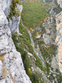

 Easy
Easy 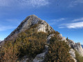
 Very difficult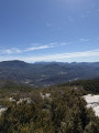
 Difficult
