Country:

 City:


To reach the starting point, head up the Roya valley and follow signs for La Brigue after Saint-Dalmas de Tende (the road branches off to the right and crosses the Roya). Pass through the village of La Brigue, then continue towards Morignole and take a road on the right leading to the sanctuary of Notre-Dame des Fontaines, where the walk begins.
(S/E) At marker 266, situated to the left of the sanctuary at the start of a dirt track, head towards the Pas de Colle Ardente. The route follows a shaded path with a steady, gentle gradient. Reach marker 268.
(1) Cross the Fraches stream and pass the marker, continuing to follow the signs for Pas de Colle Ardente. From this point, the slope becomes steeper. Further up, you’ll come to marker 269, still following the signs for Pas de Colle Ardente.
(2) At the pass, where marker 270 is located, follow the signs for Mont Saccarel. Here you’ll come to a dirt track suitable for vehicles. Leave this quickly to take a path marked in yellow (the General Council’s hiking map) and in red and white (Italian vertical markings). Follow these markings to the Pas du Saccarel. From this point, the climb becomes more challenging as you still have to tackle half the total elevation gain over a distance half that already covered.
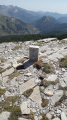
(3) Head towards Mont Saccarel, as indicated by marker 277a. You can see the summit stele to the south. Reach the summit of Mont Saccarel, then continue eastwards to reach the Statue of Christ the Redeemer on the Italian side.
(4) From the statue, follow the track to the Pas du Saccarel.
(3) Back at the Pas du Saccarel, there are two options:
- head back down to Notre-Dame des Fontaines via the same route, which is strongly recommended for less experienced or occasional walkers.
- for experienced walkers or adventurers: head towards the Pas de Tanarel to complete a circular route.
Please note: it is this circular route that has led me to classify the walk as ‘very difficult’; under no circumstances should you attempt it if you are walking in shorts with no way of covering your legs.
Start by following a path which soon joins a track.
(5) Leave the track and take a path that climbs up to the left (marked by a walking route sign from the Alpes-Maritimes General Council). Alternatively, to avoid this climb, you can reach the Pas du Tanarel by staying on the track; in this case, take care at the first hairpin bend to continue northwards (a gentle climb up to the pass).
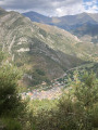
(6) Follow the signs for Bens, Notre-Dame-des-Fontaines and La Brigue, indicated by marker 277. Take the track that descends or cut across the hairpin bends via the footpath. Shortly after the third hairpin bend, take a path on the right that descends towards the west (you can see the village of La Brigue).
From this point onwards, you’ll need to be particularly attentive, vigilant and careful: the path is very steep and in very poor condition. The first few hundred metres are relatively easy to follow, but very quickly the path disappears into overgrown vegetation that reaches up to your knees. The path is often hard to make out. You’ll need to make your way through stinging nettles (hence the need to cover your legs). Despite the poor condition of the path, it’s difficult to go wrong as yellow markers are regularly visible (even if partially faded) and the route is relatively easy to follow.
(7) Cross the stream to rejoin a path in much better condition on the right bank (as viewed from the mountain). From this point, the walk becomes much easier and very pleasant through a beautiful, wild little valley.
(8) You may encounter a slight difficulty in finding your way when you reach a sheepfold, as numerous tracks criss-cross the area. The route normally continues downwards towards the south-west.
Personal note: As I couldn’t find the path, I continued on level ground heading west across cultivated terraces, came across a fence which I followed until I reached a stream where I found a path leading southwards towards marker 276 (watch out for the sheepdogs).
(9) From marker 276 onwards, the route is straightforward. Head towards Bens and Notre-Dame des Fontaines. You will then join a path or track. Pass marker 275 and then marker 276 in turn. Join the tarmac road leading up from Notre-Dame des Fontaines and follow it until you reach the starting point. This final stretch along the road may seem long and tedious before you reach the car park at Notre-Dame des Fontaines (S/E).

 Visorando Member


 Difficult
 Moderate