Circular route starting from Buc

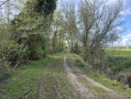
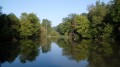
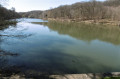
A varied route through built-up areas, fields, ditches, canals and ponds. A very shaded route on a variety of surfaces including tarmac, gravel, earth and grass. Passing by Château de Buc, along the Golf National, Toussus-le-Noble airfield, Guyancourt, and the Val d'Or and Geneste ponds.

Details

93618146
Creation:
Last update:
Last review:
  • Walking
    Activity: Walking
  • ↔
    Distance: 8.26 mi
  • ◔
    Average duration: 3h 55 
  • ▲
    Difficulty: Moderate

  • ⚐
    Back to start: Yes
  • ↗
    Ascent: + 184 ft
  • ↘
    Descent: - 184 ft

  • ▲
    Highest point: 535 ft
  • ▼
    Lowest point: 344 ft
  • ⚐ Country: France
  • ⚐ City: Buc (78530)
  • ⚑
    Start/End: N 48.775885° / E 2.126303°
  • ❏
    IGN map(s): Ref. 2214ET, 2215OT, 2215OTR, 2315OT
  • Hour-by-hour weather

Photos

Description of the walk

Park in Buc at the Pré Saint-Jean car park, which has both free parking and a Blue Zone.

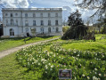
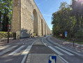
(S/E) Take Rue des Frères Robin, pass in front of the town hall, then take the steps at the entrance to Rue de l’Égalité. Note: you can avoid these hundred or so steps by taking the detour via the hairpin bend on Rue Louis Massotte. Go past the roundabout to reach the Château de Buc.

(1) Enter the park, go round the secondary schools’ sports ground until you reach Rue de la Minière, cross the housing estate, Allée des Toits de Buc. Exit onto Rue Colin-Mamet, walk past Intermarché and continue along Avenue Maurane Saulnier to reach the stadium.

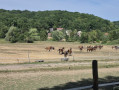
(2) Walk between the stadium and the indoor tennis courts until you reach the fields. Turn left along the hedges and walk towards Toussus Aerodrome for about 1 km. You will reach the gate to the aerodrome and the golf course.

(3) Turn right and continue between the golf course and the Rigole de Guyancourt ditch. You will then reach a stone bridge over the ditch. Here, you will find a proper path leading to a garage.

(4) Go round it on the right and follow the tarmac hiking path marked in yellow. Walk alongside the Rigole de Guyancourt again. Continue to the access road to the Renault site. Cross via the underpass beneath the Rond-point des Frères Perret. Continue to Rue Youri Gagarine.

(5) Turn right to cross the canal via the Pont du Routoir. Turn left into Allée Estienne d'Orves, keeping to the yellow markings. Continue through this part of Guyancourt and, via the pedestrianised streets of Mail Thérèse Desqueyroux and Rue du Moulin Renard, head towards the nursery and primary schools.

(6) Continue straight ahead to reach the Club de Sports des 3 Mousquetaires almost in a straight line.

(7) Then turn right into the Versailles National Forest. Here you will find the GR®2 and 11 marked in white and red. Walk along the southern bank of the Étang du Val d’Or. At the end of the lake, you will come to a picnic area.

(8) Head back up and turn left, then right into the underpass beneath the D91, reaching a car park at the start of the Route de la Porte de la Minière

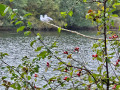
(9) Turn left onto this road – you are still on the GR® – and walk along the banks of the Bièvre, then along the northern shore of the Étang de la Geneste, until you reach a bridge at the far end of the lake.

(10) Cross the bridge and continue left along the GR® to return to the Pré Saint-Jean car park in Buc (S/E).

Waypoints

  1. S/E : mi 0 - alt. 351 ft - Pré Saint-Jean car park
  2. 1 : mi 0.47 - alt. 495 ft - Château de Buc
  3. 2 : mi 1.3 - alt. 531 ft - Buc Stadium
  4. 3 : mi 2.16 - alt. 515 ft - Aerodrome and Golf National map
  5. 4 : mi 2.85 - alt. 518 ft - Garage
  6. 5 : mi 4.66 - alt. 525 ft - Rue Youri Gagarine
  7. 6 : mi 5.19 - alt. 535 ft - Flight schools
  8. 7 : mi 5.6 - alt. 518 ft - 3 Musketeers Sports Club
  9. 8 : mi 6.38 - alt. 410 ft - End of the - Étang du Val d'Or
  10. 9 : mi 6.92 - alt. 374 ft - Car park
  11. 10 : mi 7.79 - alt. 358 ft - Étang de la Geneste
  12. S/E : mi 8.26 - alt. 351 ft - Pré Saint-Jean car park - Bièvre (affluent de la Seine)

Notes

Between (2) and (3): watch the training flights of the school planes, focusing mainly on take-offs, landings, etc.
Between (6) and (7): the start/finish point may be at Guyancourt, in the car park by the cemetery and allotments.

Worth a visit

Always be cautious and plan ahead when you're outdoors. Visorando and the author of this route cannot be held responsible for any accidents occurring on this route.

The GR® and PR® markings are the intellectual property of the Fédération Française de Randonnée Pédestre.

Reviews and comments

3.3 / 5
Based on 1 review

Reliability of the description
4 / 5
Ease of following the route
3 / 5
Route interest
3 / 5
ealet
ealet

Overall rating : 3.3 / 5

Date of your route : May 03, 2026
Reliability of the description : ★★★★☆ Good
Ease of following the route : ★★★☆☆ Average
Route interest : ★★★☆☆ Average
Very busy route : Yes

A varied walk, but crossing the town is a bit long for my liking; the route description is sometimes a bit vague (e.g. ‘turn right as you leave the housing estate to walk past the Intermarché at point 1’), and the section along the golf course is a narrow, grassy path, which isn’t ideal in wet weather
The final section (from point 9 onwards) is very pleasant
Thanks to the author for sharing this

Machine-translated

Other walks in the area

For more walks, use our search engine .

The GPS track and description are the property of this route's author. Please do not copy them without permission.