Country:
 City:
City:


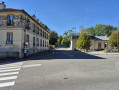
Start in Buc at the Pré Saint-Jean car park. Please note that the car park has a free section and a ‘Zone Bleue’ section.
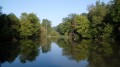
(S/E) Cross Rue des Frère Robin and the central reservation in front of the theatre, then take the narrow lane on the right and follow the GR®11 signposting: there is a barrier here. Walk alongside one branch of the Bièvre, cross it by turning left and join the other branch of the river.
(1) Cross the footbridge and turn right, walking alongside the Bièvre. Return to the right bank and continue to the junction by the pond. Take the path on the left, climb a few very steep steps and arrive at the junction with the D938 (Rue Louis Blériot).
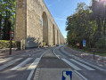
(2) Cross carefully, pass under the arcades and follow the Route de Jouy to the pedestrian crossing. Take the path leading uphill into the forest (yellow gas marker). Cross the GR®22, then turn left onto the Route du Sud and walk a little over 200 m.
(3) At the junction, turn right onto the Route des Arcades. Continue straight on, heading north-east. As you pass ,note the Arcades forest pond. You will then arrive at the Rond-point des Gonards.
(4) Head slightly diagonally to the left to follow the Route de la Fausse Porte as far as the Carrefour du Cerf Volant. Turn left to reach the Porte du Cerf-Volant: you can hear the noise from the petrol engines on the N12.
(5) Cross the road and continue straight ahead: note the former gendarmerie building on the left and, on the right, the Maison Forestière, a former hunting lodge converted into retail premises. About fifty metres further on, enter the forest via the GR®22 and follow it for 1 km.
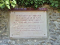
(6) Shortly after a bench, leave the marked trail and continue more or less straight on until you reach a lovely avenue. Take this, heading to the right, and continue until you reach a clearing overlooking the Camp de Satory. Enter and turn immediately left to see the commemorative plaque at the Mur des Fédérés, where Communards were executed in 1871.
(7) Head back out and continue to the right along the main track until you are as close as possible to the D91.
(8) Ignore the sign for “Étang de la Geneste 0.5 km”, which directs you to turn left. The track begins to descend after a left-hand bend. Take the less steep bend rather than the shortcut (moreover, in season, there is a patch of lily of the valley along the path). At the first junction, carry on straight ahead and cross the Bièvre.
(9) At the next junction, turn left onto the Route Forestière du Breuil. Continue along the Route des Prés de Buc.
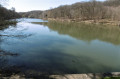
(10) At a junction, go straight on and walk alongside the Étang de la Geneste on your left. Continue to the end of the pond.
(11) Turn left down the slope, then immediately right to return to the River Bièvre and follow it along the Chemin du Pré Saint-Jean. Continue to the tennis courts.
(12) Turn left to cross the Bièvre and return to the car park (S/E).
 Visorando Member
 Moderate