Country:
 City:
City:


The walk starts at Petit-Jouy-Les Loges station, accessible via Transilien line V, between Massy-Palaiseau and Versailles-Chantiers. Whichever platform you alight from, you’ll exit the station via a downhill path:
- If you’re travelling from Massy towards Versailles, you’ll arrive at the point (S/E) as shown on the map.
- If you’re arriving from the opposite direction, turn right and go under the railway bridge to reach the point (S/E) straight away.
Other access options:
- Cycle parking at the location (S/E).
- Car parks at the checkpoint (11) and at the station exit on the Versailles-Massy side, at the junction of Rue Charles de Gaulle and Rue du Petit Jouy.
(S/E) Enter the forest via a path and head west. Follow the Route du Haras de Vauptain for a short distance on the left-hand side. At a junction, go straight on and follow the GR®22 (red and white markings), which immediately veers to the right and begins to climb. At the junction with a wider path, turn left onto a track (follow the red and white markings).
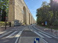
(1) After about 200 m, at a fork in the road, turn left, leave the GR® and head back down. You’ll come out onto a small road; follow it to the right. Pass under the Arcades de Buc (on the north side) and you’ll immediately reach a junction with traffic lights.
(2) Cross the D938 at the traffic lights and continue straight ahead along a path that veers diagonally to the left into the Versailles State Forest. Keep parallel to the D938, which runs higher up on your left, until you reach a junction on the banks of the Bièvre. Shortly afterwards, cross the second branch of the river and turn right.
(3) Then turn right and walk alongside the river on your right-hand side. Cross the Bièvre via a small bridge and now walk alongside it on your left-hand side. At the next bridge, turn left and cross the first branch of the Bièvre. You’ll arrive in Buc, at the foot of the Centre culturel des Arcades.
(4) Head right for a few metres, go round a roundabout on the left and take the first exit on the left. Cross Rue des Frères Robin and then the Pré Saint-Jean car park.
(5) Leave the car park via a small path on the right (north; Rue Henri et Victor Chevalier). Cross the backwater of the Bièvre, then turn left onto Rue Jean Jaurès. Pass through a residential area, go round a roundabout and enter the forest. Carry straight on along Chemin des Marais, ignoring all turn-offs to the right. You will reach the eastern end of the Étang de la Geneste.
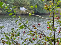
(6) Continue straight on, keeping the pond on your left, and follow its entire northern shore (you may spot some birds on the pond).
(7) At the western end of the pond, turn left onto a wide path. At the T-junction, turn left and follow the entire southern shore of the pond. At the end of the path, turn left onto the pond’s embankment and continue to its spillway.
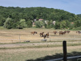
(8) Go down a flight of steps on the right, reach the River Bièvre and walk alongside it on your left. This is a very quiet path, amongst allotments and the Pré Saint-Jean, where you’ll see the horses from the Buc stud farm. Continue straight ahead along the path. After passing the tennis courts, a small wooden bridge takes you across the Bièvre, allowing you to continue along the path near the car park. Cross Rue Des Frères Robin and walk past the Centre culturel des Arcades, which you saw earlier.
(4) Follow the route you took on the way there, but in the opposite direction.
(3) At the junction, near a bench, turn right onto the main path heading south. At the crossroads, turn left onto the path that goes uphill. At the top, after the wooden posts and the barrier, turn left to reach the Arcades de Buc.
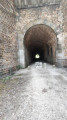
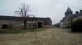
(9) Cross the D938 at the pedestrian crossing, taking great care (this is a very busy road where drivers approaching from your right have limited visibility). On the other side, go down a steep slope on the right and pass under the aqueduct. Follow a path eastwards, keeping the meadows of the Vauptain stud farm on your left. After a left-hand bend, walk past the stud farm buildings.
(10) A few metres further on, turn right onto a path running alongside the River Bièvre.
(11) You’ll come out onto Rue du Petit Jouy; follow it to the left, passing a car park on your left. You’ll soon reach Petit-Jouy-Les Loges station (S/E).
Access to the station for those travelling back by train:
- Heading towards Versailles, take the path that goes uphill to the left before the railway bridge.
- If heading towards Massy, go under the railway bridge and take the path that goes up immediately to the left.
 Visorando Member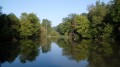
 Moderate