


Refine your search for walks in Borrigo (fleuve)
Borrigo (fleuve) walks


 Pointe de Siricocca, Pic de Garuche and Mont Ours
 Visorando Member
 5.60 mi
 +2,162 ft
 -2,136 ft
 4h 25
4h 25
 Moderate
 Departure from Sainte-Agnès (Alpes-Maritimes)
Loop hike above Sainte-Agnès with the ascent of three peaks that do not present any difficulties: the Pointe de Siricocca (and its fort-sheepfold), the Pic de Garuche (and its bunker) and the Mont Ours (and its DFCI guard post at the top of a white oak forest).
Diverse panoramic views of the coast, the Mercantour and the Nice hinterland.
Sainte-Agnès circular via Borrigo Waterfall
 4.30 mi
+1,719 ft
-1,722 ft
3h 30
Moderate
Departure from Sainte-Agnès (Alpes-Maritimes)
4.30 mi
+1,719 ft
-1,722 ft
3h 30
Moderate
Departure from Sainte-Agnès (Alpes-Maritimes)
A beautiful hike combining sightseeing, physical exercise and the discovery of Sainte-Agnès, the highest coastal village in Europe. The Borrigo Waterfall, this alpine trail and the duty to remember with a visit to the Maginot Line fort will round off a wonderful day.
Route of former military structures near Sainte-Agnès
 8.32 mi
+2,825 ft
-2,815 ft
6h 15
Moderate
Departure from Sainte-Agnès (Alpes-Maritimes)
8.32 mi
+2,825 ft
-2,815 ft
6h 15
Moderate
Departure from Sainte-Agnès (Alpes-Maritimes)
A beautiful hike north of Sainte-Agnès, Europe’s highest coastal village (700 m), featuring three high points, three former military fortifications and three different viewpoints: the Southern Alps from Mont Ours, the east from Pic de Garuche and, finally, Pointe de Siricocca, a rocky peak overlooking the coast.
From Monaco to Menton via Cap Martin
 9.73 mi
+463 ft
-459 ft
4h 55
Moderate
Departure from Roquebrune-Cap-Martin (Alpes-Maritimes)
9.73 mi
+463 ft
-459 ft
4h 55
Moderate
Departure from Roquebrune-Cap-Martin (Alpes-Maritimes)
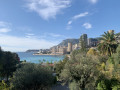
I suggest this round trip route, which starts at the eastern edge of Monaco and ends at the casino in Menton, without ever losing sight of the sea, with superb views of Monaco and Menton.
It follows the customs officers' paths, crosses or overlooks the beaches of Cabbé and Le Buse, goes around Cap Martin to arrive at Carnolès and finally Menton.
It is a 16 km (8 km x 2) route on paved terrain, with no technical difficulties, if you choose to do the round trip.
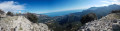
Tour and ascent of Pointe Siricocca from Monti
 8.64 mi
+2,979 ft
-2,979 ft
6h 35
8.64 mi
+2,979 ft
-2,979 ft
6h 35
 Difficult
Departure from Menton (Alpes-Maritimes)
Difficult
Departure from Menton (Alpes-Maritimes)
Circular route with a gradual elevation gain, through forests and streams, which will take you to the Siriccoca peak for a breathtaking view of Menton and its surroundings.
Circular route from Sainte-Agnès: Baudon, Farguet and Mont Ours
 15.03 mi
+5,600 ft
-5,591 ft
6 hrs
15.03 mi
+5,600 ft
-5,591 ft
6 hrs
 Very difficult
Departure from Sainte-Agnès (Alpes-Maritimes)
Very difficult
Departure from Sainte-Agnès (Alpes-Maritimes)
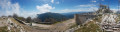
A circular route in the Menton hinterland completed on 1 May 2019 during the 40th Critérium des randonneurs de Sainte-Agnès. On the itinerary: ascents of the Cime du Baudon, the Col du Farguet and Mont Ours.
Walks near Borrigo (fleuve)
From Castillon-village to Monti via Mont Mulacié
 9.66 mi
+3,589 ft
-4,764 ft
7h 35
Difficult
Departure from Castillon (Alpes-Maritimes)
9.66 mi
+3,589 ft
-4,764 ft
7h 35
Difficult
Departure from Castillon (Alpes-Maritimes)
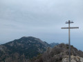
A cross-country hike through the Menton region along a little-used route, passing through wild and unspoilt areas where traces of human habitation still remain.
The route also provides access to the summit of Mont Mulacié, the second-highest peak in the Menton region, which is very little visited as it lies off the official marked trails. The view from this summit is interesting, although less spectacular than that from its neighbour, the Grammondo.
Sospel – Menton
 12.54 mi
+3,671 ft
-4,816 ft
7 hrs
Very difficult
Departure from Sospel (Alpes-Maritimes)
12.54 mi
+3,671 ft
-4,816 ft
7 hrs
Very difficult
Departure from Sospel (Alpes-Maritimes)
This route leaves theGR® 52 to head for Grammondo and cross over to the Italian side.
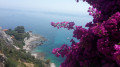
On the descent, there are almost constant views of the sea, ending in the very pretty town of Grimaldi.
Sospel - Menton
 10.24 mi
+3,691 ft
-4,767 ft
7h 55
Difficult
Departure from Sospel (Alpes-Maritimes)
10.24 mi
+3,691 ft
-4,767 ft
7h 55
Difficult
Departure from Sospel (Alpes-Maritimes)
This is the last stage ofthe GR® 52. It is certainly not the highest in altitude, but it is difficult due to its distance and the passage of certain passes with steep ascents and descents. The Mediterranean views are splendid, especially those from the Col du Razet and Col du Berceau, which rises to 1,100 metres above the town of Menton, the end point of theGR®. You walk along the Italian border throughout the route.
Be warned, in summer this stage is very challenging due to the heat, especially the descent from the Col du Berceau.
Coastline from Menton to Ventimiglia
 6.26 mi
+719 ft
-728 ft
3h 30
Moderate
Departure from Menton (Alpes-Maritimes)
6.26 mi
+719 ft
-728 ft
3h 30
Moderate
Departure from Menton (Alpes-Maritimes)
A beautiful seaside hike with some unusual sights to discover. While the coastal road from Menton to Ventimiglia is well known, the area below this road offers some little-known geographical and historical curiosities.
Torri Superiore - Ventimiglia
 9.70 mi
+1,657 ft
-1,929 ft
5h 55
Moderate
Departure from Ventimiglia (Imperia)
9.70 mi
+1,657 ft
-1,929 ft
5h 55
Moderate
Departure from Ventimiglia (Imperia)
This fifth stage will take you from Torri Superiore to the Mediterranean coast at Ventimiglia. Upon arriving in Bevera, you will find yourself at the confluence of the Bévera and Roya rivers. A final climb through the Ventimiglia hinterland will lead you to the Riviera dei Fiori and the town of Ventimiglia.
Rochetta Nervina - Torri Superiore
 10.60 mi
+3,789 ft
-4,213 ft
8h 10
Very difficult
Departure from Rocchetta Nervina (Imperia)
10.60 mi
+3,789 ft
-4,213 ft
8h 10
Very difficult
Departure from Rocchetta Nervina (Imperia)
This fourth stage will take you from Rochetta Nervina to Torri Superiore. Along the way, you’ll visit the picturesque village of Airole, which overlooks the Roya. You’ll stop off at the eco-village of Torri Superiore. This medieval village, which lay in ruins in the 1990s, has been entirely rebuilt by volunteers.
Breil – Sospel via La Baisse de Levens
 9.50 mi
+3,100 ft
-2,930 ft
7h 05
Difficult
Departure from Breil-sur-Roya (Alpes-Maritimes)
9.50 mi
+3,100 ft
-2,930 ft
7h 05
Difficult
Departure from Breil-sur-Roya (Alpes-Maritimes)
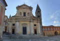
A lovely route linking the Bévéra Valley with the Roya Valley. Along the way, the Col de Brouis marks the boundary between these two valleys. If you set off early enough, you can have lunch on the terrace of one of the restaurants in this pretty village, where life flows as peacefully as the River Bévéra. The return journey is then by the Train des Merveilles, which connects the two stations in 15 minutes.
From the St-Charles tram stop to Garibaldi via Mt Vinaigrier and Mt Boron
 6.04 mi
+1,260 ft
-1,335 ft
3h 50
Moderate
Departure from Nice (Alpes-Maritimes)
6.04 mi
+1,260 ft
-1,335 ft
3h 50
Moderate
Departure from Nice (Alpes-Maritimes)
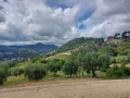
This third stage of the tour of the hills of Nice starts at the Saint-Charles tram stop on line 1 and climbs through the Saint-Charles district on the western flank of Mont Vinaigrier. From Mont Vinaigrier, it descends due south to the Col de Villefranche before climbing back up to Mont Alban and, after a loop around the Fort de Mont Boron, descends again to the port of Nice and finally reaches the Place Garibaldi tram stop via the Port district. The walk follows a beautiful ridge line and is certainly the most ‘natural’ stage of the Tour des Collines de Nice. The views over the bay of Villefranche and Cap Ferrat are magnificent.
Apricale - Rochetta Nervina
 5.56 mi
+2,306 ft
-2,464 ft
4h 35
Moderate
Departure from Apricale (Imperia)
5.56 mi
+2,306 ft
-2,464 ft
4h 35
Moderate
Departure from Apricale (Imperia)
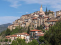
This third stage will take you from Apricale to Rocchetta Nervina. You will pass through the village of Isolabona to visit it. Rocchetta Nervina has preserved its medieval appearance and its curtain wall defences, with two bridges connecting the village to the road.