Country:

 City:


Park to the right of the entrance to the Chemin des Charrois.
(S/E) Set off along the path. Walk straight down until you reach a junction in front of a large rock. Walk past the rock and join the track (the ‘discovery trail’). Turn left, walk for about 100 metres, keeping to the right. At the junction, turn right and follow the river until you reach the Pont Noir.
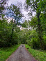
(1) Turn left, cross the bridge, then turn immediately right – going in the opposite direction to the signposted route – and then left again (leaving the house on your right) onto Chemin du Pont Noir. Follow this small country lane for about 1 km until you reach a junction with a track suitable for vehicles.
(2) Turn left onto this track. Follow it straight on for about 600 m. You’ll come to another junction (several tracks not shown on the map).
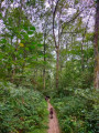
(3) At this junction, take the first path that turns right. “Please note: the map does not accurately show this junction. The path you need to take is missing from the IGN map but is shown on OSM.”
Follow it for about 700 m. You’ll come to a wide track suitable for vehicles again.
(4) Turn left. Follow it for about 1 km until you reach another junction.
(5) Keep left onto Chemin du Vert. Continue straight on for about 1.4 km until you reach another junction. Carry on straight ahead, following the river on your right, until you reach the Pont Noir. Cross the bridge.
(1) Turn right, cross the fitness trail again, and head for the car park (S/E).

 Visorando Member

 Difficult
 Moderate