Around the Soum de Cassiet

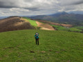
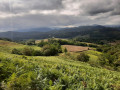
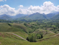
This lovely walk, starting from the village of Ance, takes you to the Soum de Cassiet. This little hill, covered in grass and ferns, is ideal for a snack or a picnic! The rest of the route alternates between forest tracks, country lanes and footpaths...

Details

n°12861184
Creation:
Last update:
Last review:
  • Walking
    Activity: Walking
  • ↔
    Distance: 2.96 mi
  • ◔
    Average duration: 2h 00 
  • ▲
    Difficulty: Moderate

  • ⚐
    Back to start: Yes
  • ↗
    Ascent: + 719 ft
  • ↘
    Descent: - 696 ft

  • ▲
    Highest point: 1,499 ft
  • ▼
    Lowest point: 804 ft
  • ⚐ Country: France
  • ⚐
    Area: Pyrenees
  • ⚐ City: Ance (64570)
  • ⚑
    Start/End: N 43.145438° / W 0.686322°
  • ❏
    IGN map(s): Ref. 1446ET, 1546OT
  • Hour-by-hour weather

Photos

Description of the walk

Park beneath the cross, along the road linking the village of Ance to Doumecq.

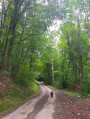
(S/E) With your back to the cross, set off to your left. Cross the bridge and take the road branching off to the left (Chemin Loulis). Walk for about 250 metres and, at the junction, turn left (Chemin Cassiet). Continue straight up for about 1 km until the road turns into a footpath.

Please note: this is a grazing area where herds roam freely. Keep your dogs on a lead!

(1) Take the path that climbs to the right. Leave the woods and you’ll reach the slope of a hill covered in meadows and ferns.
Please note: the route isn’t clear here, as there are many possible paths.
Stay on the path, heading straight ahead or slightly to the left. Take the track that winds its way along the edge of the woodland ahead of you. Follow a narrow, wooded path as it winds its way until you reach a junction.

(2) At this junction, several paths emerge. To your right are yellow PLR (Local Hiking Plan) signs. Turn left so that you have your back to them. Walk past a large tree (on your right) whose trunk forms a V-shape. Continue for about 50 metres. Opposite a fence, on the left, a small gap allows you to cross to the other side. Make sure you close it properly behind you! Follow the path. A little further on, you’ll pass a pidgeon hunting hut (on your left). Continue along the path for about 500 m. You’ll reach a junction with a wide forest track.

(3) Turn right and, 50 m further on, at the fork, turn left onto the track (Chemin Loulis). Walk along this forest track for about 1.2 km until you reach a wooden footbridge.

(4) Go through the gate. Continue for about 50 m and take the path that descends to the right. Enjoy the short view. Walk downhill for about 50 m. At the sharp bend, do not turn right; follow the path round the bend.
Please note that you are now entering a poorly maintained track. As of August 2021, it is passable, but the path may be a little difficult in places due to dense vegetation.
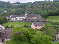
Keep to the right throughout the descent until you come to a small farmstead.

(5) Leave the farmstead on your left and join the small road. Walk downhill, keeping to the right. 450 metres further down, you’ll reach the very first junction on the walk. Take the bridge on the left towards the cross where you’ve parked (S/E).

Waypoints

  1. S/E : mi 0 - alt. 807 ft - Cross near the - Vert (rivière) - Affluent du gave d'Oloron
  2. 1 : mi 0.85 - alt. 1,217 ft - First path
  3. 2 : mi 1.03 - alt. 1,316 ft - Junction – yellow signs
  4. 3 : mi 1.37 - alt. 1,329 ft - Forest track
  5. 4 : mi 1.94 - alt. 1,470 ft - Canadian crossing
  6. 5 : mi 2.65 - alt. 942 ft - Farmhouse
  7. S/E : mi 2.96 - alt. 807 ft - Cross

Notes

Please note that in some places it is not easy to find your way (markings have been moved, several possible routes...) so I advise you to use a GPS app or a map and a compass.
A drinking trough is available halfway through the first half of the route.
Please note that a large part of the route is shared with herds.
Finally, at the time of writing this description, the last section of the path is not well maintained.
It is passable but overgrown with a few brambles and quite a lot of ferns.

Reviews and comments

4.2 / 5
Based on 2 reviews

Reliability of the description
4.5 / 5
Ease of following the route
4 / 5
Route interest
4 / 5
User 2128415

Overall rating : 3.7 / 5

Date of your route : Sep 12, 2026
Reliability of the description : ★★★★☆ Good
Ease of following the route : ★★★☆☆ Average
Route interest : ★★★★☆ Good
Very busy route : No

Hello,
We completed this route on 8 September without any problems, despite the vegetation being quite tall towards the end of the route.

Machine-translated

Solvei
Solvei

Overall rating : 4.7 / 5

Date of your route : Apr 21, 2025
Reliability of the description : ★★★★★ Very good
Ease of following the route : ★★★★★ Very good
Route interest : ★★★★☆ Good
Very busy route : No

A lovely walk. Be careful after it’s rained – it can get a bit muddy.

Machine-translated

Other walks in the area

For more walks, use our search engine .

The GPS track and description are the property of this route's author. Please do not copy them without permission.