Above and along the River Vert

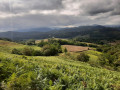
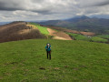
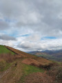
An easy walk to do with children. From the ridge, there are lovely views of the Pic d’Orrhy, the Anie and the Trône du Roi. The return route follows the River Vert, which winds through the meadows to the south-west of Oloron-Sainte-Marie.

Details

105132554
Creation:
Last update:
Last review:
  • Walking
    Activity: Walking
  • ↔
    Distance: 5.26 mi
  • ◔
    Average duration: 2h 45 
  • ▲
    Difficulty: Easy

  • ⚐
    Back to start: Yes
  • ↗
    Ascent: + 413 ft
  • ↘
    Descent: - 387 ft

  • ▲
    Highest point: 1,115 ft
  • ▼
    Lowest point: 728 ft
  • ⚐ Country: France
  • ⚐
    Area: Pyrenees
  • ⚐ City: Féas (64570)
  • ⚑
    Start/End: N 43.16337° / W 0.682895°
  • ❏
    IGN map(s): Ref. 1446ET, 1545SB, 1546OT
  • Hour-by-hour weather

Description of the walk

From Oloron-Sainte-Marie, head towards Barcus and Ance via the D919. Turn right at the Baretous rest area, shortly after crossing the Vert river via a bridge.

(S/E) Take the road on the right, cross the bridge over the Aurone and continue to a crossroads dominated by a large oak tree.

(1) Turn left and head up the road.

(2) At the signpost, take a track on the right which starts with a hairpin bend: lovely view.

(3) At the barrier, head down the path opposite, pass a footpath on the right and arrive at a stony track at the start of the karst trail: signpost.

(4) Follow this track to the right and walk down a long stretch alongside the Coste Darré stream. Cross the stream by turning 90° to the right towards Le Vert.

(5) Just before the bridge, turn right onto the small road that runs alongside the River Vert and leads directly to the crossroads by the large oak tree you passed at the start.

(1) Carry on to the left, in the opposite direction to the way out, to return to the rest area car park (S/E).

Waypoints

  1. S/E : mi 0 - alt. 728 ft - Baretous rest area - Vert (rivière) - Affluent du gave d'Oloron
  2. 1 : mi 0.57 - alt. 774 ft - Junction of the circular path, large oak tree
  3. 2 : mi 1.25 - alt. 988 ft - signpost
  4. 3 : mi 1.31 - alt. 1,010 ft - Signpost, turn right
  5. 4 : mi 1.69 - alt. 1,099 ft - Signpost – barrier
  6. 5 : mi 2.08 - alt. 909 ft - Signpost – gravel track
  7. 6 : mi 3.4 - alt. 741 ft - signpost
  8. 7 : mi 3.45 - alt. 728 ft - Turn right before the bridge over the - Vert (rivière) - Affluent du gave d'Oloron
  9. S/E : mi 5.26 - alt. 755 ft - Barétous rest area - Vert (rivière) - Affluent du gave d'Oloron

Notes

(S/E) Toilets, picnic table, shelter, electricity.

Unfortunately, there are few trails and too many roads and tracks. The route can be completed by bicycle or mountain bike.

Worth a visit

(4) Karst trail.

Other walks in the area

For more walks, use our search engine .

The GPS track and description are the property of this route's author. Please do not copy them without permission.