Country:

 City:


Park at the side of the road in the hamlet of Guray, taking care not to obstruct local residents’ traffic.
(S/E) Look out for the house at the junction. Position yourself facing it and go round it on the right. Head up the small road which leads to a sort of ‘water tower’ on your right. Once you’ve passed it, the road turns into a downhill, passable stony track. Follow this track, which becomes tarmac again a little further down. Carry on until you reach a junction between some houses (a place called Larroudé).
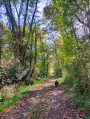
(1) Turn left. Please be careful: although the road is quiet, there is some traffic. Cross over a small stream at the corner of a large house with exposed stonework. You’ll find yourself facing a straight road that runs alongside houses (on the left) and a forest (on the right). Carry on straight ahead until you have passed all the houses. Just after the last house, cross a second small stream. Carry on straight ahead for about 200 m. You’ll come to a large house just before a bend. Here, turn left onto the path, which is just before the house. Please note: make sure you take the path before the house, not the one after it, around the bend.
(2) Take the path that climbs to the left, leaving the house on your right. Climb for about 1 km until you reach another junction at the top of a steep hill.
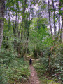
(3) Turn left. Ignore all the tracks and paths you come across and stay on this main track. A little further on, you’ll come to a large junction signposted with yellow signs. Keep right towards Bois du Haut/Buguangue. Carry on straight ahead until you reach a small hamlet (Peche) where the track becomes tarmac again. Pass the houses and carry on straight ahead to return to where you parked (S/E).

 Visorando Member

 Difficult
 Moderate