


Refine your search for walks in Binn
Binn walks


 Binn - Crampiolo
 Visorando Member
 8.06 mi
 +3,960 ft
 -2,782 ft
 7h 10
7h 10
 Difficult
 Departure from Binn (Valais)
This stage is common to both the Mineralien Tour and the Walser Tour. The Geisspfadpass marks the border between Switzerland and Italy. In Binn, cross the small bridge over the Binna, follow the road to Fäld for about 1 km, and a sign on the right indicates the path to Geisspfadsee and Mässersee. This path joins the one coming from Fäld at the Mässerchäller chalet (1,879 m). Follow the signs for Maniboden. The climb to the Geisspfadpass is then very easy. The descent to Piano della Rossa is through large scree, with passages equipped with chains and ladders, but no particular difficulty. The descent to Crampiolo is very pleasant.Markings: White-Red-White]. Via Alpina Blue D3 and D2
From Binn to Simplon Pass
 54.93 mi
+19,777 ft
-17,884 ft
7 days
Difficult
Departure from Binn (Valais)
54.93 mi
+19,777 ft
-17,884 ft
7 days
Difficult
Departure from Binn (Valais)
This hike is inspired by the Walser Tour and the Mineralien Tour. This magnificent route crosses numerous mountain pastures, where the dwellings are very varied: from wooden chalets to stone chalets. The hamlet of Salecchio Superiore consists of magnificent wooden chalets, several centuries old, all very well preserved. The chalet that houses the dormitories of the Rifugio "Zum Gora" dates back to the 17th century. In Italy, the route at the foot of the peaks bordering Switzerland, including Monte Leone, takes us through two regional parks: the Parco Naturale dell'Alpe Veglia and the Parco Naturale dell'Alpe Devero.
Binn - Binntal Hütte
 6.89 mi
+3,228 ft
-423 ft
6h 00
Difficult
Departure from Binn (Valais)
6.89 mi
+3,228 ft
-423 ft
6h 00
Difficult
Departure from Binn (Valais)
This stage is common to both the Walser Tour and the Valrando Mineral Tour. A few houses line this path in Freichi and then in Blatt. The Ofenhorn can be admired all the way to the Binntal Hütte. Although this is German-speaking territory, French is surprisingly the dominant language in this hut. The Binntal Hütte belongs to the Swiss Alpine Club: Delémont section.
Binntal Hütte - Rifugio Margaroli
 5.65 mi
+1,896 ft
-2,165 ft
4h 15
Difficult
Departure from Binn (Valais)
5.65 mi
+1,896 ft
-2,165 ft
4h 15
Difficult
Departure from Binn (Valais)
This second stage crosses the Italian-Swiss border at the Albrunpass. You will enter the Val Formazza. The highest point of the day is at Scatta Minoïa. After the Ettore Conti bivouac, the descent to Lake Vannino is very pleasant and easy. The Rifugio Margaroli is located at the end of the lake. This relatively short stage gives you the opportunity to climb up to Lake Sruer at 2,351 m. (Absolute tranquillity guaranteed and magnificent views of Lake Vannino).
Crampiolo - Alpe de Veglia
 10.03 mi
+3,373 ft
-3,346 ft
13h 05
Difficult
Departure from Baceno (Verbano-Cusio-Ossola)
10.03 mi
+3,373 ft
-3,346 ft
13h 05
Difficult
Departure from Baceno (Verbano-Cusio-Ossola)
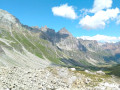
This fifth stage crosses the Devero and Veglia Natural Parks. During the day, you will cross two more passes, the Scatta d'Orogna and the Passo di Valtendra. After the second pass, the landscape becomes more harmonious. A pretty little stream and a long passage through the woods accompany the descent to Alpe de Veglia. Alpe de Veglia is a group of small hamlets located close to each other at the bottom of a very steep valley. Major peaks such as Monte Leone (3,553 m) and Bortelhorn (3,194 m) surround these peaceful hamlets.
Crampiolo - Salecchio Superiore
 9.04 mi
+3,173 ft
-4,094 ft
6h 55
Difficult
Departure from Baceno (Verbano-Cusio-Ossola)
9.04 mi
+3,173 ft
-4,094 ft
6h 55
Difficult
Departure from Baceno (Verbano-Cusio-Ossola)
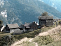
At Crampiolo, the path to Bochetta della Valle is signposted and initially follows the left bank of Lago Dévéro. The path then continues towards the Alpi della Valle and Naga mountain pastures. Further up, a sign indicates the direction of Bocchetta della Valle. Walk along the Busin Superiore lakes and descend to the Busin Inferiore lake dam. The trail resumes below the dam (red markings) and the descent is quite steep to Alpe di Vova. From there, a balcony path leads to Salecchio Superiore via Casa Francoli. Crampiolo and Salecchio Superiore: two magnificent Walser-style villages.Markings: White-Red-White.
Rifugio Margaroli - Salecchio Superiore
 6.83 mi
+1,565 ft
-3,812 ft
4h 30
Difficult
Departure from Formazza (Verbano-Cusio-Ossola)
6.83 mi
+1,565 ft
-3,812 ft
4h 30
Difficult
Departure from Formazza (Verbano-Cusio-Ossola)
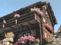
This third stage is very wild and not very busy. After Lago Vannino and Passo Busin, you will discover another lake, Lago Busin Inferiore. During the descent to Salecchio, you will notice the Walser habitat as you pass through hamlets such as Case Francoli and Salecchio Superiore. The dormitory at Rifugio Zum Gora dates back to the 17th century.
Salecchio Superiore - Crampiolo
 6.83 mi
+3,392 ft
-2,431 ft
6h 05
Difficult
Departure from Premia (Verbano-Cusio-Ossola)
6.83 mi
+3,392 ft
-2,431 ft
6h 05
Difficult
Departure from Premia (Verbano-Cusio-Ossola)
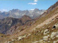
This fourth stage is marked by the crossing of two passes, the Passo Muretto and the Bocchetta di Scarpia. You will also cross several mountain pastures such as Alpe de Salecchio, Alpe de Pojola and Alpe de Sangiatto. In the evening, upon arrival in Crampiolo, you will have the opportunity to visit Lago Devero.
Salecchio Superiore - Bosco/Gurin
 9.32 mi
+4,993 ft
-4,869 ft
8h 40
9.32 mi
+4,993 ft
-4,869 ft
8h 40
 Very difficult
Departure from Premia (Verbano-Cusio-Ossola)
Very difficult
Departure from Premia (Verbano-Cusio-Ossola)
Return to Switzerland, in Ticino via the Guriner Furka. From Salecchio, take the same path as the day before to Alpi di Vova and follow the signs for Antillone and Fondovalle. Shortly after Altillone, the path joins the road, which you follow for 500 metres to the village of Fondovalle. A good path through the woods climbs towards the Guriner Furka via Alpe Stavello. Finally, a pass appears, the Passo della Foglia, but this is not the Guriner Furka. It takes another quarter of an hour to reach it via the path that branches off to the left. From Guriner Furka, you can see the chalets of Grossalp and the village of Bosco/Gurin. The descent is easy and pleasant. Bosco/Gurin is a Walser village, and German is commonly spoken there, even though it is located inTicino Markings: White-Red-White.
Alpe de Veglia - Simplon Dorf
 13.19 mi
+4,596 ft
-5,587 ft
10h 05
Very difficult
Departure from Varzo (Verbano-Cusio-Ossola)
13.19 mi
+4,596 ft
-5,587 ft
10h 05
Very difficult
Departure from Varzo (Verbano-Cusio-Ossola)
This sixth stage marks the return to Switzerland. You will cross the Passo dei Gialitt and pass through the last Italian mountain pastures of "Camoscella" and "Vallescia". After the Swiss mountain pastures of "Alpjerung" and "Corvetsch", you will descend towards the Simplon Pass road and rejoin the Stockeralper Weg at Alter Kaserne. This beautiful trail will take you to Gabi and then Simplon Dorf.
The Eggishorn circular walk from Fiescheralp
 8.53 mi
+3,497 ft
-3,524 ft
7h 00
Difficult
Departure from Fiesch (Valais)
8.53 mi
+3,497 ft
-3,524 ft
7h 00
Difficult
Departure from Fiesch (Valais)
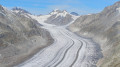
A superb alpine hike taking you from the village of Fiescheralp to the summit of the Eggishorn. You’ll go through the Tälli Tunnel and walk along the north face of the Tälligrat. At the summit of the Eggishorn, you’ll enjoy a breathtaking view of the Aletsch Glacier.
As the route takes you through a tunnel beneath the Tälligrat rather than climbing to the summit and then descending, the elevation gain is overestimated: allow for around 250 m less for the actual elevation gain, both ways.
The Eggishorn from the Bettmerhorn top station
 8.50 mi
+2,110 ft
-4,462 ft
5h 45
Difficult
Departure from Betten (Valais)
8.50 mi
+2,110 ft
-4,462 ft
5h 45
Difficult
Departure from Betten (Valais)
A very beautiful route starting from the upper Bettmerhorn station. After a panoramic viewpoint right at the start of the hike, you’ll make your way to the second summit, which offers the widest panorama of the Aletsch Glacier.
Route around Fiescheralp to see the Aletsch Glacier
 13.28 mi
+5,810 ft
-5,007 ft
2 days
Difficult
Departure from Betten (Valais)
13.28 mi
+5,810 ft
-5,007 ft
2 days
Difficult
Departure from Betten (Valais)
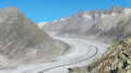
A stunning alpine hike taking you to the two most beautiful viewpoints over the Aletsch Glacier. In the evening, you’ll enjoy the tranquillity of these two villages, which also offer superb views of the Valais’ 4,000-metre peaks: the Dom, the Matterhorn and the Weisshorn
From Bettmeralp to Fiecheralp via the Bettmerhorn Bergstation
4.75 mi
+2,313 ft
-1,483 ft
4h 10
Difficult
Departure from Betten (Valais)
A very beautiful alpine hike that will take you from the village of Bettmeralp to the Bettmerhorn viewpoint. You’ll enjoy a magnificent view of the Aletsch Glacier. The rest of the route, which is downhill, will take you to Fiescheralp.
Märjelenseestube - Bellwad via the Aletsch Panoramaweg
 5.76 mi
+1,004 ft
-3,652 ft
3h 30
Difficult
Departure from Fieschertal (Valais)
5.76 mi
+1,004 ft
-3,652 ft
3h 30
Difficult
Departure from Fieschertal (Valais)
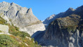
This third stage will take you to the Fieschergletcher, which runs parallel to the Aletschgletcher. On the Aspi Titter suspension bridge, you will be impressed by the depth of the Weisswasser river gorges. This fairly technical end of the route ends in the beautiful village of Bellwad, which has preserved its traditional chalets.