Country:
 City:
City:


(S/E) As you leave the leisure centre, cross the causeway over the lake, from where you can enjoy the view of the spa district set in its green surroundings, dominated on one side by the bell tower of the Chapelle d’Aligre and on the other by the belfry and the bell tower of St John’s Church.
(1) At the end of the embankment, turn right to walk alongside the lake along the greenway, and discover the casino.
(2) At the far end of the lake, continue your walk, heading straight on via La Baratte and its exhibition rooms, towards Parc Puzenat.
(3) Leave the greenway and head downhill to the right, then left towards the spa district, which you follow to reach Rue des Sources, at the foot of the feudal mound.
(4) Take this street to the left. Incidentally, when you reach Rue Croix-Vinaigrier, you can take a detour to visit this magnificent neighbourhood and the Porte de l’Éperon. Otherwise, continue straight ahead along Rue du Paradis. Cross the Ruisseau du Borne and head towards the Bois du Four by taking Rue du Paradis and Chemin des Buis straight ahead.
(5) Then continue straight ahead and turn right to walk alongside the golf course and the Étang de Givalois.
(6) Turn right at the junction, cross the road and head straight ahead, then turn right to enter the peaceful Forêt à Bretôme.
(7) At the crossroads, turn right then left.
(8) In the Germigny Forest, at the next crossroads, turn right then left towards Surbains, where you’ll discover the surprising eaves of the farmhouse.
(9) Turn right.
(10) At the end of Chemin de Montplaisir, take Rue de la Roche on the left.
(11) Take Rue de la Chaumière on the right, then Rue de la Meurette on the left. Continue straight ahead along Chemin du Grand Pré, Rue des Sables and finally Rue des Eurimants to reach the leisure centre (S/E).
 Visorando Member
 Tourist office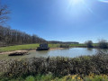
 Difficult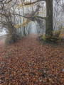
 Easy
Easy