La Sasseigne

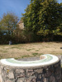
Starting from Saint-Léon, this is a short walk offering a beautiful panoramic view of the Morvan.

Details

17108899
Creation:
Last update:
Last review:
  • Walking
    Activity: Walking
  • ↔
    Distance: 4.00 mi
  • ◔
    Average duration: 2h 15 
  • ▲
    Difficulty: Easy

  • ⚐
    Back to start: Yes
  • ↗
    Ascent: + 482 ft
  • ↘
    Descent: - 502 ft

  • ▲
    Highest point: 1,411 ft
  • ▼
    Lowest point: 1,096 ft

Description of the walk

Park in the car parks at the entrance to Rue de l’Égalité.

(S/E) Follow Rue de l’Égalité towards Saligny. Turn right at the cemetery, cross a small bridge with a wash house on your right and you’ll come to a three-way junction.

(1) Take the small road leading uphill to the right. Keep right at the junction with the track leading to Les Georges.

(2) Ignore the return path on the right and carry on straight ahead along the dirt track until you reach the Font des Crues junction.

(3) Turn right towards Les Dorards. Carry on straight ahead, leaving this hamlet on your left, until you reach the next four-way junction.

(4) Follow theGR®3to the right (marked with red and white signs).

(5) Turn right, following theGR® as it climbs to the summit of Puy Saint-Ambroise.

(6) Carry on straight ahead along the tarmac road.

(7) Take the first path leading down to the right, which rejoins the junction you passed on the way there.

(2) At the bottom of the track, turn left.

(1) Carry on to the left to return to the village (S/E).

Waypoints

  1. S/E : mi 0 - alt. 1,211 ft - Saint-Léon, Rue de l’Égalité - Église Saint-Cosme et Saint-Damien (Saint-Léon)
  2. 1 : mi 0.34 - alt. 1,096 ft - Junction: A/ right – R/ left
  3. 2 : mi 0.96 - alt. 1,201 ft - Junction on the circular loop
  4. 3 : mi 1.08 - alt. 1,168 ft - La Font des Crues
  5. 4 : mi 1.78 - alt. 1,112 ft - Crossroads, on the right
  6. 5 : mi 2.01 - alt. 1,220 ft - Turn right at the fork
  7. 6 : mi 2.41 - alt. 1,411 ft - Puy Saint Ambroise
  8. 7 : mi 2.67 - alt. 1,342 ft - Dirt track on the right
  9. S/E : mi 4 - alt. 1,211 ft - Saint-Léon, Rue de l’Égalité - Église Saint-Cosme et Saint-Damien (Saint-Léon)

Notes

There are several shops in Saint-Léon: a bakery, a shop selling local produce, a chemist’s, etc.

Always be cautious and plan ahead when you're outdoors. Visorando and the author of this route cannot be held responsible for any accidents occurring on this route.

The GR® and PR® markings are the intellectual property of the Fédération Française de Randonnée Pédestre.

Reviews and comments

4.7 / 5
Based on 2 reviews

Reliability of the description
5 / 5
Ease of following the route
5 / 5
Route interest
4 / 5
Falsa
Falsa

Overall rating : 4.7 / 5

Date of your route : Sep 17, 2022
Reliability of the description : ★★★★★ Very good
Ease of following the route : ★★★★★ Very good
Route interest : ★★★★☆ Good
Very busy route : Yes

A popular route during Heritage Days;
The local association opened the public weigh house and St Léon Castle to the public, as well as several other sites along this route;
Beautiful views along most of the route
An easy and pleasant walk

Machine-translated

labombardellaz
labombardellaz

Overall rating : 4.7 / 5

Date of your route : Jan 21, 2022
Reliability of the description : ★★★★★ Very good
Ease of following the route : ★★★★★ Very good
Route interest : ★★★★☆ Good
Very busy route : No

A very pleasant walk offering panoramic views of the Morvan, Beaujolais and Madeleine hills in turn.
This area is very popular on fine days, with road access to the Puy de Saint Ambroise, which has a campsite and picnic areas: returning via part of the outward route (from point 2 onwards) avoids having to go back to the starting point, in the heart of the village, via the Côtes and the D21, where there is a lot of traffic at such times.

Machine-translated

Other walks in the area

For more walks, use our search engine .

The GPS track and description are the property of this route's author. Please do not copy them without permission.