


 Country:
 City:
City:


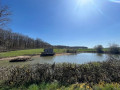
(S/E) From the cemetery car park (Rue du 19 mars 1962), head towards the town hall. Pass a road on your left and carry on for a further 50 metres.
(1) Take the Chemin du Bréraud on the right, then turn right again onto the path.
(2) When you reach the hamlet of Beauregard, continue along the road, then take the track on the right towards La Grande Houlle.
(3) At La Garenne, rejoin the road, turn right, then left at the junction with the Route de la Côte des Noyers and follow it for 1 km until you reach the junction with the D51.
(4) Follow it to the right, then slightly to the left along the Chemin des Sources for 1 km until you reach the D237.
(5) Turn right towards Les Bornets. Continue straight on along the track at the end of the cul-de-sac.
(6) You’ll reach the Route du Boulet; turn right onto it.
(7) Turn left at the junction after the farm and follow the path alongside the woodland for 800 metres.
(8) Turn right, enter the forest and, further on, continue along the track to the left. Carry on straight ahead for 3 kilometres, first through the woods, then alongside them.
(9) At La Goutte de Bran, turn right. Carry on until you reach the D51.
(10) Cross it and carry on along the road to the right, straight on for 2.7 km.
(11) At the crossroads, head towards Gavardin on the right, then take thesecond turning on the right.
(12) At La Borne Jaune, turn left, heading due south along the track. After 800 metres, turn left then right. Continue straight on until you reach a road.
(13) At Les Petites Brosses, take the track to the right, then left.
(14) Take the track on the right opposite the two cattle sheds.
(15) At La Goutte aux Chevaux, turn left. At the junction, keep left onto the road and carry on straight ahead. At the next junction, continue straight ahead onto Rue du 19 mars 1962 D238E.
(16) When the road bends to the right, take the road on the left towards La Tuilerie. Continue for 200 metres, then turn left again.
(17) At Les Grandes Terres, turn left towards the viewpoint, then turn right and join Rue du 19 mars 1962. Follow it to the right to return to the car park (S/E).
 Visorando Member
 Easy
Easy 

 Very difficult
 Moderate
 Tourist office
