Circular route around Chevagnes

A walk around the village of Chevagnes, in the Sologne Bourbonnaise, along the Acolin stream and then across meadows, passing numerous farms which are no longer inhabited.

Details

n°33077144
Creation:
Last update:
Last review:
  • Walking
    Activity: Walking
  • ↔
    Distance: 7.02 mi
  • ◔
    Average duration: 3h 15 
  • ▲
    Difficulty: Average

  • ⚐
    Back to start: Yes
  • ↗
    Ascent: + 66 ft
  • ↘
    Descent: - 69 ft

  • ▲
    Highest point: 791 ft
  • ▼
    Lowest point: 719 ft

Description of the walk

Head to Chevagnes and park in the public car park in the village centre along the D973, near the chemist’s, opposite the health centre on Place du Marché.

(S/E) Join the D973, cross it carefully and take the street opposite leading to the church. Walk past the church and then turn right immediately afterwards onto Rue Les Bibelets.
Continue to Place de la Croix des Rameaux. There is a stone cross in the centre of the square.

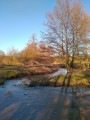
(1) Turn right, then keep left onto Rue de La Maison Rouge. Further on, follow the banks of the Acolin stream, keeping to the right. Cross a metal footbridge over the Huzarde stream and continue straight ahead on the same path to reach Le Chassin farm, which is private property.

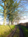
(2) Head slightly to the right to follow a grassy, tree-lined path opposite. Cross another metal footbridge over a stream just before the hamlet of Le Ruisseau. Continue straight ahead, following the visible trail on the ground. Cross the courtyard of the abandoned Le Ruisseau farm. Arrive at the crossroads of tracks.

(3) Turn left (PC221) onto a dirt track which joins the D31 to the west at PC223.

(4) Cross this road carefully and continue straight ahead towards Les Proux. Shortly afterwards, you’ll reach a place called Les Quatre Vents, at a crossroads (PC225).

(5) Carry on in the same direction until you reach an abandoned farm, Les Proux (PC233). The path forms an S-shape here, turning left then right.

(6) Follow the main path, which leads back westwards onto a local road at PC241.
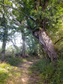
There is a white metal cross here, dated 1877. Look out for a fine oak tree at this crossroads, facing the direction you are walking in.

(7) Turn left and carefully take this road, which passes through Les Gourands Neufs and Les Vieux Gourands (another White Cross). Shortly afterwards, you’ll reach the junction at PC237.

(8) Turn right onto the dirt track through the fields. Walk alongside a copse, keeping to the right, cross the Sourroux farm and join the D481 just after.

(9) Turn left and follow this road carefully, even though it is rarely used. Cross a stream at PC224. At the entrance to the village of Chevagnes, you’ll come to the first set of crossroads.

(10) Turn right onto Rue de Saint-Jacques and join the D779. Cross it and head straight on towards the gendarmerie on Route des Colas. You’ll reach the end of the Saint-Jacques housing estate.

(11) Turn left onto Chemin de La Motte. Cross a stream before rounding a bend at La Motte farm. Then turn left to head back up towards the centre of Chevagnes. This will take you to the public car park (S/E).

Waypoints

  1. S/E : mi 0 - alt. 735 ft - Car park opposite the health centre in Chevagnes
  2. 1 : mi 0.14 - alt. 735 ft - Chevagnes Church. Towards the - Acolin (rivière) - Affluent de la Loire
  3. 2 : mi 1.49 - alt. 748 ft - Crossroads near the Chassin farm
  4. 3 : mi 1.85 - alt. 725 ft - PC221, on the left
  5. 4 : mi 2.08 - alt. 735 ft - D31, opposite
  6. 5 : mi 2.27 - alt. 741 ft - PC225, straight ahead
  7. 6 : mi 2.74 - alt. 761 ft - PC233, abandoned farm Les Proux
  8. 7 : mi 3.59 - alt. 791 ft - Local road, on the left
  9. 8 : mi 4.71 - alt. 778 ft - PC237, on the right
  10. 9 : mi 5.42 - alt. 748 ft - D481, turn left towards Chevagnes. Towards the - Huzarde (cours d'eau) - Affluent de l'Acolin
  11. 10 : mi 6.13 - alt. 735 ft - Chevagnes, on the right on Rue Saint-Jacques
  12. 11 : mi 6.51 - alt. 768 ft - At the end of the housing estate, turn left
  13. S/E : mi 7.02 - alt. 735 ft - Car park opposite the health centre in Chevagnes

Notes

Public toilets are located to the right of the chemist’s.
Good to know: ‘Les Monnaies’ (registered trademark) always delights food lovers and gourmets who stop off in Chevagnes at the bakery and patisserie on the main road (after the chemist’s and the tobacconist’s).
Most of the walk is through an area with little tree cover. Best avoided during periods of extreme heat.

Worth a visit

The Church of Chevagnes – 12th, 15th and 17th centuries.
It served as a village hall during the Revolutionary period, at a time when the sanctuary had become the ‘Temple of the Supreme Being’ and a meeting place for citizens, hence the inscription ‘Liberty, Equality, Fraternity’ on its south façade.
Note that the height of the bell tower has been reduced.

Opposite the church stands ‘La Grosse Maison’. This house was listed as a historic monument in 1981 for its style typical of the Bourbonnais Sologne region: a steeply pitched hipped roof, and a construction of diamond-shaped brickwork, with the three dominant colours achieved through variations in firing. It was acquired during the French Revolution by the Martel family and is still owned by their descendants.

La Maison des Nains: A half-timbered house situated in the village, on Rue de la Maison Rouge. A single-block building probably dating from the 16th century.

Les Quatre Vents: ‘Jardin des Quatre Vents’ – this is an organic farm.

To find out more about Chevagnes and its surroundings, visit the website of the Association Chevagnes en Sologne Bourbonnaise

Reviews and comments

3.7 / 5
Based on 3 reviews

Reliability of the description
4.3 / 5
Ease of following the route
3.7 / 5
Route interest
3 / 5
Jerome B
Jerome B

Overall rating : 4.3 / 5

Date of your route : Aug 28, 2023
Reliability of the description : ★★★★★ Very good
Ease of following the route : ★★★★★ Very good
Route interest : ★★★☆☆ Average
Very busy route : No

An easy walk as it is relatively flat.

Machine-translated

Allen
Allen

Overall rating : 4.7 / 5

Date of your route : Jul 28, 2023
Reliability of the description : ★★★★★ Very good
Ease of following the route : ★★★★★ Very good
Route interest : ★★★★☆ Good
Very busy route : No

A pleasant, easy route.

Machine-translated

chomel**
chomel**

Overall rating : 2 / 5

Date of your route : Jul 23, 2023
Reliability of the description : ★★★☆☆ Average
Ease of following the route : ★☆☆☆☆ Very disappointing
Route interest : ★★☆☆☆ Disappointing
Very busy route : No

The start of the hike was difficult to find; there were no signposts
Very disappointed with this route

Machine-translated

Other walks in the area

For more walks, use our search engine .

The GPS track and description are the property of this route's author. Please do not copy them without permission.