From Belle Plagne to Plagne Bellecôte via the Dou du Praz

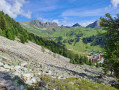
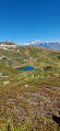
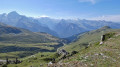
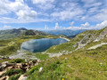
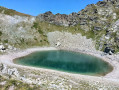
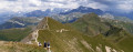
An easy route linking Belle Plagne to Plagne Bellecôte via the Dou du Praz, offering panoramic views of the various villages of La Plagne, as well as the valley and the surrounding mountains. With the (free) cable car ride back up, this route is a circular one. Those who wish to can walk back up to Belle Plagne.

Details

n°36611670
Creation:
Last update:
Last review:
  • Walking
    Activity: Walking
  • ↔
    Distance: 2.79 mi
  • ◔
    Average duration: 1h 30 
  • ▲
    Difficulty: Easy

  • ⚐
    Back to start: No
  • ↗
    Ascent: + 279 ft
  • ↘
    Descent: - 745 ft

  • ▲
    Highest point: 7,028 ft
  • ▼
    Lowest point: 6,319 ft

Photos

Description of the walk

Various starting points in Belle Plagne can be chosen for this short walk. Here, we’ve chosen to start from the car-accessible square with a covered car park at the top of the village (free in summer).

(S) From the car park, take the covered pedestrian access to the right of the car park entrance, heading due south. After descending several flights of steps, this path leads you to the centre of the village. Continue through the shops and leave the village at its southern end until you reach the second stony track.

(1) Turn left, heading south-west, and walk slightly uphill.
(Be careful not to take the first track which climbs steeply to the left, further south towards the lakes or the Via Ferrata. Also, be careful not to walk past the treetop adventure course, which is situated just a little further down.)
Continue to the Dou du Praz crossroads, ignoring all side paths.

(2) Turn right, heading due north. The path climbs a little further. After a few minutes, you’ll reach the highest point of this route, Les Colosses (2,144 m).
Take in the view over the surrounding villages and mountains. There are a few picnic tables available.
Continue until you reach a fork in the path.

(3) Begin the descent towards Plagne Bellecôte, heading due east, along the zigzagging path that cuts through a more wooded area. You’ll reach Plagne Bellecôte at the cable car station (E).

The return to the starting point is via the cable car (or, for the more adventurous, via the various paths leading back to Belle Plagne). On exiting the cable car, cross back through the village in the opposite direction, heading north, to reach the starting point.

Waypoints

  1. S : mi 0 - alt. 6,788 ft - Upper Belle Plagne car park
  2. 1 : mi 0.39 - alt. 6,772 ft - Junction. The Dou du Praz road
  3. 2 : mi 1.38 - alt. 6,969 ft - Crossroads. Le Dou du Praz
  4. 3 : mi 1.71 - alt. 6,982 ft - Junction. Downhill path towards Bellecôte
  5. E : mi 2.79 - alt. 6,319 ft - Bellecôte cable car

Notes

Picnic tables at the highest point.
Free cable cars.

Worth a visit

  • Shops in La Belle Plagne or Plagne Bellecôte.
  • A range of activities on offer in the villages.

Reviews and comments

4.7 / 5
Based on 1 review

Reliability of the description
5 / 5
Ease of following the route
5 / 5
Route interest
4 / 5
Alaur
Alaur

Hi,
Is this route suitable for snowshoeing in winter?
Thank you very much for your help.

Machine-translated

dougere
dougere

Overall rating : 4.7 / 5

Date of your route : Aug 20, 2024
Reliability of the description : ★★★★★ Very good
Ease of following the route : ★★★★★ Very good
Route interest : ★★★★☆ Good
Very busy route : Yes

A pleasant, easy walk. This is the first time we’ve been to this area, and this walk has helped us get to know the geography of La Plagne by identifying the various resorts.

Machine-translated

Other walks in the area

For more walks, use our search engine .

The GPS track and description are the property of this route's author. Please do not copy them without permission.