


 Country:

 City:
City:


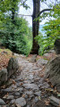
The path is clearly signposted from the car park. You can either do a simple return walk or a short circular route as suggested on this route.
Balma Boves


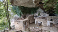
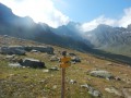
A lovely, easy little walk that takes you past some rather impressive houses built beneath a rocky outcrop. Between Crissolo and Sanfront, head towards Roccheta. Shortly after crossing the River Po, park in the designated car park signposted on the right, then set off on foot, following the signs. The walk is very well signposted all along the route. On arrival, there is a ticket office where you pay the entrance fee, but during our visit, the site was open to the public free of charge and the ticket office appeared to have been closed for quite some time.
Details
Creation:
Last update:
Last review:
–
–
-
 Activity: Walking
 -
 Distance: 2.45 mi
 -
 Average duration: 1h 55
 -
 Difficulty: Easy
 -
-
 Back to start: Yes
 -
 Ascent: + 876 ft
 -
 Descent: - 705 ft
 -
-
 Highest point: 2,211 ft
 -
 Lowest point: 1,706 ft
Photos
Description of the walk
Waypoints
- S/E : mi 0 - alt. 1,726 ft - Car park
- 1 : mi 0.31 - alt. 1,877 ft - Uphill path
- 2 : mi 0.6 - alt. 2,113 ft - Museum
- 3 : mi 0.76 - alt. 2,139 ft - Bauma Boves
- 4 : mi 1.7 - alt. 1,883 ft - Crossroads
- S/E : mi 2.45 - alt. 1,896 ft - Arrival
Notes
No shops, no water along the way.
Worth a visit
At the museum (not always open), you might find jars of honey on a table, the price list and a basket for leaving your money. Don’t deny yourself the pleasure.
Other walks in the area
Rifugio Quintino Sella – Pian Del Re refuge
 Visorando Member3.65 mi
+266 ft
-2,280 ft
1h 55
Easy
Visorando Member3.65 mi
+266 ft
-2,280 ft
1h 55
Easy
 Departure from Crissolo (Cuneo)
This short stage of the Mont Viso circuit is completely straightforward. To make the day more enjoyable, 500 m from the starting point, you can turn right for a return trip to the summit of Viso Mozzo at 3,019 m, offering a stunning view of the Po Valley, which has its source at Pian del Re, the end point of this stage
Trek around Monte Viso day 3: Refuge Sella Quintino - Refuge Vallanta
 8.54 mi
+2,277 ft
-2,917 ft
5h 55
8.54 mi
+2,277 ft
-2,917 ft
5h 55
 Difficult
Departure from Oncino (Cuneo)
Difficult
Departure from Oncino (Cuneo)
Italian stage through wild upper valleys and rocky wasteland, scattered by beautiful mountain lakes, consistantlyaround Monte Viso.
Trek around Monte Viso in 5 days, stage 4
 Association / Club / Walk leader
 8.53 mi
+2,713 ft
-3,337 ft
6h 15
Difficult
Departure from Oncino (Cuneo)
8.53 mi
+2,713 ft
-3,337 ft
6h 15
Difficult
Departure from Oncino (Cuneo)
This stage gives you a frontline view over Monte Viso on one side and Pô prairie (plaine du Pô) on the other. Then a climb through Vallanta's small green valley.
From the Pian de Re refuge to the Barbara Lowrie refuge
5.38 mi
+1,893 ft
-2,772 ft
4h 05
 Moderate
Departure from Crissolo (Cuneo)
Moderate
Departure from Crissolo (Cuneo)
This stage of the Mount Viso circuit alternates between meadowland and rocky terrain. A hike without any particular difficulty, the round trip to Punta Sea Bianca can make for a pleasant addition to the day.
Pan del Re - Quintino Sella Refuge
3.66 mi
+2,238 ft
-217 ft
3h 40
Moderate
Departure from Crissolo (Cuneo)
This is the first stage of the 4-day tour of Monte Viso.
The planned tour starts from Pian del Re (mountain hut). The first stage ends at the Quintino Sella mountain hut before tackling, the following day, the crossing at the Col de San Chiaffredo, the descent to Chianale, then the climb to the Vallanta mountain hut.
Vallanta Refuge - Sella Quintino Refuge
8.47 mi
+2,982 ft
-2,333 ft
6h 30
Difficult
Departure from Pontechianale (Cuneo)
This Italian stage of the Mont Viso circuit presents no particular difficulties. You will discover its wild high valleys dotted with high-altitude lakes. You will cross a few scree slopes before reaching the Sella Quintino Refuge, near Lake Mont Viso.
For more walks, use our search engine .
The GPS track and description are the property of this route's author. Please do not copy them without permission.

