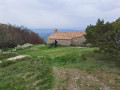
Plain Ride – Dieulefit-Bourdeaux region

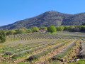
This very easy ride, on flat, open terrain, is ideal for outings with young children or complete beginners. It takes place in part of the beautiful Valdaine plain, a popular agricultural area. Please watch out for cars as the route includes a few tarmac sections.

Details

n°1214108
Creation:
Last update:
Last review:
  • Mountain biking
    Activity: Mountain biking
  • ↔
    Distance: 8.67 mi
  • ◔
    Duration according to the author: 1 hr 
  • ▲
    Difficulty: Easy

  • ⚐
    Back to start: Yes
  • ↗
    Ascent: + 302 ft
  • ↘
    Descent: - 302 ft

  • ▲
    Highest point: 771 ft
  • ▼
    Lowest point: 568 ft
  • ⚐ Country: France
  • ⚐
    Area: Dauphiné
  • ⚐ City: La Bégude-de-Mazenc (26160)
  • ⚑
    Start/End: N 44.545167° / E 4.932698°
  • ❏
    IGN map(s): Ref. 3038SB

  • ◶
    Type of surface:
  •  
     
     
    ■ 33% Road ■ 34% Byway ■ 33% Path
  • ⇧
    Bike carrying: Not specified
  • ▲
    Difficulty: Not specified
  • Hour-by-hour weather

Description of the route

Park in the car park opposite the La Bégude-de-Mazenc Tourist Office.

Mountain bike route no. 1.

(S/E) Head towards Dieulefit, then turn right towards Aleyrac.

(1) Turn right after the Pont du Jabron (alt. 215m) to reach La Grande Tuilière.

(2) Turn right onto a stony track and continue straight on until you reach a fork.

(3) Turn right onto the Route de la Treille, pass between the houses and reach a road.

(4) Turn right, follow the road as it climbs gently and reach the D540.

(5) Cross the D540: Watch out for cars! Then turn left onto a flat track and continue until you reach a fork in the road.

(6) Turn right twice, join a dirt track and, at the end, turn left to reach Les Blaches.

(7) On the right, take a small road, pass through a campsite marked ‘private road’ and head towards Fontémieu.

(8) Take the road on the right for 400m, then turn left and follow the track to Vermenon.

(9) Take the road on the right to Les Moulières.

(10) Carry on straight ahead, back onto the D9: watch out for cars! Go downhill and turn right towards the Tourist Office (S/E).

Waypoints

  1. S/E : mi 0 - alt. 705 ft - La Bégude-de-Mazenc Tourist Office
  2. 1 : mi 0.23 - alt. 702 ft - First right after the Pont du - Jabron (rivière) - Affluent du Rhône
  3. 2 : mi 0.67 - alt. 702 ft - La Grande Tuilière signpost
  4. 3 : mi 1.52 - alt. 728 ft - Brés Farm junction
  5. 4 : mi 2.14 - alt. 653 ft - D127a at La Treille
  6. 5 : mi 2.98 - alt. 614 ft - Crossing the D540
  7. 6 : mi 4.05 - alt. 571 ft - On the right, Chemin du Château Rouge
  8. 7 : mi 5.17 - alt. 581 ft - Les Blaches signpost
  9. 8 : mi 5.83 - alt. 617 ft - Fontémieu signpost
  10. 9 : mi 7.1 - alt. 666 ft - Vermenon signpost
  11. 10 : mi 7.68 - alt. 715 ft - Moulières signpost
  12. S/E : mi 8.67 - alt. 705 ft - La Bégude-de-Mazenc Tourist Office

Notes

We strongly recommend that you take the IGN map referred to on these pages with you. Mountain bikers must be self-sufficient; professional guides are available if required. Emergency number: 18 or 112.
Enquiries at the Dieulefit-Bourdeaux Tourist Office
Tel: 04 75 46 42 49
Email: ot@dieulefit-tourisme.com

Reviews and comments

4.7 / 5
Based on 1 review

Reliability of the description
5 / 5
Ease of following the route
5 / 5
Route interest
4 / 5
SP494KE
SP494KE

Overall rating : 4.7 / 5

Date of your route : Jun 17, 2024
Reliability of the description : ★★★★★ Very good
Ease of following the route : ★★★★★ Very good
Route interest : ★★★★☆ Good
Very busy route : No

A lovely walk.

Machine-translated

Other walks in the area

For more walks, use our search engine .

The GPS track and description are the property of this route's author. Please do not copy them without permission.