Route de la Roche au Pihü in Thilay

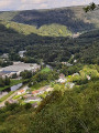
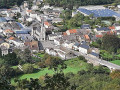
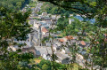
A lovely little route that follows the Ruisseau de Narbruay and offers views of Thilay and the Semoy valley from the Roche au Pihü viewpoint. You can admire this village and the hamlet of Naux set amidst lush greenery.

Details

39138153
Creation:
Last update:
Last review:
  • Walking
    Activity: Walking
  • ↔
    Distance: 3.08 mi
  • ◔
    Average duration: 1h 55 
  • ▲
    Difficulty: Moderate

  • ⚐
    Back to start: Yes
  • ↗
    Ascent: + 594 ft
  • ↘
    Descent: - 594 ft

  • ▲
    Highest point: 1,093 ft
  • ▼
    Lowest point: 489 ft

Photos

Description of the walk

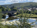
The starting point is at Place de l’Église. Parking is available on the square, in front of the Salle des Fêtes opposite, on the bridge side.

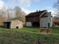
(S/E) Set off opposite, crossing the bridge over the Semoy. Turn left and then immediately right onto Rue de Nouzonville. Pass Chemin de Narbruay on your left, go past a wayside shrine on the left and you will immediately come to a large stone house on the left. Leave the road here and take Chemin de Bozin on the left.

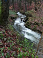
(1) Leave the return path on your right and continue straight on. About a hundred metres further on, keep to the right and climb gently alongside the Ru de Narbruay. Pass in front of the former home of Father Labranche, which has been restored and extended. The path is known as the Chemin des Brailles and leads to the vicinity of the Pré des Planes.

(2) Leave the path at the bottom of the valley and take a path on the right which climbs almost at a right angle towards the power line.

(3) At the top, at the junction of several paths, turn right towards the high-voltage power line, turn left directly opposite it, then follow a path to the right to reach the Roche au Pihü.

(4) Enjoy the lovely view from here. You can see Thilay, its forest and, to the right, the Semoy valley stretching towards the hamlet of Naux. Keep an eye on children, as this site is not secured. With your back to the viewpoint, continue down the path to the left for about 100 metres.

(5) Leave this path, which descends very steeply and may be slippery, and head right for about fifty metres to join another path. Turn left and follow it down towards Narbruay and the Chemin Bozin.

(1) Turn left and retrace your steps along the route you took on the way there, crossing the bridge to reach the Place de l’Église (S/E).

Waypoints

  1. S/E : mi 0 - alt. 499 ft - Place de l’Église.
  2. 1 : mi 0.35 - alt. 581 ft - Junction of the circular loop
  3. 2 : mi 1.55 - alt. 935 ft - Junction, turn right
  4. 3 : mi 2.11 - alt. 1,070 ft - Multi-directional junction, turn right
  5. 4 : mi 2.34 - alt. 978 ft - La Roche au Pihü, viewpoint
  6. 5 : mi 2.43 - alt. 883 ft - Turn right at the fork
  7. S/E : mi 3.08 - alt. 499 ft - Place de l’Église

Notes

Wear suitable footwear. If it’s hot, take some water with you.

(5) A change of route is recommended (choose your own path) as the descent can be difficult and slippery.

(4) Roche au Pihü: unsecured site, danger.

Parking: if you cannot park on the Place de l’Église, you can park on Rue des Pâquis, about a hundred metres from the square.

Worth a visit

400 m from the point (1) on the left, at the Ru de Narbruay, beavers have made their home near the chalet.

After the walk, visit the old wash houses.
You can ask for the key at the Café des Amis de la Semoy to visit the exhibition in the Lavoir Neuve Fontaine on the left as you head towards Monthermé.
Access is 100 m away via a small path leading to the Roche washhouse.

Reviews and comments

4.8 / 5
Based on 2 reviews

Reliability of the description
5 / 5
Ease of following the route
5 / 5
Route interest
4.5 / 5
natachabaro
natachabaro
• Edited:

Overall rating : 5 / 5

Date of your route : Oct 11, 2025
Reliability of the description : ★★★★★ Very good
Ease of following the route : ★★★★★ Very good
Route interest : ★★★★★ Very good
Very busy route : Yes

A superb autumn walk! With a superb view as a bonus. We did it as a family. Baby carrier and 11-year-old child. There is a slope towards the end which can be slippery if it has rained. Just make sure you have good, suitable walking shoes.

Machine-translated

User 2176661

Overall rating : 4.7 / 5

Date of your route : Aug 25, 2025
Reliability of the description : ★★★★★ Very good
Ease of following the route : ★★★★★ Very good
Route interest : ★★★★☆ Good
Very busy route : No

A pleasant hike off the beaten track, but be sure to follow the route carefully from the high-voltage power line or you may miss the viewpoint

Machine-translated

Other walks in the area

For more walks, use our search engine .

The GPS track and description are the property of this route's author. Please do not copy them without permission.