Country:

 City:
City:


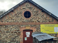
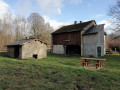
The starting point is at Place de l’Église. Parking is available on the square, in front of the village hall opposite, on the bridge side. (If you plan to visit the washhouse at point (9), ask for the key at the “Amis de la Semoy” café).
(S/E) Turn right facing the church and immediately turn left onto Rue de la Motte (note the mural on the wall of the Boutique d’Antan). At the war memorial, turn right onto Rue de la Roche, which leads uphill.
(1) At the top of the street, take the stony path on the right immediately after passing the last house. Follow it to the junction with theGR®16.
(2) Follow theGR®16for 300 m to the right, heading down towards Naux.
(3) Leave theGR®16and take the path on the left towards Le Chaufour and Les Éteignères.
(4) At the crossroads, turn left and join the Route Forestière des Éteignères.
(5) Cross it and follow the path opposite.
(6) Take a small path on the right towards the Roc la Tour site.
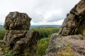
(7) At the junction with the Roc la Tour path (visit the geological site on the right), turn sharply left, then further on continue straight ahead to descend via theGR®16to the departmental road (D31) and the Auberge de Blossette.
(8) At the inn, cross the road carefully and, on the left at the start of the road towards Haulmé, take a small path towards Wachelot and Thilay. Further on, the path turns sharply left, then right, then left again. Further on, it runs alongside the D31.
(9) You’ll arrive at the Neuve Fontaine washhouse (well worth a visit – see the start of the description). Follow the main street to the right to return to the Place de l’Église (S/E).
(Don’t forget to return the key to the Café ‘Les Amis de la Semoy’.)

 Visorando Member
 Moderate