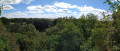
A family walk exploring the Landreau vineyards

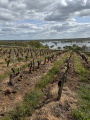
There are some truly beautiful views over the Landreau vineyards.

Details

n°1784172
Creation:
Last update:
Last review:
  • Walking
    Activity: Walking
  • ↔
    Distance: 2.82 mi
  • ◔
    Average duration: 1h 20 
  • ▲
    Difficulty: Easy

  • ⚐
    Back to start: Yes
  • ↗
    Ascent: + 69 ft
  • ↘
    Descent: - 69 ft

  • ▲
    Highest point: 276 ft
  • ▼
    Lowest point: 180 ft

Photos

Description of the walk

Park at the Place de l’Hôtel de Ville (near the church).

(S/E) Walk towards the pond (north). Take in the scenery. Follow the south-western side of the pond.
Head back up through the vineyards (yellow signposts). Reach the junction with Rue de Racapé.

(1) Turn right onto this road and head towards Racapé Castle. Continue along this road until you reach the junction with the D37. Turn left onto it, taking care. After about 300 metres, you’ll reach the junction with the farm track leading to the vineyard.

(2) Cross the D37 road with care towards the new industrial estate and follow the twists and turns of this small road between the vineyards and the industrial units. You’ll reach the Moulin Guillet.

(3) Turn right and walk alongside the vineyards. Change direction completely, heading due south. Pass the hamlet known as La Petite Giraudière. You will then reach the hamlet of La Gauterie. Turn left after the sports ground.

(4) Turn right onto Rue de la Gauterie. At the next junction, turn right again towards the Sauvagère neighbourhood. Turn left onto the small path between the houses to reach the D37 road near the Salle des Noëlles.

(5) Cross at the pedestrian crossing and, going round the pond on the left, head back to the starting car park (S/E).

Waypoints

  1. S/E : mi 0 - alt. 207 ft - Car park at the Town Hall square
  2. 1 : mi 0.41 - alt. 220 ft - Rue de Racapé
  3. 2 : mi 1.02 - alt. 256 ft - Vineyard crossroads
  4. 3 : mi 1.6 - alt. 269 ft - Moulin Guillet
  5. 4 : mi 2.18 - alt. 266 ft - La Gauterie
  6. 5 : mi 2.58 - alt. 207 ft - Crossing the D37
  7. S/E : mi 2.82 - alt. 207 ft - Car park at the Town Hall square

Notes

Car park and toilets available at the start.
This route is a family walk where children will have fun under their parents’ supervision.
It can be enjoyed in all seasons, even in light footwear. Recommended in spring and before the grape harvest!
It’s best to choose a day with good weather to enjoy the views (all the way to Nantes).

Worth a visit

200 metres on the right is the pretty house of the first mayor of Landreau in 1850. Further on, to the left, is a lovely wine cellar where you can discover and enjoy Muscadet. As you turn left, take note of this old wine press dating from 1830 (keep clear of the roadside).
This route takes you through the vineyards, which are a prominent feature of Le Landreau, and offers sweeping views towards Nantes.

Reviews and comments

4 / 5
Based on 2 reviews

Reliability of the description
4.5 / 5
Ease of following the route
5 / 5
Route interest
2.5 / 5
general11
general11

Overall rating : 4.3 / 5

Date of your route : Mar 04, 2026
Reliability of the description : ★★★★★ Very good
Ease of following the route : ★★★★★ Very good
Route interest : ★★★☆☆ Average
Very busy route : No

A short stroll to aid digestion at the end of the afternoon, a largely uninteresting route, mostly paved and passable in winter.

Machine-translated

Jamimi44
Jamimi44

Overall rating : 3.7 / 5

Date of your route : Jul 27, 2024
Reliability of the description : ★★★★☆ Good
Ease of following the route : ★★★★★ Very good
Route interest : ★★☆☆☆ Disappointing
Very busy route : No

Too many roads and not enough paths

Machine-translated

Other walks in the area

For more walks, use our search engine .

The GPS track and description are the property of this route's author. Please do not copy them without permission.