A picturesque walk around Brûlon

This short but fairly challenging walk will allow you to discover the landscape and heritage of the area around Brûlon, the birthplace of Claude Chappe, the brilliant inventor of the aerial telegraph.

Details

2106421
Creation:
Last update:
Last review:
  • Walking
    Activity: Walking
  • ↔
    Distance: 4.42 mi
  • ◔
    Average duration: 2h 15 
  • ▲
    Difficulty: Easy

  • ⚐
    Back to start: Yes
  • ↗
    Ascent: + 276 ft
  • ↘
    Descent: - 282 ft

  • ▲
    Highest point: 335 ft
  • ▼
    Lowest point: 171 ft
  • ⚐ Country: France
  • ⚐ City: Brûlon (72350)
  • ⚑
    Start/End: N 47.967154° / W 0.234008°
  • ❏
    IGN map(s): Ref. 1619SB
  • Hour-by-hour weather

Description of the walk

The route starts at the Place de la Mairie in the centre of the village, where parking is available. There is another car park around the church, 200 metres away.

(S/E) Take Rue Constant Cordier (named after a former mayor of the village) opposite the town hall and turn left at the end into Rue de la Douve. Then cross (carefully!) the D4 at the pedestrian crossing to reach Place des Anciennes Halles (the oldest part of Brûlon).

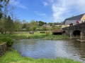
(1) Head down to the right and continue along Chemin du Pissot to the left of the Maison de Vigneron. Walk past the old wash house, which has been restored by the heritage association. At the bottom, turn right towards the lake.

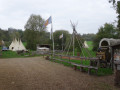
(2) Walk past the Camp d’Indiens. Go round the lake on the left. After walking alongside the Vègre, head up the path that runs alongside the archery range and cross the hillock.
Take the path opposite until you reach the D4.

(3) Walk up it to the right for a few metres, then cross it at the pedestrian crossing before heading back down and turning right towards the climbing wall.
At the crossroads, follow the path to the left and continue to the village of Avessé.

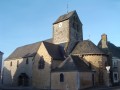
(4) When you reach the church (take a moment to admire the millstone of an old horse-driven mill on your left), follow the road to the right.
At the roundabout, take the road on the right towards Saint-Denis d’Orques and follow it for about 1 km. As you pass, at the entrance to the field on the right, you’ll see the Château de la Grand Vigne and then the beautiful house on Rue before reaching the wash house.

(5) Just after this, turn right and walk for about 1 km, straight on to the top of the hill, where you’ll turn right onto the road.

(6) Walk straight past the Château de la Grand Vigne and follow the road to the right. At the end of this road, you’ll find yourself in front of Claude Chappe’s birthplace, with the church on your left and the priory a little further on.

(7) Cross the square straight ahead to join Rue de l’Église, which is the oldest street in Brûlon; it once linked the castle on the feudal motte to the church.

(8) At the end of the street is the feudal motte (information panel), which you should leave via the street you came from to reach, on your left, the Place de la Mairie (S/E).

Waypoints

  1. S/E : mi 0 - alt. 331 ft - Town Hall Square
  2. 1 : mi 0.25 - alt. 295 ft - Chemin Pissot
  3. 2 : mi 0.59 - alt. 180 ft - Indian Camp. Lake and - Vègre (rivière)
  4. 3 : mi 1.52 - alt. 289 ft - D4
  5. 4 : mi 2.53 - alt. 266 ft - Avessé Church
  6. 5 : mi 3.12 - alt. 203 ft - Washing house
  7. 6 : mi 4 - alt. 325 ft - Château de la Grand Vigne
  8. 7 : mi 4.18 - alt. 335 ft - Birthplace of Claude Chappe
  9. 8 : mi 4.31 - alt. 331 ft - Feudal motte
  10. S/E : mi 4.42 - alt. 331 ft - Town Hall Square

Notes

Toilets at the start of the trail, then by the lake.

Worth a visit

The ‘Tipis du Bonheur de Vivre’ camp, Europe’s largest Native American camp.
The millstone of the horse-driven mill, near the village hall in Avessé.
The heritage foundation house on Rue.
The wash house.
The Château de la Grand Vigne.
The birthplace of Claude Chappe, inventor of the aerial telegraph.
A priory sharing the church’s Romanesque origins (spiral staircase tower), with a 14th-century porch, rebuilt in the 15th and 16th centuries.
A motte, marking the site of the former Château de Brûlon, dating from the Gallo-Roman period and the Middle Ages, listed as a historic monument in 1995. The first telegraphic message was sent from this motte; a telegraph pole still stands in the centre of it.

Reviews and comments

5 / 5
Based on 2 reviews

Reliability of the description
5 / 5
Ease of following the route
5 / 5
Route interest
5 / 5
Le Coureur des bois
Le Coureur des bois

Overall rating : 5 / 5

Date of your route : Sep 23, 2024
Reliability of the description : ★★★★★ Very good
Ease of following the route : ★★★★★ Very good
Route interest : ★★★★★ Very good
Very busy route : No

A lovely walk.

Machine-translated

Fabien!
Fabien!

Overall rating : 5 / 5

Date of your route : May 02, 2021
Reliability of the description : ★★★★★ Very good
Ease of following the route : ★★★★★ Very good
Route interest : ★★★★★ Very good
Very busy route : No

A very pleasant walk through villages, along paths and through woods. We were with three children (the youngest aged 5) and the difficulty level was just right.

Machine-translated

Other walks in the area

For more walks, use our search engine .

The GPS track and description are the property of this route's author. Please do not copy them without permission.