Route of the two churches in Cossé-en-Champagne – Bannes

Starting from the pretty village of Cossé-en-Champagne, set off on this circular walk to explore the
Mayenne countryside. Along the way, you’ll encounter two superb Romanesque churches, a charming chapel,
paths lined with broom and dense shrubbery.

  • You can combine this route with route no. 3.

Details

183910
Creation:
Last update:
Last review:
  • Walking
    Activity: Walking
  • ↔
    Distance: 11.26 mi
  • ◔
    Average duration: 5h 20 
  • ▲
    Difficulty: Moderate

  • ⚐
    Back to start: Yes
  • ↗
    Ascent: + 223 ft
  • ↘
    Descent: - 213 ft

  • ▲
    Highest point: 338 ft
  • ▼
    Lowest point: 190 ft

Photos

Description of the walk

From Brûlon, take the D4 towards Poillé-sur-Vègre, then turn off onto the D43/D130 and continue to Cossé-en-Champagne. Park at the car-sharing area and City Park.

(S/E) With your back to the car-sharing area and City Park, turn right and walk up the main street to the church. At the roundabout, turn left onto the D563. Take the first right, called Chemin des Demoiselles, which is lined with stone walls and gardens. Continue along the track, keeping to the right at the junction, until you reach a second fork.

(1) Turn left towards La Gontrie. At the tarmac road, turn left and then right onto the first track. Follow this track until you reach the D563.

(2) Head north-east towards Le Coudray. Pass a first hamlet to reach a second one, called Les Robidasières.

(3) Turn left onto a track, then carry on straight ahead until you reach the road. Follow this road, then first turn right then left onto the D108 towards La Promenade. Turn right onto a path at a cross and you’ll arrive at the Chapelle de la Piquellière.

(4) Turn left and you’ll reach the village of Bannes.

(5) Take Rue du Lavoir straight ahead. Once at the three-way junction, keep left onto Chemin du Pâtis to join the D554.

(6) Turn right towards Saulges until you reach the first junction.

(7) Turn left towards Bois Isabeau. At the hamlet, continue to the left and follow the track up to the RD130.

(8) Cross with care, continue along the path opposite, then turn left (marker 79), and carry on to the three-way junction.

(9) Turn right towards L’Habit. Turn right onto the D7 until you reach the next crossroads at Les Jarris

(10) Turn left onto the small tarmac road to l’Épine until you reach the first four-way junction.

(11) Turn right onto a wide track, then keep left twice towards Saint-Martin. Turn left again towards Les Fougerais once you reach the end of the track, and you’ll then come out onto the road.

(12) First turn right then left towards Les Martellières. Continue straight on until you reach La Croix au Gendre, passing by the Fléchardière training track.

(13) Turn right as far as the church, then turn left onto the Rote de Plaisance and return to the starting point (S/E).

Waypoints

  1. S/E : mi 0 - alt. 230 ft - Carpooling area and City Park
  2. 1 : mi 0.8 - alt. 230 ft - Turn left towards La Gontrie
  3. 2 : mi 1.65 - alt. 295 ft - D563
  4. 3 : mi 2.43 - alt. 322 ft - Les Robidasières: take the path on the left
  5. 4 : mi 3.91 - alt. 335 ft - La Piquellière Chapel - Chapelle de la Piqulière
  6. 5 : mi 4.22 - alt. 276 ft - Take Rue du Lavoir - Église Saint-Jean-Baptiste (Bannes)
  7. 6 : mi 4.86 - alt. 285 ft - D554
  8. 7 : mi 5.35 - alt. 292 ft - Croix – Path to Bois Isabeau
  9. 8 : mi 6.33 - alt. 308 ft - D130
  10. 9 : mi 7.16 - alt. 299 ft - T-junction
  11. 10 : mi 7.93 - alt. 243 ft - Turn left onto the tarmac road to L’Épine
  12. 11 : mi 8.58 - alt. 240 ft - L’Épine, crossroads; turn right towards Saint-Martin
  13. 12 : mi 9.84 - alt. 236 ft - Les Fougerais
  14. 13 : mi 10.69 - alt. 285 ft - La Croix au Gendre
  15. S/E : mi 11.26 - alt. 230 ft - Carpooling area and City Park

Notes

Alternative: you can start the walk from the village of Bannes. The starting sign is located near the
town hall.

Worth a visit

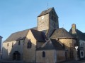
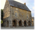
Church dedicated to the Virgin Mary, Cossé-en-Champagne: built in the early 12th century, the interior of the sanctuary houses murals dating from different periods, with the oldest decoration dating from the 13th century. Notable features include: on the vault, a magnificent scene of angelic musicians; in the central register, the Coronation of the Virgin; and a Last Judgement of significant iconographic importance.

Church of St John the Baptist: the church displays the characteristics of 12th-century Romanesque churches: a semicircular apse pierced by narrow windows, a Latin cross plan, a bell tower featuring Romanesque windows, and the presence of buttresses. The church is still surrounded by its parish cemetery, a feature common in the 11th and 12th centuries.

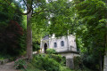
La Piquellière Chapel, Bannes: situated on an ancient Roman road and built towards the end of the 18th century, this chapel is said to have been erected in honour of frequent apparitions of the Virgin Mary at this site. Processions were held at the chapel on Pentecost and on Rogation Days (processions intended to invoke divine blessing upon crops and livestock).

(*) Château de Varennes l’Enfant in Val-du-Maine: this château is said to be an exact replica of a
Scottish castle. The site offers a superb view of the castle and its outbuildings: 16th-century sections with earlier remains and 19th-century restoration work. The 13th-century chapel is listed in the supplementary register of Historic Monuments.

Reviews and comments

4.3 / 5
Based on 3 reviews

Reliability of the description
4.3 / 5
Ease of following the route
4.7 / 5
Route interest
4 / 5
lily72
lily72
• Edited:

Overall rating : 3.7 / 5

Date of your route : Nov 25, 2019
Reliability of the description : ★★★★☆ Good
Ease of following the route : ★★★★☆ Good
Route interest : ★★★☆☆ Average

Too many roads

Machine-translated

CENOMAN
CENOMAN
• Edited:

Overall rating : 4.3 / 5

Date of your route : Feb 20, 2019
Reliability of the description : ★★★★☆ Good
Ease of following the route : ★★★★★ Very good
Route interest : ★★★★☆ Good

Just a minor problem – I had trouble finding the first path at the start of the walk.

Machine-translated

Hugo53
Hugo53
• Edited:

Overall rating : 5 / 5

Date of your route : Feb 28, 2016
Reliability of the description : ★★★★★ Very good
Ease of following the route : ★★★★★ Very good
Route interest : ★★★★★ Very good

A lovely walk. Damp in places in winter. Take care after Cosse-en-Champagne – there are two signposted walking trails. Make sure you follow the one on the left.

Machine-translated

Other walks in the area

For more walks, use our search engine .

The GPS track and description are the property of this route's author. Please do not copy them without permission.