Through the centuries along the Vègre

This route passes through two parishes: Brûlon and Avessé. You’ll come across some beautiful churches and other architectural heritage along the way.

Details

205444
Creation:
Last update:
Last review:
  • Walking
    Activity: Walking
  • ↔
    Distance: 5.61 mi
  • ◔
    Average duration: 2h 55 
  • ▲
    Difficulty: Easy

  • ⚐
    Back to start: Yes
  • ↗
    Ascent: + 344 ft
  • ↘
    Descent: - 325 ft

  • ▲
    Highest point: 335 ft
  • ▼
    Lowest point: 171 ft
  • ⚐ Country: France
  • ⚐ City: Brûlon (72350)
  • ⚑
    Start/End: N 47.961691° / W 0.225473°
  • ❏
    IGN map(s): Ref. 1619SB
  • Hour-by-hour weather

Description of the walk

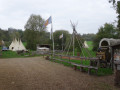
(S/E) From the Leisure Park next to the “Le Septentrion” campsite, head back along the road in the opposite direction and walk past the Indian camp “Les Tipis du Bonheur de Vivre”.

(1) Just after the camp, turn left onto the Chemin du Pissot, which climbs towards Brûlon. When you reach the tower of the same name, enjoy the view over the lake.

(2) When you reach the Place des Anciennes Halles, turn left to join the main street. First turn right then left to take Rue de la Douve. This street, which no longer exists, once surrounded a “motte” castle. La Motte is on your left. It was here that Claude Chappe carried out his first telegraphic experiments. First turn right then left onto Rue de l’Église to join Rue Maussion. Continue straight ahead along the small street which turns into a path and winds down the hillside before veering left at the bottom.

(3) At the junction, turn right before you reach the tarmac. This track crosses a small stream, then climbs before descending again on the other side to cross another stream. Carry on straight ahead to climb up to Avessé and reach the church.

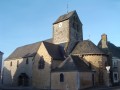
(4) Walk round the church at Avessé, keeping it on your right; pass in front of its main entrance and continue along Rue de la Libération to the roundabout. Take the road on the right. Pass the hamlet known as La Rue, then, shortly after the washhouse, turn right towards La Bècre.

(5) Do not follow the road when it bends, but carry straight on along the track. Then, at the Fork in the road, take the track on the left. This climbs up to join a small road; turn left and then, before the first houses in the hamlet of La Fosse, turn right onto the small track (an old railway line, the Promenade des Anglais).

(6) At the next road, first turn right then left to continue almost directly opposite along the path. This will take you past the cemetery. Keep going in the same direction until you reach the D35. Turn right, then right again to reach Brûlon Church.

(7) Walk past the main entrance to the church, follow the side of the church keeping it on your left, and turn right onto Chemin des Vignes. You’ll cross the path you took on the way out and continue straight ahead.

(8) At the Croix Cornuel, turn left to cross Avenue de la Libération and immediately turn right into the small street. Turn left at the Fork in the road. After about a hundred metres, a path leads down to the left; take this path. It leads to the campsite and the leisure park.

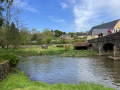
(9) Once you reach the lake, finish this walk by walking round the lake, keeping it on your left (with the Vègre on your right), and return to the starting point (S/E).

Waypoints

  1. S/E : mi 0 - alt. 171 ft - Lake
  2. 1 : mi 0.29 - alt. 180 ft - Chemin du Pissot
  3. 2 : mi 0.54 - alt. 315 ft - Place des Anciennes Halles
  4. 3 : mi 1.17 - alt. 217 ft - Junction
  5. 4 : mi 2.03 - alt. 266 ft - Avessé Church
  6. 5 : mi 2.83 - alt. 200 ft - La Bècre
  7. 6 : mi 3.64 - alt. 256 ft - Crossroads
  8. 7 : mi 4.36 - alt. 331 ft - Brûlon Church
  9. 8 : mi 4.79 - alt. 285 ft - La Croix water chestnut
  10. 9 : mi 5.26 - alt. 171 ft - Vègre (rivière)
  11. S/E : mi 5.61 - alt. 171 ft - Lake

Notes

Some sections may be closed during the hunting season.

Worth a visit

Reviews and comments

3.4 / 5
Based on 5 reviews

Reliability of the description
3.2 / 5
Ease of following the route
3.2 / 5
Route interest
3.8 / 5
poloaimelarando
poloaimelarando

Overall rating : 1 / 5

Date of your route : Feb 10, 2022
Reliability of the description : ★☆☆☆☆ Very disappointing
Ease of following the route : ★☆☆☆☆ Very disappointing
Route interest : ★☆☆☆☆ Very disappointing
Very busy route : No

Please note that this walk is no longer signposted and follows a section of a ‘private’ path which is off-limits during the hunting season from September to February. It has been replaced by an alternative route, which can be found on the LBN Community of Communes’ website.

Machine-translated

bonnin_nicole
bonnin_nicole

Overall rating : 4 / 5

Date of your route : Oct 26, 2020
Reliability of the description : ★★★★☆ Good
Ease of following the route : ★★★★☆ Good
Route interest : ★★★★☆ Good
Very busy route : No

A walk through woods and fields. In Sarthe, there aren’t any hills, but there are lovely sunken paths
The only downside was that at a place called ‘La Ballade des Anglais’, the path was fenced off, so we had to crawl under the barbed wire.

Machine-translated

gloria
gloria

Hello, we really enjoyed it and even had a good laugh crawling on our stomachs under the barbed wire

Machine-translated

Vallée de la Sarthe
Vallée de la Sarthe

Hello,
Sorry for the inconvenience – I hope it didn’t stop you from enjoying the walk?

Have a lovely day
Marianne Marteau

Machine-translated

gloria
gloria

Overall rating : 4.3 / 5

Date of your route : Sep 25, 2020
Reliability of the description : ★★★★☆ Good
Ease of following the route : ★★★★☆ Good
Route interest : ★★★★★ Very good
Very busy route : No

not really the way to mark a passage that’s closed off with barbed wire

Machine-translated

JLG72
JLG72

Overall rating : 3.7 / 5

Date of your route : Jul 13, 2020
Reliability of the description : ★★★☆☆ Average
Ease of following the route : ★★★☆☆ Average
Route interest : ★★★★★ Very good
Very busy route : No

Lack of precision; no signposting.
It crosses another route, which is a bit confusing.
It’s still a lovely walk, though.

Machine-translated

Vallée de la Sarthe
Vallée de la Sarthe

Hello,
We’re sorry for the inconvenience you experienced during your walk.
We’ve taken note of this and will pass the information on to the relevant local council to resolve the issue.

To find out about our other walks in our beautiful Sarthe Valley, please visit: http://www.vallee-de-la-sarthe.com/fr/sy....

Have a lovely day.

Marianne Marteau

Machine-translated

kabilou
kabilou

Overall rating : 4 / 5

Date of your route : Mar 08, 2016
Reliability of the description : ★★★★☆ Good
Ease of following the route : ★★★★☆ Good
Route interest : ★★★★☆ Good

Mountain bike route completed on 8 March 2016; only part of the route was completed due to the path being completely blocked by a huge pile of brushwood (over 3 metres high) pushed there by a local resident using agricultural machinery (deliberately placed) between points 3 and 4 on the map, on the boundary between the municipalities of Brûlon and Avessé; the passage was absolutely impassable

Machine-translated

Other walks in the area

For more walks, use our search engine .

The GPS track and description are the property of this route's author. Please do not copy them without permission.