Country:
 City:
City:


Park in the village hall car park, near the fire station.
(S/E) Walk past the fire station, then head down Rue de Sable to the right, keeping to the left-hand side, until you reach the roundabout.
(1) Turn left, then enter the park. Walk alongside the lake and the wildlife park on your left. Cross a motorhome site, then reach a road.
(2) Turn right onto Chemin du Four, continue along the road via a small path until you reach a main road. Carry on to the right until you reach a house by the roadside on your left, at a place called La Bailleullerie.
Walk about fifty metres there and back along the path on the right until you reach a wash house.
After taking in the view, retrace your steps and continue along the road to the right until you reach a junction.
(3) Ignore the road to the right and follow the path to the left. After veering to the right, walk alongside a stream and, at a house on your right (visible about a hundred metres from the path), turn left between the fields. Go round the hamlet of La Locherie on the left and reach the D79. Turn right onto the path that runs alongside the road on your left.
(4) At this small road, cross the D79 and continue in the same direction on the other side of it.
(5) Near the high-speed rail line (LGV), turn onto the grassy path on the left and follow the railway line on your right. The hamlet of Chantemesle no longer exists; carry on to the Croix de l’Ormeau, at the junction with the cross-road (the railway line is visible on the right).
(6) Walk a few metres to the left, then turn right (sign: ‘No entry except for residents’). Walk for about twenty metres, then take the grassy path on the left. Follow the high-speed rail line again, then turn left. Follow a stream, then reach a road (D24) after taking a tarmac path on the left for a few metres.
(7) Cross the road, then immediately turn right onto the grassy path that runs alongside the fields. Make a circular loop to the left and, when you reach the copse, turn right. Join the access path to the hamlet of La Bélisière.
(8) Turn left and follow this track until you pass a farm, La Marchaichère, on your right. Pass Bellevue and Maupertuis. Continue for a few metres until you come to the start of a track on the right, just before a cemetery.
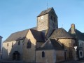
(9) Follow this path, skirting the cemetery, then, at the end, turn left. Continue straight on until you reach the church.
(10) Turn right towards Sablé, then quickly turn right into a small lane. At the end, turn left onto Rue des Quatre Roues. Cross Rue d’Erve and take the small lane opposite to reach the village hall car park (S/E).


 A lovely walk with not too much tarmac and plenty of things and animals to see
 Tourist office
 Moderate
 Visorando Member