Country:
 City:
City:


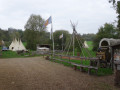
Car park near the lake.
(S/E) Start the walk by walking round the lake in an anti-clockwise direction. Walk past the beach and continue along the lakeside.
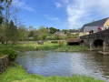
(1) Leave the path and turn right to cross the River Vègre via a small wooden bridge.
Carry on along the path which climbs until you reach the departmental road.
(2) Take the departmental road to the right for 1 km to reach Chevillé via Rue de Saint-Aubin.
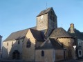
(3) At the crossroads, turn right onto Rue de la Cavalcade to pass in front of the Church of Notre-Dame de Chevillé, a 12th-century building. Continue straight on along this street, passing the hamlet of Les Ormeaux.
(4) Turn onto the track on the left, then continue straight ahead along this track, keeping to the right, until you join the D43 at the hamlet of Les Hervables.
(5) Turn right, pass the hamlet of Le Verger, then turn left a little further on onto the Route du Petit Martigné. Continue along the track to the wooden bridge spanning the River Vègre. Continue along the Chemin de Mondon to reach the D4 at the hamlet of Le Minerai.
(6) Take the road on the right, passing the hamlets of Les Bons Enfants and then La Salle.
(7) Leave the D4 (take care when crossing it) and turn left onto theGR® 365, which takes you along Rue des Jardins to the village of Avessé. Walk through the village and follow Rue de l’Église.
(8) In front of the building, turn right and immediately take the path on the left that leads downhill (the old Avessé road). Keep to the right and continue along the path.
(9) At the bottom, before La Croix Cornuel, turn left onto the path that climbs up to the climbing wall. At the junction, take thesecond street on the left, the Chemin des Vignes.
(10) At the crossroads (with the church opposite), turn left onto Rue Claude Chappe. Walk past his birthplace (now a museum) and then continue keeping to the left. As you pass, admire the Château de la Grand-Vigne and carry on straight ahead along the Chemin de La Fosse.
(11) Leave the road and take the path on the left until you reach a Fork in the road.
(12) Turn right onto the path that climbs back up to the Route de la Fosse and turn left. Just before the hamlet, turn immediately right onto the path that leads onto the Route du Ronceray. Cross the road and carry on straight ahead to reach the Promenade des Anglais (this is the old railway line that linked Sablé to Sillé-le-Guillaume). Large stones mark the entrance.
(13) At the end of the street, turn right onto Rue du Cimetière, then continue straight on along Rue Saint-Marc. At the end of this street, turn right onto Boulevard de la Gare. Cross the Place des Anciennes Halles, then follow Rue William Béatrix straight ahead and turn left onto Rue de l’Église.
(14) Turn left into Rue de La Douve. At the corner, you’ll notice the oppidum (feudal mound), on which stands a perfect replica of Claude Chappe’s telegraph. When you reach the main street, Rue Charles Barreau, cross with great care (danger!!! heavy traffic). Turn right, then further on take the street on the left (Rue de Buet) towards the lake. Head down Chemin du Pissot.
(15) As you pass, you’ll notice the Tour du Pissot (a former watchtower or vineyard cottage for seasonal workers) as well as the wash house. Enjoy the view over the lake. At the end of the path, turn right and follow the access path to the leisure centre. In front of the Indian camp “Les Tipis du Bonheur de Vivre”, turn left to reach the car park (S/E).

 Visorando Member
 Easy
Easy 
 Tourist office