Walk around the village of Plomelin

A short family route to explore the area around the village of Plomelin.

Details

n°228057
Creation:
Last update:
Last review:
  • Walking
    Activity: Walking
  • ↔
    Distance: 2.98 mi
  • ◔
    Average duration: 1h 25 
  • ▲
    Difficulty: Easy

  • ⚐
    Back to start: Yes
  • ↗
    Ascent: + 69 ft
  • ↘
    Descent: - 69 ft

  • ▲
    Highest point: 194 ft
  • ▼
    Lowest point: 95 ft
  • ⚐ Country: France
  • ⚐ City: Plomelin (29700)
  • ⚑
    Start/End: N 47.934195° / W 4.15132°
  • ❏
    IGN map(s): Ref. 0519ET, 0519OT
  • Hour-by-hour weather

Photos

Description of the walk

Car park at the socio-cultural hall, ‘Espace Kerne’ sports complex.

(S/E) From the car park, head towards the main street, walking past Lucie Aubrac Primary School, and turn left into Rue Hent Kerfram, opposite the doctor’s surgery. Turn right at the first street, Hent Eric Tabarly, which passes the post office and runs alongside a housing estate.

(1) At the gable end of the last building before the road, turn right onto a dirt track (marked with a light blue sign) then veer right to follow this well-marked path. Continue past a school, pass between houses and cross the main road at the pedestrian crossing. Walk past the town hall, then round the back of the school, and continue along Allée du 19 Mars 1962, which leads down to a large grassy area.

YellowPR® markings

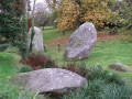
(2) Turn left, follow the path which veers to the right and joins Rue Hent Tingoff. Follow this street to the right, cross it and continue to the left into the Park Ar Menhir residential area. Head left towards the menhirs.

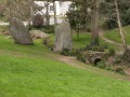
(3) Walk round the menhirs, cross the small stone bridge and continue along the very well-marked path, heading south-east then north-west.

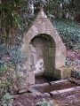
(4) Turn left towards the Kerneven Work-Based Support Centre, walk alongside the greenhouses and turn left again to go round the buildings. Just before the roundabout, head right to walk along the street and follow the path on the right leading to Saint-Philibert’s Chapel. Walk past the chapel and turn left. Right at this spot, set slightly back, is the fountain, which is unfortunately unmarked.

At the road, turn right onto the road leading to Kervouyen Farm. Continue along a wide path and note a small, recently restored fountain on the left. Carry on to join the Trébé road, where you’ll leave thePR® signposting behind.

No signposts

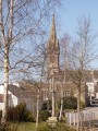
Turn right and follow the road towards the village, which you can spot by its bell tower.

(5) Just before the road sign marking the entrance to the village of Plomelin, turn left into Rue Hent Victor Roussin. Continue straight ahead between the houses to follow a path (not shown on the IGN map) which turns right, running alongside a stream. Follow this path, part of which is a boardwalk over the wetland.

(2) At the junction of the paths, go up the street and then turn left immediately at a group of green letterboxes. This route goes round the school and leads to the car park (S/E).

Waypoints

  1. S/E : mi 0 - alt. 148 ft - Car park: Socio-Cultural Hall, Sports Complex
  2. 1 : mi 0.28 - alt. 167 ft - Path on the right
  3. 2 : mi 0.6 - alt. 131 ft - Junction
  4. 3 : mi 0.91 - alt. 157 ft - Walk around the menhirs
  5. 4 : mi 1.32 - alt. 144 ft - Turn left towards the E.S.A.T. in Kerneven
  6. 5 : mi 2.42 - alt. 112 ft - Turn left onto Rue Hent Victor Roussin
  7. S/E : mi 2.98 - alt. 148 ft - Car park: Socio-Cultural Hall, Sports Complex

Notes

Toilets are available en route near the town hall.
Plain flat shoes are sufficient.

Worth a visit

Saint-Philibert Chapel: Set in lush green surroundings, in the shape of a Latin cross with a rounded apse, the chapel was built between 1621 and 1684

Menhirs: Remnants of the Neolithic period (around 5000 BC).

Always be cautious and plan ahead when you're outdoors. Visorando and the author of this route cannot be held responsible for any accidents occurring on this route.

The GR® and PR® markings are the intellectual property of the Fédération Française de Randonnée Pédestre.

Reviews and comments

4.3 / 5
Based on 2 reviews

Reliability of the description
4.5 / 5
Ease of following the route
5 / 5
Route interest
3.5 / 5
Jerome et Sandra su 16

Overall rating : 4.3 / 5

Date of your route : Aug 07, 2023
Reliability of the description : ★★★★★ Very good
Ease of following the route : ★★★★★ Very good
Route interest : ★★★☆☆ Average
Very busy route : No

A nice little walk

Machine-translated

emma976
emma976

Overall rating : 4.3 / 5

Date of your route : Mar 15, 2021
Reliability of the description : ★★★★☆ Good
Ease of following the route : ★★★★★ Very good
Route interest : ★★★★☆ Good
Very busy route : No

A short family walk taking in both the village and the countryside. A lovely time

Machine-translated

Other walks in the area

For more walks, use our search engine .

The GPS track and description are the property of this route's author. Please do not copy them without permission.