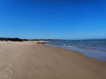
Wissant Bay

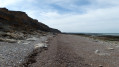
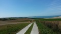
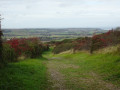
Surrounded by the two capes of Gris Nez and Blanc Nez, the bay of Wissant offers beautiful panoramic views along its kilometres of dunes.

Details

n°13416439
Creation:
Last update:
Last review:
  • Walking
    Activity: Walking
  • ↔
    Distance: 4.65 mi
  • ◔
    Average duration: 2h 15 
  • ▲
    Difficulty: Easy

  • ⚐
    Back to start: Yes
  • ↗
    Ascent: + 105 ft
  • ↘
    Descent: - 105 ft

  • ▲
    Highest point: 138 ft
  • ▼
    Lowest point: 10 ft

Photos

Description of the walk

Tardinghen car park

(S/E) Take the road known as the Route du Châtelet, which runs on from the car park and leads past a few farms to the hamlet of Châtelet.

(1) Head right towards the car park and follow the path which runs alongside it on the left, then continues along the Dune du Châtelet. Turn left to reach the beach.

(2) Turn right onto the beach and walk along it for about 1.4 km, following the Dune d’Aval.

(3) Leave the beach before Wissant by taking a sandy path that climbs to the right and follow the signs for “Motte du Bourg” along a pleasant, shaded track. Cross the small tarmac road and continue along the track opposite.

(4) Turn right to reach and cross the car park. At the D940, follow it carefully to the left for about 200 m, then turn right twice and follow the wide track (suitable for bicycles), which runs parallel to the departmental road before curving to the left, opposite the car park you passed earlier. Follow it straight on to Haut de Tardinghen.

(5) Turn right towards Tardinghen via the D249. In Tardinghen, turn left onto the D940 before joining the Route du Châtelet on the right and the car park (S/E).

Waypoints

  1. S/E : mi 0 - alt. 92 ft - Tardinghen car park
  2. 1 : mi 0.79 - alt. 20 ft - On the right, alongside the car park
  3. 2 : mi 1.45 - alt. 20 ft - Beach
  4. 3 : mi 2.52 - alt. 46 ft - Turn right at the junction before Wissant
  5. 4 : mi 3.07 - alt. 62 ft - D940
  6. 5 : mi 4.24 - alt. 138 ft - D249, on the right
  7. S/E : mi 4.65 - alt. 92 ft - Tardinghen car park

Reviews and comments

4.4 / 5
Based on 18 reviews

Reliability of the description
4.4 / 5
Ease of following the route
4.2 / 5
Route interest
4.6 / 5
famille Devaux
famille Devaux

Thank you, and all the best for the future

Machine-translated

Denis26
Denis26 ★

Thank you for your comments. I have just amended the route after (4) to avoid the section of the embankment in question.

Machine-translated

JMdC
JMdC

Overall rating : 4.3 / 5

Date of your route : Oct 19, 2026
Reliability of the description : ★★★★☆ Good
Ease of following the route : ★★★★☆ Good
Route interest : ★★★★★ Very good
Very busy route : No

Point 4 on the route presents a slight problem because, after crossing the D940, you find yourself not facing a path but a fairly high, steep and slippery embankment which you have to climb to reach the next section of the route, which lies just above.

Machine-translated

famille Devaux
famille Devaux

Overall rating : 4.3 / 5

Date of your route : Oct 16, 2026
Reliability of the description : ★★★★☆ Good
Ease of following the route : ★★★★☆ Good
Route interest : ★★★★★ Very good
Very busy route : No

Hello,
As previously mentioned, there is an issue with point 4 of the description.
(4) Turn right to reach and cross the car park. Cross the D940 with care and, opposite, slightly to the right, take a footpath which leads onto a wide, vehicle-accessible track (suitable for bicycles). Follow it straight on to Haut de Tardinghen.
In fact, after crossing the D940, there is no path. There is indeed a slope that some people have tried to climb, but it is very steep and slippery, and therefore impassable. The solution found was to continue to the right for approximately 300 metres until you reach the end of the embankment and the end of a low wall. Immediately after that, turn left straight away along a fence and walk along the edge of a field. After 100 metres, you’ll reach this track.

Machine-translated

PHLNT72
PHLNT72

Overall rating : 4.3 / 5

Date of your route : Sep 17, 2026
Reliability of the description : ★★★★☆ Good
Ease of following the route : ★★★★☆ Good
Route interest : ★★★★★ Very good
Very busy route : Yes

Hello,
There seems to be an error in the instructions under point 4, unless the layout has changed. Here is my version based on my experience:
(4) “Turn right to reach and cross the car park. Turn left and carefully follow the D940 for 150 metres, then cross it at a junction to join a wide, carriageable track (cycle path)”. etc...

Machine-translated

Thierry Destailleur
Thierry Destailleur

Overall rating : 5 / 5

Date of your route : Sep 07, 2026
Reliability of the description : ★★★★★ Very good
Ease of following the route : ★★★★★ Very good
Route interest : ★★★★★ Very good
Very busy route : Yes

A lovely walk through the countryside and along the coast

Machine-translated

voisart
voisart

Overall rating : 4.3 / 5

Date of your route : Jun 22, 2026
Reliability of the description : ★★★★☆ Good
Ease of following the route : ★★★★★ Very good
Route interest : ★★★★☆ Good
Very busy route : No

A pleasant walk

Machine-translated

Angèle LEMMEL
Angèle LEMMEL

We haven't been there yet, but we will be soon. THANK YOU

Machine-translated

User 12388416

Overall rating : 4 / 5

Date of your route : Apr 16, 2026
Reliability of the description : ★★★★☆ Good
Ease of following the route : ★★★★☆ Good
Route interest : ★★★★☆ Good
Very busy route : No

a lovely walk

Machine-translated

DUFOUR PAUL
DUFOUR PAUL

Overall rating : 4 / 5

Date of your route : Nov 10, 2025
Reliability of the description : ★★★★★ Very good
Ease of following the route : ★★★☆☆ Average
Route interest : ★★★★☆ Good
Very busy route : Yes

Thank you

Machine-translated

fil 59140
fil 59140

Overall rating : 4.3 / 5

Date of your route : Sep 29, 2025
Reliability of the description : ★★★★☆ Good
Ease of following the route : ★★★★★ Very good
Route interest : ★★★★☆ Good
Very busy route : Yes

at the end of the beach, take the stairs. Walk past the campsite, leaving it on your left.

Machine-translated

MAMIEJO
MAMIEJO

Overall rating : 5 / 5

Date of your route : Jul 31, 2025
Reliability of the description : ★★★★★ Very good
Ease of following the route : ★★★★★ Very good
Route interest : ★★★★★ Very good
Very busy route : No

A very pleasant morning walk, combined with LES HAUTS DE WISSANT in the afternoon. There are benches around the car park at the start, where you can enjoy a picnic before heading to the start of the second loop in Wissant (by car)

Machine-translated

Le Sys Deux
Le Sys Deux

Overall rating : 4 / 5

Date of your route : Apr 19, 2025
Reliability of the description : ★★★★☆ Good
Ease of following the route : ★★★★☆ Good
Route interest : ★★★★☆ Good
Very busy route : No

It's a little difficult to find your way out of the dunes downstream. Otherwise, the description is generally well done.

Machine-translated

User 14738520

Overall rating : 4.3 / 5

Date of your route : Jun 02, 2025
Reliability of the description : ★★★★★ Very good
Ease of following the route : ★★★☆☆ Average
Route interest : ★★★★★ Very good
Very busy route : No

A wonderful discovery and a fantastic hike. My only regret is that the route was very poorly marked.

Machine-translated

gs
gs

Overall rating : 4.3 / 5

Date of your route : Mar 31, 2025
Reliability of the description : ★★★★☆ Good
Ease of following the route : ★★★★☆ Good
Route interest : ★★★★★ Very good
Very busy route : No

A lovely walk in the sunshine, really very pleasant, and the scenery is well worth seeing.
Please note that at point 3, the path through the dunes no longer exists, as the dune is increasingly being eroded by the sea.
Continue to the stairs leading up to the sea wall, take them, and turn right immediately before the first house to join the path to the village mound.
Don't hesitate to give it a go!

Machine-translated

Other walks in the area

For more walks, use our search engine .

The GPS track and description are the property of this route's author. Please do not copy them without permission.