From Wissant to Audinghen – Cap Gris Nez

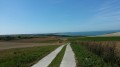
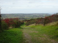
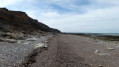
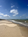
A lovely walk from Wissant to Cap Gris Nez along the cliffs.
You’ll need to leave a car in the Cap Gris Nez car park for the return journey.

Details

46017307
Creation:
Last update:
Last review:
  • Walking
    Activity: Walking
  • ↔
    Distance: 4.61 mi
  • ◔
    Average duration: 2h 15 
  • ▲
    Difficulty: Easy

  • ⚐
    Back to start: No
  • ↗
    Ascent: + 180 ft
  • ↘
    Descent: - 167 ft

  • ▲
    Highest point: 148 ft
  • ▼
    Lowest point: 10 ft
  • ⚐ Country: France
  • ⚐
  • ⚐ City: Wissant (62179)
  • ⚑
    Start: N 50.886634° / E 1.663555°
  • ⚑
    End: N 50.869682° / E 1.590558°
  • ❏
    IGN map(s): Ref. 2103ET
  • Hour-by-hour weather

Description of the walk

Park at the old harbour in Wissant: there are several car parks, but you’ll need to arrive early to find a space.
You can leave your vehicles at the end point and return by car to the starting point.

(S/E) Walk back towards the sea along theGR®128, Rue Arlette Davids.

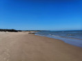
(1) Turn left, walk past the Les Sirènes restaurant and follow the Digue de Mer. Then follow the path for several kilometres.

(2) Walk along the Dune d’Aval, then continue along the Chemin des Douaniers. Pass the Pointe de la Courte Dune and emerge onto Rue de la Plage, in the hamlet of Gris Nez.

(E) Turn left, then keep to the right at the three-way junction, staying on the same street. Next, turn right onto Route du Cap and arrive at the Cap Gris Nez car park.

(3) Walk through the circular car park, enter the housing estate and head towards Rue du Fort. Turn left, then turn right at the small car park to follow a zigzagging path back to Rue de la Plage (E).

Waypoints

  1. S : mi 0 - alt. 46 ft - The old harbour at Wissant
  2. 1 : mi 0.15 - alt. 23 ft - Turn left at the fork
  3. 2 : mi 1.36 - alt. 10 ft - Aval Dune
  4. 3 : mi 4.1 - alt. 148 ft - Cap Gris Nez car park
  5. E : mi 4.61 - alt. 39 ft - Audinghen, Rue de la Plage

Notes

Water point at Wissant cemetery.
A few restaurants in Audinghen – Cap Gris Nez.

Worth a visit

The Cap Gris Nez lighthouse.
Framezelle Fort.

Always be cautious and plan ahead when you're outdoors. Visorando and the author of this route cannot be held responsible for any accidents occurring on this route.

The GR® and PR® markings are the intellectual property of the Fédération Française de Randonnée Pédestre.

Reviews and comments

5 / 5
Based on 2 reviews

Reliability of the description
5 / 5
Ease of following the route
5 / 5
Route interest
5 / 5
Mathieuserge
Mathieuserge

Overall rating : 5 / 5

Date of your route : May 12, 2026
Reliability of the description : ★★★★★ Very good
Ease of following the route : ★★★★★ Very good
Route interest : ★★★★★ Very good
Very busy route : No

Machine-translated

Valeureux marcheurs
Valeureux marcheurs

Overall rating : 5 / 5

Date of your route : Jun 19, 2025
Reliability of the description : ★★★★★ Very good
Ease of following the route : ★★★★★ Very good
Route interest : ★★★★★ Very good
Very busy route : No

A magnificent trail, easy in favourable weather conditions.

Machine-translated

Other walks in the area

For more walks, use our search engine .

The GPS track and description are the property of this route's author. Please do not copy them without permission.