Ugni Blanc Route

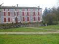
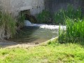
Set slightly apart from the main roads, the village seems to have fallen asleep… And yet, at the start of the last century, it was home to numerous shops and craftsmen who made it famous throughout the surrounding area. Criteuil-la-Magdeleine boasts a wealth of large houses, known as ‘logis’, and around ten mills (no longer in operation today) situated on the River Né. Some of these can be seen from the walking trail.

Details

379903
Creation:
Last update:
Last review:
  • Walking
    Activity: Walking
  • ↔
    Distance: 4.63 mi
  • ◔
    Average duration: 2h 15 
  • ▲
    Difficulty: Easy

  • ⚐
    Back to start: Yes
  • ↗
    Ascent: + 141 ft
  • ↘
    Descent: - 138 ft

  • ▲
    Highest point: 207 ft
  • ▼
    Lowest point: 98 ft

Photos

Description of the walk

Yellow markings

(S/E) The walk starts at the Town Hall square. Head towards the road and turn left. Cross the road and continue straight on towards the church. Walk past the church and continue straight on.

(1) Turn right at the three-way junction and follow the right-hand-hand road at the three-way junction (Rue du Petit Fief). Carry on straight ahead. Just past the last houses, take the dirt track opposite at the three-way junction. Carry on straight ahead through the vineyards. Walk past the houses and carry on straight ahead.

(2) Take the path on the left and carry on straight ahead. Stay on the main track for about 700 metres. Take the path on the left at the junction to join the road. Turn left and carry on straight ahead.

(3) Turn into the first road on the left and carry on straight ahead. Carry on straight ahead along the dirt track at the bend. At the junction, turn right to join the road. Cross the road and follow the track opposite. Carry on straight ahead and turn left onto the road (D151). Turn onto the limestone track on your right. At the next junction, turn right and carry on straight ahead. Turn left onto the track at the junction by the trees. Carry on straight ahead for about 950 metres, staying on the main track.

(4) Turn left, then immediately right onto the path leading towards the houses. Cut slightly left and carry on straight ahead along the limestone path. Once you reach the road, take the one furthest to the right and go past the houses on the left. Turn right at the junction, then take the first road on the left, ‘Chemin de Fonteny’.

(5) Turn onto the path on the left just before the stream. Follow the path on your right to walk alongside the stream on the left-hand side. Carry on straight ahead and cross through the woods. Turn right as you leave the woods (not shown on the map) to continue along the limestone path. Turn left at the T-junction to join the road (D151).
Cross the road and follow the path opposite. Carry on straight ahead. Cross the road (Rue de l’Écurat) and continue along the path in front of you, keeping the houses on your right. Carry on straight ahead through the vineyards.

(6) Turn right at the junction (Rue du Logis de la Motte) towards the village centre. Turn left and head towards the village centre. Continue straight ahead, then turn left to reach the Place de la Mairie (S/E).

Waypoints

  1. S/E : mi 0 - alt. 187 ft - Town Hall Square
  2. 1 : mi 0.14 - alt. 161 ft - Rue du Petit Fief
  3. 2 : mi 0.59 - alt. 154 ft - Turn left
  4. 3 : mi 1.22 - alt. 135 ft - Turn left
  5. 4 : mi 2.53 - alt. 105 ft - Turn left
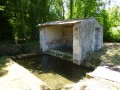
  6. 5 : mi 3.07 - alt. 115 ft - Turn left, following the branch of the - Né (rivière)
  7. 6 : mi 4.19 - alt. 200 ft - Turn right
  8. S/E : mi 4.63 - alt. 187 ft - Town Hall Square

Notes

Picnic tables are available behind the church.

Worth a visit

The town hall and the local school:
Opposite the town hall stands the local school, founded in 1890: Jules Ferry once passed this way! This is a classic example of a republican primary school...

The Church of Saint John the Baptist:
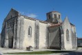
It combines the Romanesque style (façade, dome, piers and south side wall) with 15th-century Gothic elements in perfect harmony. Its remarkable octagonal bell tower is what makes it unique. The inscription ‘temple of reason’, dating from the Revolution, adorns its pediment.
Inside, there is a beautiful apse with its tiny columns topped with capitals and the altar dedicated to the Virgin Mary.

The Logis de la Mothe:
It is first recorded in 1126. The present-day manor house, surrounded by a moat, appears to date from the late 16th century. In the 17th century, Jean Marchand de la Mothe, a friend of the Chevalier de la Croix Maron (the illustrious figure behind the double distillation of Cognac), played an active part in his friend’s experiments.

The nature reserve and interpretive trail allow you to discover the flora and fauna of the Né Valley.

Reviews and comments

4.1 / 5
Based on 4 reviews

Reliability of the description
4 / 5
Ease of following the route
4.3 / 5
Route interest
4 / 5
chipie33290
chipie33290

Overall rating : 5 / 5

Date of your route : Jan 09, 2023
Reliability of the description : Not used / Not applicable
Ease of following the route : ★★★★★ Very good
Route interest : ★★★★★ Very good
Very busy route : No

A very pleasant route and not too muddy, despite the rain over the last few days.
It’s signposted, but some of the signs are missing. Fortunately, with the app on your phone, you just have to follow it.
Thanks for this route

Machine-translated

moulipat
moulipat

Overall rating : 3 / 5

Date of your route : Jun 09, 2020
Reliability of the description : ★★★☆☆ Average
Ease of following the route : ★★★☆☆ Average
Route interest : ★★★☆☆ Average
Very busy route : No

A pleasant walk, especially along the river – a bit too many vineyards, but we are in the region after all

Machine-translated

29MCSTT12ZYW4804AHP2

Overall rating : 4 / 5

Date of your route : Jun 18, 2019
Reliability of the description : ★★★★☆ Good
Ease of following the route : ★★★★☆ Good
Route interest : ★★★★☆ Good

A lovely walk.
The only problem: poor maintenance of the paths, particularly along the Né valley (logging operations involving
and tall grass and brambles, sometimes overhanging the paths)
Also, the section of the path leading from the RD151 towards point 6 (forcing you to take the vineyard paths, which
which doesn’t seem right to me).

Machine-translated

Azimut71
Azimut71

Overall rating : 4.7 / 5

Date of your route : Jun 25, 2018
Reliability of the description : ★★★★★ Very good
Ease of following the route : ★★★★★ Very good
Route interest : ★★★★☆ Good

The car park near the church is shaded, as is the route itself, which is a nice bonus.
The paths are clear; the signposting is fairly good, although missing at certain key points (but the route description is there); there’s not much tarmac. A pleasant walk, then.
At point (5), head left towards the gate of a property, then at the last moment go round the wall to the right — and be immediately swarmed by a swarm of mosquitoes!

Machine-translated

Other walks in the area

For more walks, use our search engine .

The GPS track and description are the property of this route's author. Please do not copy them without permission.