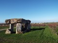
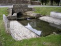
The Bois de Saint-Eugène in Archiac, in the Champagne region

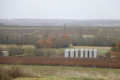
Hike down the vineyard-covered slopes of the Petite Champagne region, home to Cognac brandies, and venture into the woodland with its fabulous atmosphere. In Saint-Eugène, the hill, crowned by a beautiful church overlooking the Né valley, offers a magnificent panoramic view of the vineyards.

Details

124244
Creation:
Last update:
Last review:
  • Walking
    Activity: Walking
  • ↔
    Distance: 6.19 mi
  • ◔
    Average duration: 3h 15 
  • ▲
    Difficulty: Moderate

  • ⚐
    Back to start: Yes
  • ↗
    Ascent: + 440 ft
  • ↘
    Descent: - 440 ft

  • ▲
    Highest point: 397 ft
  • ▼
    Lowest point: 233 ft
  • ⚐ Country: France
  • ⚐ City: Archiac (17520)
  • ⚑
    Start/End: N 45.524785° / W 0.30328°
  • ❏
    IGN map(s): Ref. 1632SB
  • Hour-by-hour weather

Description of the walk

Park near the sports grounds and the Maison du Temps Libre.

(S/E) Turn right (south-east) onto a grassy path (Rue de la Font Ginier) which climbs up to the town hall.

(1) At the crossroads, keep slightly to the left towards Saint-Eugène via the D251 to leave Archiac.

(2) Turn right onto Chemin des Coutures.

(3) At the junction of four paths, take the path opposite, which curves slightly to the right, and immediately turn left to head up towards the Bois de Saint-Eugène. Cross the woods, following the path which curves first to the right and then to the left, and head down into Saint-Eugène.

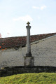
(4) Walk past the town hall and the church, turn right and follow the main road to a wayside cross.

(5) Turn right, opposite the cemetery, onto the path that climbs the wooded hillside and then descends again. At the Billet farm, cross the road (D152) and continue in the same direction along a small road opposite.

(6) Opposite the Taulé houses, follow the dirt track to the right for 500 metres, then turn left onto a road. After 500 metres, the road bends to the right before the Riveron woods and leads to the Archiac post office car park. Cross the car park, turn left onto the main street, Rue de Riveron, and follow it for 400 metres.

(7) Turn left onto a path overlooking Arthenac and the surrounding area. Walk down past the church.

(8) At the corner by the church, turn right then left, and cross the D149. At the junction with the D699, follow this road for about thirty metres to the left, then turn right onto a path that climbs up through the vineyards.

(9) At the junction with the D150, continue along a small road opposite (250m) and turn right towards Archiac. Cross the D149 again to take the small street opposite and turn right into Rue des Sports to head back towards the swimming pool and sports grounds on the left (S/E).

Waypoints

  1. S/E : mi 0 - alt. 233 ft - Archiac – Sports grounds
  2. 1 : mi 0.26 - alt. 354 ft - Archiac – Crossroads and town hall
  3. 2 : mi 0.46 - alt. 331 ft - Leave the road, turn right
  4. 3 : mi 0.88 - alt. 292 ft - Crossroads
  5. 4 : mi 1.6 - alt. 358 ft - Église Saint-Eugène (Saint-Eugène)
  6. 5 : mi 1.96 - alt. 299 ft - Calvary, take the path on the right
  7. 6 : mi 3.12 - alt. 259 ft - At Taulé’s, take the dirt track on the right
  8. 7 : mi 4.28 - alt. 367 ft - Leave the road and take the path on the left
  9. 8 : mi 4.72 - alt. 266 ft - Église Saint-Martin (Arthenac)
  10. 9 : mi 5.4 - alt. 259 ft - At the junction with the D150, take the small road opposite
  11. S/E : mi 6.19 - alt. 233 ft - Archiac, sports grounds

Notes

Yellow signpost no. 17.
Water points and toilets in Archiac and Saint-Eugène.

Worth a visit

Reviews and comments

5 / 5
Based on 1 review

Reliability of the description
Not used
Ease of following the route
5 / 5
Route interest
5 / 5
chipie33290
chipie33290

Overall rating : 5 / 5

Date of your route : Jun 05, 2023
Reliability of the description : Not used / Not applicable
Ease of following the route : ★★★★★ Very good
Route interest : ★★★★★ Very good
Very busy route : No

A really lovely route: beautiful scenery and architectural heritage.
We set off from St Eugène’s Church.
Thank you for this route

Machine-translated

Other walks in the area

For more walks, use our search engine .

The GPS track and description are the property of this route's author. Please do not copy them without permission.