Around the Bois du Charbon from Saint-Médard

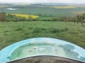
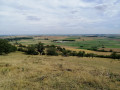
This walk begins with a route along wide forest tracks. The forest is particularly beautiful and well-maintained. If you wish, you can take a detour to visit the Chêne du Roi. As you walk, you’ll enjoy splendid panoramic views (the Dieuze area with the Vosges, Wuisse and so on in the background). As soon as you leave Saint-Médard, you enter the heart of the Saulnois. With no traffic and few other walkers, it’s the ideal setting to fully enjoy nature.

Details

n°12738790
Creation:
Last update:
Last review:
  • Walking
    Activity: Walking
  • ↔
    Distance: 6.94 mi
  • ◔
    Average duration: 3h 45 
  • ▲
    Difficulty: Moderate

  • ⚐
    Back to start: Yes
  • ↗
    Ascent: + 597 ft
  • ↘
    Descent: - 591 ft

  • ▲
    Highest point: 1,066 ft
  • ▼
    Lowest point: 771 ft

Photos

Description of the walk

The starting point is the car park at Saint-Médard Town Hall.

(S/E) Take Rue de la Vuinesse, which continues as a small tarmac road closed to vehicles.

(1) Near a small pond, ignore the path on the left, which will be the return route. Carry on, past the forest ranger’s house, then take a right/left turn and continue along the Route forestière de la Laie du Pont.

(2) After 4 km, at the end of the Route forestière de la Laie du Pont, turn left onto the Route forestière de Wuisse for about 300 m.

(3) When you reach a Fork in the road, carry straight on along the Route forestière de Bérange for 1.1 km.

(4) At the junction, turn slightly left onto the Route Forestière de la Haute Charrière until you reach a Fork in the road about 2 km further on.

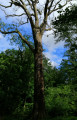
(5) At the fork in the road, turn right onto a path leading to the Chêne du Roi (follow the trail carefully, as the path can sometimes be hard to find). Make sure you take the path straight ahead; do not take any paths on your right (the Chêne du Roi is about 500 m ahead of you). Walk for about 450 m and, at a Fork in the road, take the right-hand path (almost all the paths lead there). Another fifty metres or so and you’ll be standing in front of the Chêne du Roi, which you can admire.

(6) Turn back to rejoin the Haute Charrière forest road.

(5) Carry on to your right until you reach a raised hunting blind.

(7) At the crossroads, turn onto the path on your left. Be careful to follow the track closely; the second part of the path, which does indeed exist, is not shown on the IGN map.

(8) After 200 m, the track turns left. Follow it to leave the forest.

(9) You’ll come to a wide track shown on the map, which takes you onto the small tarmac road you’ve already used.

(1) Turn right to reach the village and your starting point at the town hall car park (S/E).

Waypoints

  1. S/E : mi 0 - alt. 784 ft - Car park at Saint-Médard Town Hall
  2. 1 : mi 0.8 - alt. 778 ft - Small pond – Junction of the circular loop
  3. 2 : mi 2.48 - alt. 1,027 ft - Wuisse Forest Road
  4. 3 : mi 2.73 - alt. 1,014 ft - Bérange Forest Road
  5. 4 : mi 3.69 - alt. 938 ft - Route Forestière de la Haute Charrière
  6. 5 : mi 4.52 - alt. 1,017 ft - Towards the Chêne du Roi
  7. 6 : mi 4.85 - alt. 797 ft - The Chêne du Roi site
  8. 7 : mi 5.44 - alt. 1,040 ft - Junction
  9. 8 : mi 5.56 - alt. 1,066 ft - Junction
  10. 9 : mi 5.84 - alt. 886 ft - Wide path
  11. S/E : mi 6.94 - alt. 784 ft - Car park at Saint-Médard Town Hall

Notes

- No particular difficulties apart from making sure you follow the track carefully to reach the Chêne du Roi and the path taken at point (5).
- Much of the route is on stony ground, but the two sections mentioned above require sturdy footwear.
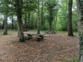
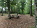
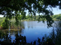
- There are several picnic spots along the route (see photos).

Reviews and comments

4.7 / 5
Based on 1 review

Reliability of the description
5 / 5
Ease of following the route
5 / 5
Route interest
4 / 5
Rebel88
Rebel88

Overall rating : 4.7 / 5

Date of your route : Jan 25, 2026
Reliability of the description : ★★★★★ Very good
Ease of following the route : ★★★★★ Very good
Route interest : ★★★★☆ Good
Very busy route : No

A pleasant route with no particular difficulties. Mainly on forest roads.
Access to the King's Oak can be difficult in wet weather as it can be slippery, but a rope with posts has been installed to help with the descent and ascent.
During our hike, there were even three accessible toilet cubicles along the path.

Machine-translated

Other walks in the area

For more walks, use our search engine .

The GPS track and description are the property of this route's author. Please do not copy them without permission.