Route de l'Iton in Bonsmoulins

An easy walk around the village of Bonsmoulins, crossing the Iton and passing in front of the old station. Wear waterproof footwear in wet weather.

Details

69337562
Creation:
Last update:
Last review:
  • Walking
    Activity: Walking
  • ↔
    Distance: 2.70 mi
  • ◔
    Average duration: 1h 15 
  • ▲
    Difficulty: Easy

  • ⚐
    Back to start: Yes
  • ↗
    Ascent: + 46 ft
  • ↘
    Descent: - 49 ft

  • ▲
    Highest point: 817 ft
  • ▼
    Lowest point: 741 ft

Description of the walk

Park in the car park at Bonsmoulins Town Hall.

(S/E) As you leave the car park, head to the right, then take the small road on the right towards Les Aillebouts until you reach a Fork in the road.

(1) Follow the path on the right towards Les Brumes and carry on straight ahead, passing a pond on private property on your right. Continue along the path, which bends to the right at a small pond, until you reach the bridge over the Iton. Cross the bridge and you’ll come to a junction of paths.

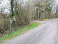
(2) Turn right. Please note: in wet weather, this path is often covered in huge puddles. At the end of the path, at a place called Les Petites Bruyères, continue to the right until you reach the Route de Soligny

(3) Turn left, then take the first road on the right towards the hamlet of Friloux. Continue to the first houses.

(4) Head along the path on the right. After the houses, the path is grassy and quite narrow, running between two fields for about a hundred metres before reaching a more even section.

(5)Continue to the right, passing a large shed on the left and the old Bonsmoulins railway station on the right, before rejoining the Route de Soligny at the start of the Chemin des Audierry.

(6) Turn left, then right at the junction, cross the bridge over the Iton and return to the town hall and the car park (S/E) .


Waypoints

  1. S/E : mi 0 - alt. 791 ft - Town hall car park
  2. 1 : mi 0.23 - alt. 797 ft - Fork
  3. 2 : mi 0.8 - alt. 797 ft - Junction - L'Iton
  4. 3 : mi 1.3 - alt. 801 ft - Route de Soligny
  5. 4 : mi 1.8 - alt. 804 ft - Friloux
  6. 5 : mi 2.21 - alt. 787 ft - Junction
  7. 6 : mi 2.5 - alt. 810 ft - Route de Soligny
  8. S/E : mi 2.7 - alt. 787 ft - Town hall car park

Reviews and comments

4.1 / 5
Based on 3 reviews

Reliability of the description
4 / 5
Ease of following the route
4.3 / 5
Route interest
4 / 5
benoitrando
benoitrando

Overall rating : 4.7 / 5

Date of your route : Mar 04, 2026
Reliability of the description : ★★★★★ Very good
Ease of following the route : ★★★★★ Very good
Route interest : ★★★★☆ Good
Very busy route : No

A short, easy and pleasant route

Thank you, Adduic, for this lovely walk.

Machine-translated

User 24138119
• Edited:

Overall rating : 3.7 / 5

Date of your route : Aug 03, 2025
Reliability of the description : ★★★☆☆ Average
Ease of following the route : ★★★★☆ Good
Route interest : ★★★★☆ Good
Very busy route : No

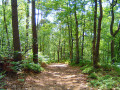
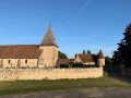
Shady path, ideal for summer. Beautiful view of the village of Bonsmoullins upon arrival. The church is worth a visit.

Machine-translated

Kitsouné
Kitsouné

Overall rating : 4 / 5

Date of your route : Mar 10, 2025
Reliability of the description : ★★★★☆ Good
Ease of following the route : ★★★★☆ Good
Route interest : ★★★★☆ Good
Very busy route : No

An easy walk, not very busy and mainly along paths. Very pleasant in dry weather. Do be wary of one section of the path which is VERY wet, but you can take a detour through the woods to avoid getting your feet too wet.

Machine-translated

Other walks in the area

For more walks, use our search engine .

The GPS track and description are the property of this route's author. Please do not copy them without permission.