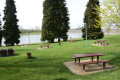
Around Guindrecourt-aux-Ormes

This walk between Guindrecourt-aux-Ormes and Sommermont should be undertaken during the hunting season, as the route avoids the forest.

Details

n°5607694
Creation:
Last update:
Last review:
  • Walking
    Activity: Walking
  • ↔
    Distance: 7.42 mi
  • ◔
    Average duration: 4h 00 
  • ▲
    Difficulty: Moderate

  • ⚐
    Back to start: Yes
  • ↗
    Ascent: + 666 ft
  • ↘
    Descent: - 686 ft

  • ▲
    Highest point: 1,014 ft
  • ▼
    Lowest point: 715 ft

Description of the walk

Car park at Place du 19 mars 1962, near the church.

(S/E) Leave Place du 19 Mars 1962 and follow Rue des Vignes towards Sommermont.

(1) 400 m after leaving the village, at the junction, take the right-hand lane and follow this small road, heading due east, to Sommermont and the church.

(2) Walk past the church, where the road turns into a farm track, and follow it north-west

(3) You’ll reach a road near a farm; continue along the farm track that runs alongside it until you reach a junction with a small road.

(4) At this junction, situated at the highest point (280 m), turn left and follow this road for about 4 km.

(1) Turn right and follow the route back along the same path you took on the way out to return to the starting point, Place du 19 Mars 1962 (S/E).

Waypoints

  1. S/E : mi 0 - alt. 932 ft - Place du 14 Mars 1962 - Église Notre-Dame-de-l'Assomption (Guindrecourt-aux-Ormes)
  2. 1 : mi 0.35 - alt. 843 ft - Crossroads at the end of the circular loop
  3. 2 : mi 3.43 - alt. 755 ft - Église Saint-Maurice (Sommermont)
  4. 3 : mi 3.84 - alt. 968 ft - Road junction (farm)
  5. 4 : mi 4.59 - alt. 919 ft - Road junction
  6. S/E : mi 7.42 - alt. 932 ft - Place du 14 Mars 1962 - Église Notre-Dame-de-l'Assomption (Guindrecourt-aux-Ormes)

Reviews and comments

4.7 / 5
Based on 1 review

Reliability of the description
5 / 5
Ease of following the route
5 / 5
Route interest
4 / 5
Gilles MSD
Gilles MSD

Thanks, that’s nice. I usually go on this walk in winter when the hunting season means we’re not allowed in the forest.
Wishing you some lovely walks
G.MSD

Machine-translated

User 3682656

Overall rating : 4.7 / 5

Date of your route : Jul 07, 2025
Reliability of the description : ★★★★★ Very good
Ease of following the route : ★★★★★ Very good
Route interest : ★★★★☆ Good
Very busy route : No

A short, easy but very pleasant walk. A hiking trail with few visitors.

Machine-translated

Other walks in the area

For more walks, use our search engine .

The GPS track and description are the property of this route's author. Please do not copy them without permission.