Country:

 City:
City:


Leave the D785 at the sign for Mont Saint-Michel.
The car park is at the end of the road.
GR®®380markings: White and red (very few visible)
+ YellowPR®® signs: at junctions
(S/E) With your back to the car park, take the stony path leading down towards the north-west (GR®®). At the first Fork in the road (junction with aPR®® signpost), carry on straight along the path, which widens as you keep the imposing television relay station in sight. When you reach the road, follow the D42 for a few tens of metres to the right.
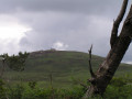
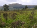
(1) Turn left towards the mast. Take the path on the right which climbs towards Tuchenn Kador (north-east), leaving anotherPR®® (signpost) on your left. Follow this single grassy path as it climbs steadily through heathland and heather. From time to time, large cairns mark the route.
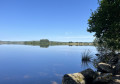
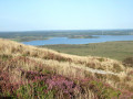
(2) On reaching the summit (383 m), veer slightly to the right towards the large boulder, from where you’ll have the finest view of Lake Brennilis (Saint-Michel Reservoir on the map). This summit is also a launch site for paragliders. Then begin a steady descent, staying on the same path, to reach another potential parking area. Ignore thePR®® signpost heading left (Lac du Drennec) and turn right towards the D885.
(3) Cross this road (take extreme care) and follow it to the right, passing the “Croaz Torred” (Broken Cross) bar. At the road sign for Botmeur, turn left onto this road.
(4) Immediately turn right onto a wide grassy path that runs behind a house (do not continue along the Botmeur road). It runs parallel to the departmental road at first, then veers away from it. Continue along this path through the meadows until it joins a small road leading to Botcador.
(5) Turn left to cross this hamlet and look out for an old wash house on your left, renovated in 2001 (dry in August 2017). Take note of the architecture of the houses. In the heart of the hamlet, a picnic table awaits you near the Tree of Liberty.
Nearby is a remarkable well dating from 1818.
Carry on straight ahead along the small road to the next hamlet, Balanec Ber (another picnic table), and you’ll come to a T-junction.
No signposts
(6) At the crossroads, turn right despite the various crosses and follow this small road towards Kernevez. It passes through meadows and pastures. The marks on the ground indicate that it is used more by herds than by cars.
YellowPR®® signs (Route du Yeun): at junctions
(7) APR®® path joins from the left; continue straight on (signposted ‘Route du Yeun’) along a path that narrows as it winds its way into the peat bogs.
(8) Cross the Stêr Red stream and turn right onto the only path.
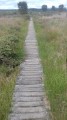
(9) A footbridge takes you across the River Ellez, which feeds into Lake Brennilis. Continue along the section fitted with wooden duckboards. (Caution: some of the planks are slightly damaged and may be slippery when wet).
(10) At the crossroads after the peat bogs, turn left (signposted ‘Route du Yeun’), leaving anotherPR®® path heading straight on. Follow the wide clay track, heading south-east, with Roc’h Cléguer (317m) looming overhead. The path has numerous puddles which you’ll need to regularly walk round. The map showsthe GR®®37but there are no signs for it on the ground. Walk alongside a coniferous woodland on your left and pass close to a water intake for the fire service (note the black colour of the water, caused by the peat). A little further on, the path turns right and heads uphill.
No signposting (despite theGR®®37-GR®®380markings on the map)
(11) At the crossroads, let thePR®® continue to the left and carry on straight ahead to the menhir by the roadside.
(12) Turn right onto a narrow ridge path heading due west. Here too, theGR®® markings shown on the map are absent. From this ridge line, on your left, you have a view of another ancient mountain range: the Montagnes Noires. The narrow, stony path crosses an area of moorland and heather.
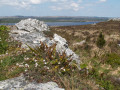
(13) When you come to the first path on the right, take this path to reach a rocky outcrop (305 m) on the left: a viewpoint over the lake and Montagne Saint-Michel, then return to the fork (allow about 700 m there and back). Continue to the right along the single path, still heading west.
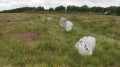
(14) At the crossroads, turn right (signposted ‘heathland and peat bogs’), then turn left behind the Ty Blaise building to take a path running along the edge of a meadow. This leads to the megalithic site known as ‘An Eured Veign’ (The Stone Wedding), consisting of 77 or 88 menhirs aligned across the moor (information panel). Only a few are visible. Follow this west-facing path. You can turn left for a short round trip to a viewing point with information panels on the maintenance of this natural area. You’ll reach the D785.
(15) Cross this road (take extreme care) and continue straight ahead along the access road to Mont Saint-Michel.
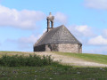
(16) Turn right and continue up the newly built steps, designed to preserve the vegetation. The wide, multi-tiered steps lead to a broad, stabilised path that takes you to the summit, where the Saint-Michel Chapel stands (381 m). From up there, there is a sweeping panorama of the artificial lake created by the Brennilis dam to the east, the summit of Tuchenn kador (383 m) to the north and the western end of the Monts d’Arrée to the west.
Descend via the wide, well-maintained path taken at the end of the ascent to reach the car park (S/E).



 Visorando Member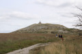

 Difficult
  Local authority
 Easy
Easy