Arplane, via La Turra

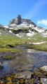
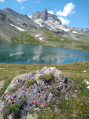
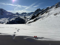
A hike with a unique layout: an ascent at the start, a long stretch running almost along a ridge, then a lovely descent just before the final climb. Lovely views of Arrondaz, the Vanoise, etc.

Details

24361677
Creation:
Last update:
Last review:
  • Walking
    Activity: Walking
  • ↔
    Distance: 5.17 mi
  • ◔
    Average duration: 4h 15 
  • ▲
    Difficulty: Moderate

  • ⚐
    Back to start: Yes
  • ↗
    Ascent: + 2,182 ft
  • ↘
    Descent: - 2,182 ft

  • ▲
    Highest point: 7,618 ft
  • ▼
    Lowest point: 5,472 ft

Description of the walk

To get to the hamlet of Le Lavoir by car, leave Valfréjus heading towards Le Seuil, and take the track on the right, just before the Refuge des Tavernes. It’s straightforward from there, provided you drive slowly.

(S/E) To start the walk, return to the car park entrance, walk back down a few metres and take the first bridge on the left.

(1) After climbing for about a hundred metres, leave the track and take the small path on the left: there’s a very clear signpost marked ‘La Turra 50 minutes’. The path then winds upwards, with plenty of signposts, cairns and blue markings. Pass the Chalet de la Turra and continue north-west.

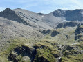
(2) Take care at this section where the path is sometimes less visible; you should still be able to follow it, though. Enjoy the lovely view of the nearby peaks!

(3) Keep to the right in the bed of the (dry) stream as you descend, ignoring the balcony path opposite. At the next junction, keep to the right again. The path is then clearly marked: it does not appear on the IGN map but is clearly shown on OSM.

(4) Turn left and continue along the balcony path to Arplane, where there are several chalets in varying states of repair.

(5) Enjoy the lovely view, then retrace your steps.

(4) Turn left onto the path that descends towards Les Herbiers. The descent is quite steep!

(6) Head right towards Les Herbiers and join the track that crosses the hamlet.

(7) Turn right: note the wayside shrine on your right.

(8) Leave the track and take a path on the left through the woodland. Almost immediately, on the right, you’ll see the entrance to an old mine, with a mine cart still visible. Further up, rejoin the track and follow it to the left.

(9) First turn left then right, and continue to the Lavoir car park (S/E).

Waypoints

  1. S/E : mi 0 - alt. 6,253 ft - Lavoir car park
  2. 1 : mi 0.13 - alt. 6,289 ft - Leave the track and take the path on the left
  3. 2 : mi 1.25 - alt. 7,618 ft - A section of the path that is not very visible
  4. 3 : mi 1.37 - alt. 7,543 ft - Junction, turn right
  5. 4 : mi 2.36 - alt. 6,906 ft - Common junction (out and return)
  6. 5 : mi 2.65 - alt. 6,913 ft - Arplane
  7. 6 : mi 3.21 - alt. 6,385 ft - Turn right at the junction towards Les Herbiers
  8. 7 : mi 4 - alt. 5,472 ft - Les Herbiers, on the left
  9. 8 : mi 4.57 - alt. 5,876 ft - Turn off to the left
  10. 9 : mi 4.94 - alt. 6,181 ft - Junction, left/right
  11. S/E : mi 5.17 - alt. 6,253 ft - Lavoir car park

Worth a visit

This is a very quiet walk, at least until you reach Les Herbiers.

From Arplane, the summit of Le Truc is about an hour’s walk one way. You can see it very clearly from the path. The view from the summit is exceptional.

From the car park, you can pop into the cheese shop. In 2023, the cheese shop was open every day from 3 pm to 6 pm. Alternatively, if you walk past the right-hand side of the building (the former barracks), you’ll be treated to a lovely view of Valfréjus.

Reviews and comments

4.5 / 5
Based on 2 reviews

Reliability of the description
5 / 5
Ease of following the route
4 / 5
Route interest
4.5 / 5
frankmolle
frankmolle

Overall rating : 4.7 / 5

Date of your route : Jul 15, 2026
Reliability of the description : ★★★★★ Very good
Ease of following the route : ★★★★☆ Good
Route interest : ★★★★★ Very good
Very busy route : No

Having walked this route both ways, I’d recommend doing it in the opposite direction to the one suggested. That way, you climb in the shade, through the woods, and descend in the open. What’s more, the steepest section is then on the way up, and the descent is gentler.

Machine-translated

stef LB
stef LB

Overall rating : 4.3 / 5

Date of your route : Jul 13, 2024
Reliability of the description : ★★★★★ Very good
Ease of following the route : ★★★★☆ Good
Route interest : ★★★★☆ Good
Very busy route : No

A lovely walk with some beautiful views

Make sure you follow the path and the instructions at the start

Machine-translated

Other walks in the area

For more walks, use our search engine .

The GPS track and description are the property of this route's author. Please do not copy them without permission.