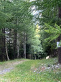
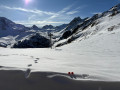
Punta Bagna and the Col du Fréjus from the Arrondaz plateau

A hike through the hills offering 360° views and a vista of Italy.

Details

n°38417979
Creation:
Last update:
Last review:
  • Walking
    Activity: Walking
  • ↔
    Distance: 8.24 mi
  • ◔
    Average duration: 5h 25 
  • ▲
    Difficulty: Moderate

  • ⚐
    Back to start: Yes
  • ↗
    Ascent: + 1,893 ft
  • ↘
    Descent: - 1,870 ft

  • ▲
    Highest point: 8,944 ft
  • ▼
    Lowest point: 7,287 ft

Photos

Description of the walk

At Valfréjus station, take the Arrondaz cable car to reach the start of the walk at the upper station.

(S/E) Opposite, take the path that winds its way beneath the Punta Bagna chairlift. Return to the area beneath the chairlift.

(1) Cross it, then continue straight ahead and, after a steep climb, emerge at the Col d’Arrondaz.

(2) Follow the wide track downhill towards the Col du Fréjus. You’ll reach a crossroads of tracks at the end of the descent in the Fréjus valley.

(3) Now head back up the Sentier de la Mémoire; at a stream, you’ll reach a junction of paths above the Fréjus military barracks.

(4) Leave the Sentier de la Mémoire here and take the path on the left. Continue the winding ascent until you reach the top of Lac de Punta Bagna.

(5) Continue the ascent and, via a wide circular loop to the left, reach the summit of Punta Bagna at the top of the chairlift.

(6) Descend via the same route in the opposite direction to return to the Baraquement du Fréjus crossroads.

(4) Turn left onto the Sentier de la Mémoire and, following a level path, easily reach the Col du Fréjus on the French-Italian border. Continue for a few metres to enjoy the view towards Italy.

(7) Follow the same path back in the opposite direction to reach the Baraquement du Fréjus crossroads.

(4) Follow the route back in the opposite direction to reach the upper station of the Arrondaz cable car (S/E).

Waypoints

  1. S/E : mi 0 - alt. 7,290 ft - Upper station of the - Ttélécabine d'Arrondaz
  2. 1 : mi 0.78 - alt. 7,749 ft - Below the Punta Bagna chairlift
  3. 2 : mi 1.56 - alt. 8,232 ft - Col d'Arrondaz (2507m)
  4. 3 : mi 2.05 - alt. 8,100 ft - Crossroads of ski runs
  5. 4 : mi 2.4 - alt. 8,327 ft - Baraquements du Fréjus junction
  6. 5 : mi 2.88 - alt. 8,615 ft - Lake Punta Bagna
  7. 6 : mi 3.57 - alt. 8,944 ft - Punta Bagna
  8. 7 : mi 5.32 - alt. 8,337 ft - Col du Fréjus
  9. S/E : mi 8.24 - alt. 7,290 ft - Upper station of the - Ttélécabine d'Arrondaz

Notes

Worth a visit

(6) Punta Bagna summit: take in the view of the surrounding mountains listed on the orientation boards, on both the French and Italian sides.

Reviews and comments

5 / 5
Based on 1 review

Reliability of the description
5 / 5
Ease of following the route
5 / 5
Route interest
5 / 5
stef LB
stef LB

Overall rating : 5 / 5

Date of your route : Aug 08, 2024
Reliability of the description : ★★★★★ Very good
Ease of following the route : ★★★★★ Very good
Route interest : ★★★★★ Very good
Very busy route : No

A lovely route
A bit of snow before the cable car, but no trouble
We extended the walk on the way back via Le Lavoir, which gave us the chance to spot some new hiking routes

Machine-translated

Other walks in the area

For more walks, use our search engine .

The GPS track and description are the property of this route's author. Please do not copy them without permission.