Valfrejus – Col des Sarrazins, Refuge des Marches, Refuge du Mont Thabor

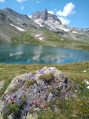
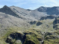
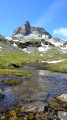
A lovely circular walk starting from the Lavoir in Valfréjus. Varied scenery, lakes and breathtaking views of all the mountains.
Access by car to the start point (Lavoir) isn’t possible in winter (as it’s a ski run)!
You’ll cross two passes, so the walk involves two ascents (and descents!), which are quite steep but enjoyable.

Details

n°28007973
Creation:
Last update:
Last review:
  • Walking
    Activity: Walking
  • ↔
    Distance: 12.65 mi
  • ◔
    Average duration: 10h 05 
  • ▲
    Difficulty: Difficult

  • ⚐
    Back to start: Yes
  • ↗
    Ascent: + 4,921 ft
  • ↘
    Descent: - 4,905 ft

  • ▲
    Highest point: 9,334 ft
  • ▼
    Lowest point: 6,260 ft

Photos

Description of the walk

Meet at the Lavoir car park.

(S/E) Follow the signs for Mont Thabor; the climb gets quite steep straight away.

(1) After the dam, take the path on the right. The sign for Refuge des Marches will guide you.

(2) Cross the small bridge and head up to the right, towards the Col des Sarrazins.

(3) Ignore the path that goes straight on, wade across the stream and head right to cross the beautiful plateau.

(4) At Mont Cula, continue left along the path through the rocks, following the yellow markings.

(5) Follow the path to the left.

(6) You’ll reach the Col des Sarrazins. Follow the signposts towards the Refuge des Marches. Head downhill and enjoy the breathtaking views.

(7) Continue down the path to the left, towards the Refuge des Marches.

(8) Turn right to take a short break at the Refuge des Marches.
You can carry on due north for 10 minutes towards Lac de Bissorte to catch a glimpse of it.

(9) Return to the fork in the path.

(8) Turn right, following the sign for the Refuge du Mont Thabor. Follow the cairns and/or the red and white markings.

(:10) Pass Lac des Bataillères on your left.

::11: Reach the Col des Bataillères, enjoy the view and head towards the Refuge du Mont Thabor.

(:12) At the refuge, take a short break to recover from the descent, then continue towards Valfrejus and Le Lavoir.

(13) At this junction, turn sharp left, heading due north.

(14) At the signpost, take the path leading down to the left to rejoin the original fork in the track.

(1) Carry on straight ahead, following the route in the opposite direction to the way out, and head back to the car park (S/E).

Waypoints

  1. S/E : mi 0 - alt. 6,260 ft - Lavoir car park
  2. 1 : mi 0.75 - alt. 6,890 ft - Dam. Common junction for out-and-back route
  3. 2 : mi 1.22 - alt. 7,070 ft - Small bridge. Le Plan
  4. 3 : mi 1.72 - alt. 7,720 ft - Ford, on the right
  5. 4 : mi 2.38 - alt. 8,192 ft - Mount Cula, on the left
  6. 5 : mi 2.88 - alt. 8,799 ft - Junction: turn left
  7. 6 : mi 3.44 - alt. 9,321 ft - Col des Sarrasins. Descent
  8. 7 : mi 5.3 - alt. 7,431 ft - Junction: turn left towards the mountain hut
  9. 8 : mi 5.48 - alt. 7,277 ft - T-junction to and from the refuge - Refuge des Marches
  10. 9 : mi 5.56 - alt. 7,260 ft - Refuge des Marches
  11. 10 : mi 7 - alt. 7,956 ft - Lac des Batailléres
  12. 11 : mi 8.15 - alt. 9,140 ft - Col des Bataillères
  13. 12 : mi 9.53 - alt. 8,192 ft - Refuge du Mont Thabor
  14. 13 : mi 9.97 - alt. 7,986 ft - Crossroads, turn left
  15. 14 : mi 10.26 - alt. 7,858 ft - Mont Thabor Cross, on the left
  16. S/E : mi 12.65 - alt. 6,260 ft - Lavoir car park

Notes

In summer, both mountain huts serve meals and drinks. Even if food is no longer available, it is still possible to stay overnight there.
There is nowhere along the route to shelter from the sun. Make sure you bring water, hats and walking poles.
No particular difficulties, apart from the elevation gain! (no sections over a drop, ladders, etc.)

We completed the hike in 8 hours (experienced walkers).

Worth a visit

At the Refuge des Marches (9), make the most of the opportunity to carry on for a further 10 minutes to see Lake Bissorte.

Reviews and comments

5 / 5
Based on 1 review

Reliability of the description
5 / 5
Ease of following the route
5 / 5
Route interest
5 / 5
chris26120
chris26120

Overall rating : 5 / 5

Date of your route : Aug 07, 2023
Reliability of the description : ★★★★★ Very good
Ease of following the route : ★★★★★ Very good
Route interest : ★★★★★ Very good
Very busy route : No

A really lovely route, especially the first part, up to the Refuge des Marches, which is very quiet; however, according to my Garmin GPS, the elevation gain was 2,000 metres, and the route was 24 km long!!! It took us 9 hours, bearing in mind that we’d parked on the road 20 minutes’ walk from the Lavoir car park.

Machine-translated

Other walks in the area

For more walks, use our search engine .

The GPS track and description are the property of this route's author. Please do not copy them without permission.