Fréjus Pass and the Fréjus military fortification

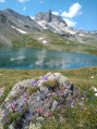
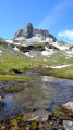
A lovely walk in the hills with stunning views.
Lake and a military fortification from the Second World War.

Details

n°1349105
Creation:
Last update:
Last review:
  • Walking
    Activity: Walking
  • ↔
    Distance: 8.79 mi
  • ◔
    Average duration: 6h 05 
  • ▲
    Difficulty: Moderate

  • ⚐
    Back to start: Yes
  • ↗
    Ascent: + 2,365 ft
  • ↘
    Descent: - 2,356 ft

  • ▲
    Highest point: 8,415 ft
  • ▼
    Lowest point: 6,247 ft

Description of the walk

In Valfréjus (ski resort), head towards Le Lavoir.
It is recommended that you park in the Le Lavoir car park.

(S/E) On leaving the car park, turn right and follow the Sentier de la Mémoire, which passes through the hamlet of Le Jeu.
At the first fork, turn left.

(1) At the second junction in the hamlet of Le Jeu, turn right. At the third junction, turn left.

(2) Head right for 2 km from the hamlet of Le Jeu, where you can see two military memorials carved into schist (grey slate-coloured rock). Continue in the same direction.

(3) At Pas du Roc, take the path on the right before the Ruisseau du Fréjus, heading towards the Col du Petit Argentier.

(4) As you climb, you’ll see a ruined combat block; continue uphill – the gradient is 30 per cent in places.

(5) At the Combe du Petit Argentier, follow the path on the left, which runs almost parallel to the Sentier de la Mémoire, situated opposite on your left.

(6) You’ll come to a fork in the path.
To reach the Fréjus artillery emplacement, take the path on the right, which winds upwards in a zigzag.
Otherwise, take the path on the left which descends towards the Ruisseau de Fréjus.

(7) Fréjus artillery emplacement, comprising several blocks spread out within a 200-metre radius.
Turn back and follow the same path you took on the way up; at the fork, turn left.
Cross the stream and head up towards the lake via the path on the right.

(8) At Lac du Fréjus, continue along the path to the pass.

(9) At the pass, turn back and, at the cross, head right onto the main “Sentier de la Mémoire”, which descends towards the barracks.

(10) At the Fréjus military barracks (ruins), continue to the left (2,537 m) along the Sentier de la Mémoire, which leads back to the Pas du Roc.
At the next fork (2,467 m), turn left.

(3) Continue straight on along the same path you took on the way out to return to the starting point (S/E).

Waypoints

  1. S/E : mi 0 - alt. 6,247 ft - Lavoir car park
  2. 1 : mi 1.21 - alt. 7,087 ft - A place known as Le Jeu
  3. 2 : mi 1.96 - alt. 7,500 ft - Military memorial
  4. 3 : mi 2.22 - alt. 7,625 ft - Pas du Roc
  5. 4 : mi 2.31 - alt. 7,677 ft - Ruined combat block
  6. 5 : mi 2.53 - alt. 7,956 ft - Combe du Petit Argentier: 30 per cent gradient
  7. 6 : mi 3.62 - alt. 8,179 ft - Intersection (Fréjus artillery fortification)
  8. 7 : mi 3.9 - alt. 8,415 ft - Former Blaukaus, casemate
  9. 8 : mi 4.53 - alt. 8,261 ft - Lake Fréjus
  10. 9 : mi 4.8 - alt. 8,314 ft - Col du Fréjus
  11. 10 : mi 5.29 - alt. 8,320 ft - Fréjus Barracks
  12. S/E : mi 8.79 - alt. 6,247 ft - Lavoir car park

Notes

There’s no drinking water; just a spring on the way back, past the Fréjus barracks.
Good walking boots are essential, as are walking poles, which are particularly helpful on the climb up the Combe du Petit Argentier.
A torch or headlamp is essential if you wish to visit the interior of the Fréjus artillery fortification, which is dilapidated (at the sole risk of anyone who decides to enter).
Remember to bring rainwear, as the weather changes very quickly at altitude.
Including visits to the military fortifications, taking photos of flowers, and stops for lunch and a snack, the walk took us a total of 7 hours 30 minutes at a leisurely pace.

Worth a visit

Reviews and comments

5 / 5
Based on 1 review

Reliability of the description
5 / 5
Ease of following the route
5 / 5
Route interest
5 / 5
JNMASSON
JNMASSON

Overall rating : 5 / 5

Date of your route : Aug 03, 2019
Reliability of the description : ★★★★★ Very good
Ease of following the route : ★★★★★ Very good
Route interest : ★★★★★ Very good

This route follows the description in reverse, starting from the Pas du Roc (allowing you to climb at a steady pace along the stony path leading to the Col du Fréjus): the only drawback is the occasional passage of vehicles.
Once you reach Fréjus, there are lovely views towards Italy and the option to head downhill.

Machine-translated

Other walks in the area

For more walks, use our search engine .

The GPS track and description are the property of this route's author. Please do not copy them without permission.