Super Morzine Ridge Circular Loop

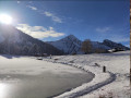
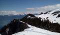
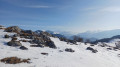
The first part of this walk offers magnificent views of the surrounding peaks, stretching as far as the Aravis. On the return journey, you’ll walk below the ridges through unspoilt countryside, with the chance to spot chamois.

Details

n°44354925
Creation:
Last update:
Last review:
  • Snowshoeing
    Activity: Snowshoeing
  • ↔
    Distance: 7.91 mi
  • ◔
    Duration according to the author: 5 hrs 
  • ▲
    Difficulty: Difficult

  • ⚐
    Back to start: Yes
  • ↗
    Ascent: + 1,286 ft
  • ↘
    Descent: - 1,309 ft

  • ▲
    Highest point: 5,988 ft
  • ▼
    Lowest point: 5,138 ft

Photos

Description of the walk

Car park: you can park in one of the underground car parks near the resort reception.
The starting point is the exit from the Plateau car park (photo), at the far end of the transfer area.

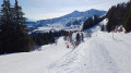
(S/E) First, take the Passage du Malinka to its end. There, you’ll see the ‘Domaine Nordique’ banner on your right, slightly below you, which you’ll pass under. A little further on, you’ll come to another identical banner. From this point, follow the ‘mixed trail’ for cross-country skiers, snowshoers, ski-joring enthusiasts, etc. Continue on to the altiport, which you’ll spot in the distance.

(1) Pass over the altiport and join the RD338.

(2) Cross the road and continue along the mixed-use path opposite, which offers magnificent views of the surrounding peaks, as well as the valleys lying to the north below your path.

(3) Pass the top station of the Séraussaix chairlift and head towards the top station of the Zore chairlift. You will then begin the descent along the Super Morzine ridge.

(4) Head down the mixed-terrain path on the left and follow it through three hairpin bends.

(5) Leave the wide, easy mixed-terrain path and start on the narrower track below the ridge. Follow this clear track to a junction (elevation 1696).

(6) The next section requires a bit of care; head south-southeast to join an unmarked summer path which initially runs beneath the high-voltage power line before veering left to descend north-east. After a final bend to the right and a walk of about 800 metres, you’ll reach the road—closed in winter—which leads to the Col de la Joux Verte from Les Lindarets.

(7) Turn right and follow this road uphill to the Col de la Joux Verte. Then join the D338 and turn right to return to the mixed-terrain path you took on the way up.

(2) Turn left and follow the entire outward route back to the car park (S/E).

Waypoints

  1. S/E : mi 0 - alt. 5,984 ft - Underground car parks near the resort reception
  2. 1 : mi 0.57 - alt. 5,768 ft - Avoriaz Altiport
  3. 2 : mi 1.02 - alt. 5,758 ft - D338 road – Junction of the loop
  4. 3 : mi 2.04 - alt. 5,807 ft - Upper station of the Séraussaix chairlift
  5. 4 : mi 2.58 - alt. 5,676 ft - Start of descent
  6. 5 : mi 3.02 - alt. 5,449 ft - Leave the mixed-surface path
  7. 6 : mi 3.95 - alt. 5,564 ft - Junction
  8. 7 : mi 5.31 - alt. 5,177 ft - Junction with the Route des Lindarets
  9. S/E : mi 7.91 - alt. 5,988 ft - Underground car parks near the resort reception

Reviews and comments

5 / 5
Based on 1 review

Reliability of the description
5 / 5
Ease of following the route
Non utilisé
Route interest
5 / 5
Calanquaise
Calanquaise

Overall rating : 5 / 5

Date of your route : Jul 12, 2026
Reliability of the description : ★★★★★ Very good
Ease of following the route : Not used / Not applicable
Route interest : ★★★★★ Very good
Very busy route : No

A magnificent walk in the hills above Avoriaz… Despite the sweltering heat, there were flowers and butterflies everywhere! Everyone was delighted!
I think it would be a good idea to do the route anti-clockwise (which is what I wanted to do, but I was chatting too much and got it wrong!!!) to avoid the long climb at the end of the walk (especially when it’s hot!).
Other options:
At La Joue Verte, we took the small path below (on the IGN map) the one indicated by the author – which is more of a track – allowing us to stop in the shade of the trees at the rangers’ hut and cool off at the spring!
At the Combes crossroads, we headed down to the Montriond viewpoint to take in the magnificent view of Lake Montriond.
Finally, to reach the Col de la Joue Verte, we took the footpath (rather than the mountain bike trail next to it) instead of baking in the sun on tarmac!
Large free car park in Avoriaz during the summer
The hike started at 8.30 am… And it was quiet… Much less so in the afternoon!
Highly recommended hike. Thanks to the author!

Machine-translated

Other walks in the area

For more walks, use our search engine .

The GPS track and description are the property of this route's author. Please do not copy them without permission.