Country:

 City:
City:


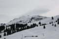
Les Grangettes car park, at the north-north-eastern end of Les Carroz d’Arâches. It is helpful to have the guide to snowshoe hiking routes, or the village map, provided by the village Tourist Office, to find the car park.
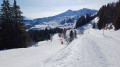
(S/E) Leave the car park heading north, with snowshoes on if snow conditions allow, following the signposted Route No. 4: Croix des Sept Frères. For a while, this route runs alongside Route No. 3: the Malatrait circular route. The signposting is very well done, clear and consistent. Right from the start, the slope is quite steep.
(1) At the signpost marked ‘La Lanche d’en haut’, the two routes split. Turn right to follow Route No. 4: Croix des Sept Frères. The slope becomes steeper and steeper, before levelling off slightly after a hairpin bend to the left. Just after this, you come to Les Tronchets, a pair of buildings: the one on the left is a mountain refuge, which was closed when we were there due to Covid-19 health restrictions, and the one on the right is a cowshed.
(2) Turn right in front of the two buildings (note: a signpost was missing at this point when we were there) and head towards the next signpost, which indicates that you should turn left, heading due north.
(3) About 150 metres further on, a new signpost indicates that you should head uphill again towards the north-east. Further up, as you pass under the high-voltage power line, a sign warns that you are about to cross a ski run and that caution is advised, as walkers do not have right of way.
Cross the run and, slightly to the right, you’ll find a marker indicating that you should continue northwards. Head deeper into the forest, climbing a little further, to reach the Croix des Sept Frères 150 metres on, the highest point of our hike.
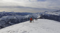
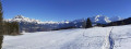
(4) The view is superb: Morillon to the north, Tête du Pré des Saix to the east, and so on.
From there, head down through the forest, still heading north, following the red-line markings towards L’Igloo. The path joins the ski run, where there is a table where you can have a picnic. Continue for a further 50 metres to reach a fork in the path.
(5) Opposite is the “L’Igloo” restaurant at the top of a ski lift, and to the left is the “Marvel” ski run. Without walking on the ski run (hikers do not have right of way), follow the edge of the woodland to the left. Less than 400 m further on, look out for the signposts on the left for route no. 3, the ‘Boucle de Malatrait’, which is normally walked in the opposite direction (from north to south on this section of the route).
Continue north-north-west, following the “Boucle de Malatrait” route in the opposite direction! You’ll need to look back from time to time to make sure you don’t miss a marker (Route No. 3: Boucle de Malatrait). The descent is quite steep.
(6) As you approach Mottal, the trail turns left twice and then right (the signposting is very clear) to head south. The gradient has eased considerably, even rising slightly in places, passes above Les Sommards, and remains more or less level until it reaches the junction where Route No. 3 (Malattrait Circular Route) and Route No. 4 (Croix des Sept Frères) diverge.
(1) Follow the same route as on the way out to return to the car park (S/E).

 Visorando Member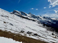

 Moderate
 Easy
Easy